Customer Stories
Smarter Investment Decisions for Workspace Providers: The Instant Group
Make smarter investment decisions for flexible workspace with The Instant Group’s Coworkintel platform, powered CARTO.
Smarter Investment Decisions for Workspace Providers: The Instant Group
Make smarter investment decisions for flexible workspace with The Instant Group’s Coworkintel platform, powered CARTO.
Participatory Mapping to Tackle Food & Water Insecurity in Ethiopia
Learn about UCL ExCiteS' ground-level approach to co-create tools and methods with local communities to map and monitor their land.
VFMatch.org: The First Mapping-and-Matching Global Health Platform
Learn about the pioneering platform VFMatch.org which harnesses the transformative potential of geospatial data in healthcare.
Towards a Carbon Neutral Future with CARTO & NetCarbon
Discover how NetCarbon, winners of Planet’s Copernicus Masters competition, leverages CARTO to tackle climate change with scalable satellite data solutions.
How Yale Climate Connections Uses Spatial Visualization for Community Engagement
See how Yale Climate Connections used CARTO to create a spatial visualization that shares local stories to help explain climate change.
How ASDA Uses Location Intelligence for Site Selection
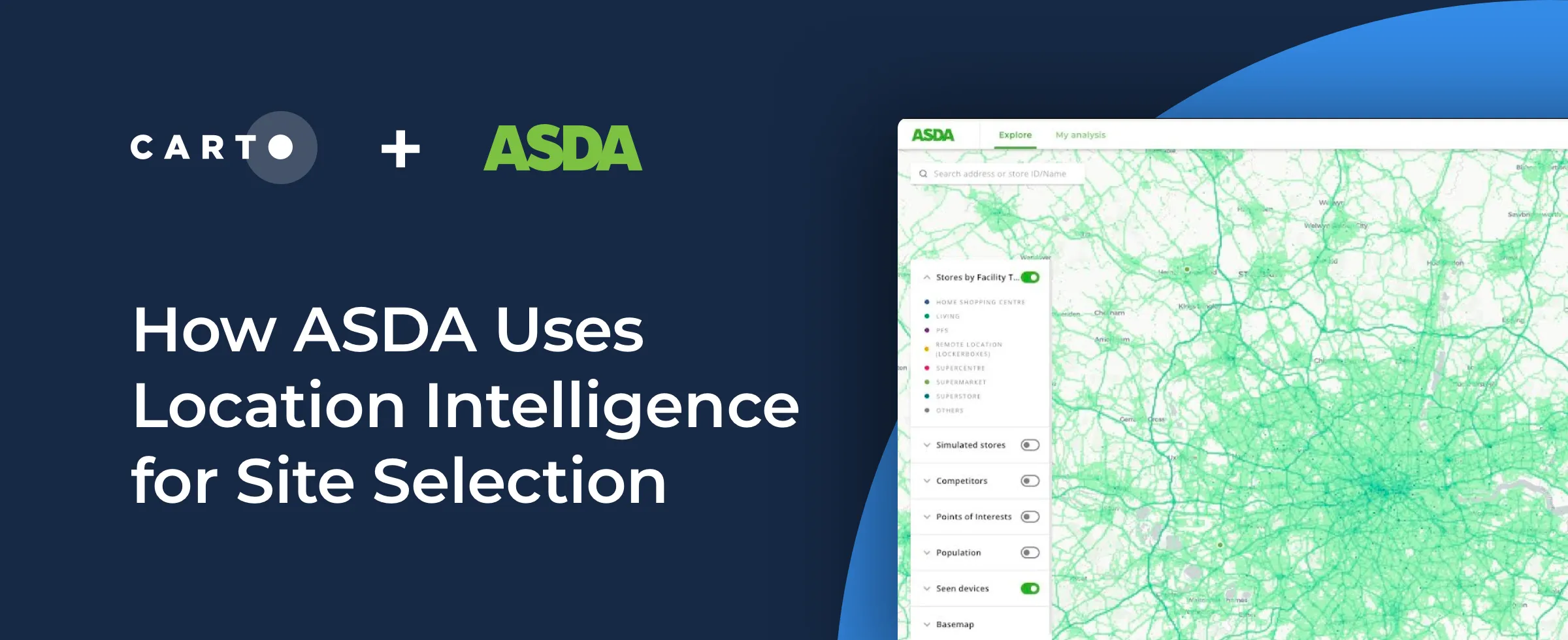
Interested in learning how using Location Intelligence can boost your site selection strategy as a retailer? See how ASDA uses this data to make informed expansion decisions.
Guest post - New online service, Who Represents Me: NYC
Discover your NYC representatives easily with "Who Represents Me: NYC." Use the site to find contact info and district maps for all levels of government.
A round-up of maps build by CartoDB users
Discover projects from the US Dept. of Energy's Alternative Fueling Station Locator to Baltimore's Vacant Buildings map and Moscow's DIY traffic counter.
Map of the Month: Global Partnership for Effective Development Co-operation Dashboard
Officially launched in March 2018, the Global Partnership's Dashboard is specifically designed to be the monitoring tool that Partner Countries need to measure their progress
Academy
CARTO AI Agents: now in public preview!
Discover how CARTO AI Agents are democratizing spatial analysis, making it accessible to all users. Learn about real-life applications revolutionizing geospatial industries.
Automating your spatial workflows in Databricks with CARTO
Automate your geospatial workflows in Databricks with CARTO. Schedule, trigger, and integrate spatial data processes seamlessly using Databricks Workflows.
Space-time anomaly detection for smarter property risk assessment
Learn how to detect crime anomalies & assess property risk in near real-time using CARTO Workflows—low-code spatial analytics for scalable spatial data science