

Spatial Analytics


Crowd-funding core open source development
CARTO joined the #gdalbarn crowd-funding effort to improve GDAL coordinate system handling.

Meet the growing demand for senior care facilities with a modern site planning approach
Discover why healthcare professionals are turning to location intelligence when deciding when, where, and in what form to open senior care centers to meet medical needs of rapidly increasing senior population.

The Future of Location Intelligence
Learn about the latest Location Intelligence trends discussed at CARTO Locations

Opportunity Zones in the Wake of Amazon HQ2
Real estate is still abuzz about the U.S. Treasury Department's creation of 8,700 Opportunity Zones, and in this post learn why Location Intelligence can provide the contextual insights needed for finding the right investments.

Q&A: A Look at NYC's Open Data Approach with Mayor's Senior Project Manager
Adrienne Schmoeker of the NYC Mayor Office for Tech and Innovation answers nine tough questions about open data and smart cities.

Introducing CARTO SalesQuest: Location-Based Sales Analytics
CARTO SalesQuest is a location-based Sales Analytics solution that applies spatial analysis and location data streams to your company’s sales CRM data.

The 4 Types of Analytics Shaping Location Data Today
Using descriptive, diagnostic, and predictive analytics transforms location data points into dynamic data insights for your business solutions.


COPY'ing with the Python SDK
We'd like to introduce the COPY in the CARTO's Python SDK to you
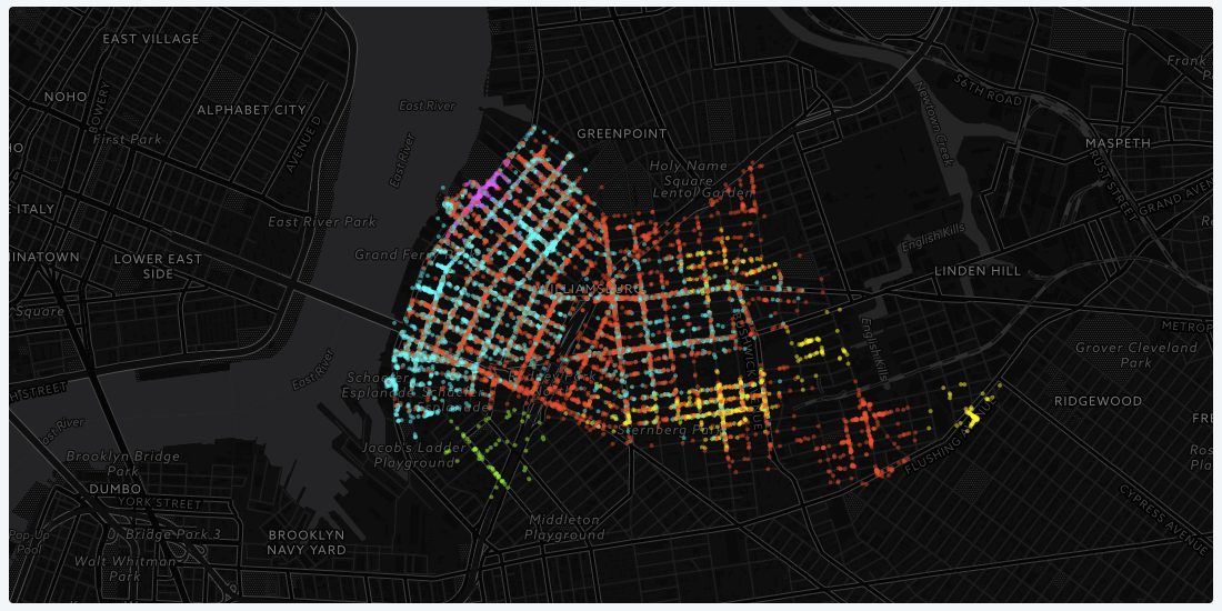
Using Location Data to Identify Communities in Williamsburg, NY
We wanted to explore how we can use data to better understand and define communities of people, going beyond spatial borders like zip code and neighborhood boundaries.

Academy


Spatial Analytics in 2026: What's Changing?
Explore how AI, cloud-native tools, and evolving skills are reshaping spatial analytics in 2026, based on insights from 200+ geospatial experts.

CARTO AI Agents now integrated with Google AI Studio & Vertex AI
Unlock AI-driven spatial analysis. CARTO's Agentic GIS now integrates with Google AI Studio & Vertex AI to run secure geospatial workflows on BigQuery.
Agentic GIS now integrated with Snowflake Cortex AI
Unlock Agentic GIS in Snowflake. CARTO's native integration leverages Snowflake Cortex AI for secure, powerful, and AI-driven spatial analysis.