

Technology
.png)


The Changing Role of the GIS Analyst
Discover how GIS Analysts are evolving from map makers to strategic AI-driven experts shaping enterprise decision-making with cloud-native tools.


What is Agentic GIS?
Discover Agentic GIS: AI-powered spatial analysis that automates workflows, amplifies GIS expertise, and delivers actionable geospatial insights.
5 ways to transform spatial analysis for environmental resilience
Discover 5 ways to transform spatial analysis for environmental resilience using cloud-native GIS, automation, and real-time insights.
What is Agentic GIS?
Discover Agentic GIS: AI-powered spatial analysis that automates workflows, amplifies GIS expertise, and delivers actionable geospatial insights.
.png)

.jpg)
Navigate consumer demand with NIQ Purchasing Power Data
Navigate consumer demand with NIQ Purchasing Power Data. Understand consumer spending, optimize location planning, and boost marketing.
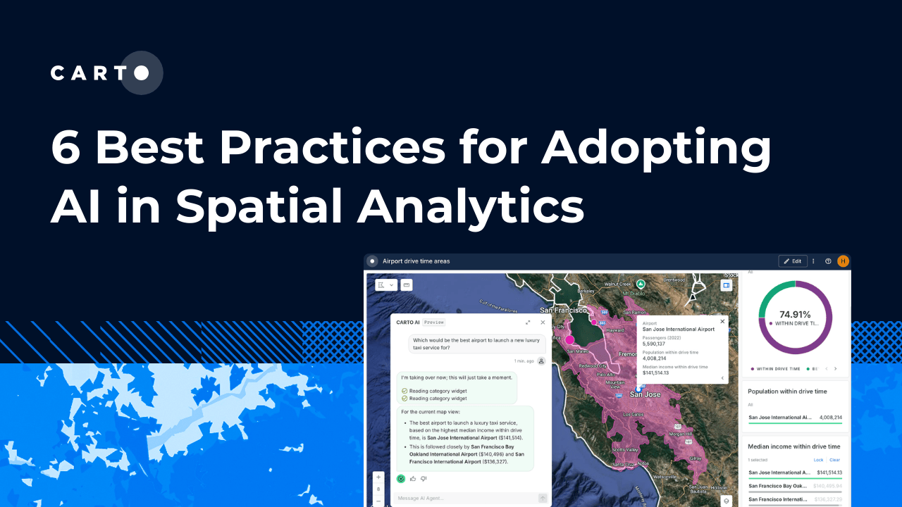

6 best practices for adopting AI in Spatial Analytics
Learn 6 best practices for integrating AI into spatial analytics. Establish a secure, scalable AI strategy to automate tasks and make confident decisions.
.png)
Geospatial Sovereignty in the Age of AI: A Layered Approach
Geospatial sovereignty in the AI era: why open formats, flexible compute, and interoperable standards are key to resilient, independent digital infrastructure.
.png)


CARTO MCP Server: turn your AI Agents into geospatial experts
Discover how the CARTO MCP Server lets enterprises connect AI agents like ChatGPT & Gemini to geospatial data and workflows via MCP.
.jpg)


Maps with a Mission: Environmental Impact with Spatial Analytics
Let’s dive into how organizations use CARTO to protect biodiversity, advance climate research, manage natural resources, and drive sustainable decision-making.
.png)
The first 5 maps everyone needs to make with CARTO
New to CARTO? Start with these 5 essential maps! Learn how to analyze proximity, work with big data, integrate real-time updates, and leverage AI-driven insights.

24 of the best maps, visualizations & analysis from 2024
Discover 24 of the best maps, visualizations, and analyses from 2024! Explore innovations in geospatial data, user-centric tools, & advanced spatial analytics.
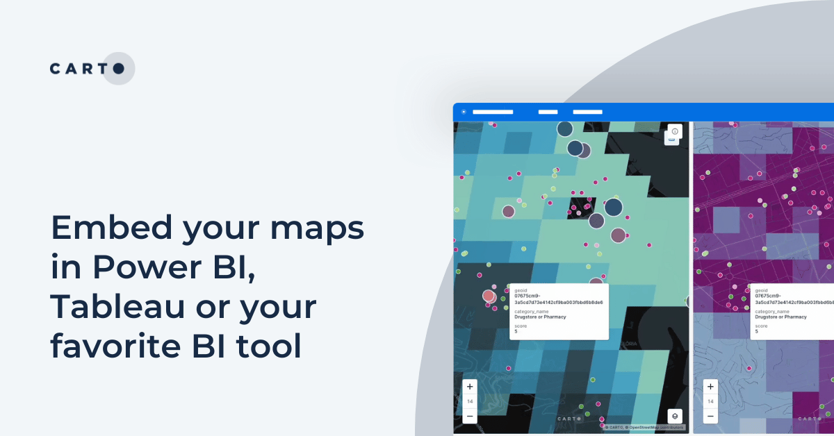
Embed your maps in Power BI, Tableau or your favorite BI tool
Learn how to embed CARTO maps in Power BI, Tableau, and other BI tools to enhance dashboards with interactive spatial data visualization and insights.
.png)

Cloud-native Life Sciences analytics with CARTO & Snowflake
Optimize Life Sciences analytics with cloud-native geospatial solutions using CARTO & Snowflake. Scale data insights for improved decision-making.
.png)
What is Supply Chain Network Design and How Does It Work?
Improve your supply chain network design! Use spatial analysis to optimize your supply chain design for cost savings, efficiency, resilience & sustainability.


.png)


Academy
The State of Spatial Analytics 2026 - Register interest!
Key findings from the survey reveal major changes since 2024. Register interest now and get early access to the State of Spatial Analytics 2026 Report.
What is Agentic GIS?
Discover Agentic GIS: AI-powered spatial analysis that automates workflows, amplifies GIS expertise, and delivers actionable geospatial insights.
Geospatial Sovereignty in the Age of AI: A Layered Approach
Geospatial sovereignty in the AI era: why open formats, flexible compute, and interoperable standards are key to resilient, independent digital infrastructure.