


CARTO & Snowflake: Location Intelligence for Energy and Utilities
CARTO and Snowflake expanding cloud-native Location Intelligence for Energy and Utility organizations, unifying IoT data for resilient operations.


Open Data on COVID-19 Now Available in Data Observatory
CARTO makes available a set of COVID-19 related datasets as public data in the Data Observatory v2.0


CARTO & Fulcrum partner to provide COVID-19 emergency response solutions
Leaders in data collection & spatial analysis come together to enable organizations to overcome the coronavirus through grants program.


Spatial.ai in CARTO: Geosocial Data Insights During & Post COVID-19
Geosocial Data is now available in CARTO through our partnership with Spatial.ai. See how location-based social media data can be used in spatial analysis.

AsistenciaCOVID-19 Available in Five New Regions of Spain
AsistenciaCOVID-19, the self diagnosis app which CARTO is collaborating on, is now available in five new regions of Spain.


Location Analytics: A Roadmap to Post COVID-19
Everyone has the same question: when will we return to normal? Spatial analysis has helped immensely to contain the spread, now how will it help us recover?

How Location Data Streams Can Be Used to Fight Against COVID-19
A look at how spatial data & analytics can become insightful resources to those designing, monitoring & optimizing responses against COVID-19.

Analyzing Food Access in NYC During COVID-19
We explore how Territorial Empathy are using spatial analysis to visualize food access across NYC during the pandemic.

Online Grocery Shopping - Route Optimization & Spatial Analysis during COVID19
How can online grocery shopping businesses use spatial analysis & route optimization to optimize through panic-buying? We explore real-life examples.

Mobilizing Volunteers to Help the Most Vulnerable through Maps
#StudentsAgainstCorona is a platform supported by our grants program enabling the pairing of volunteers with the elderly & vulnerable individuals who need support through the Coronavirus lockdown.
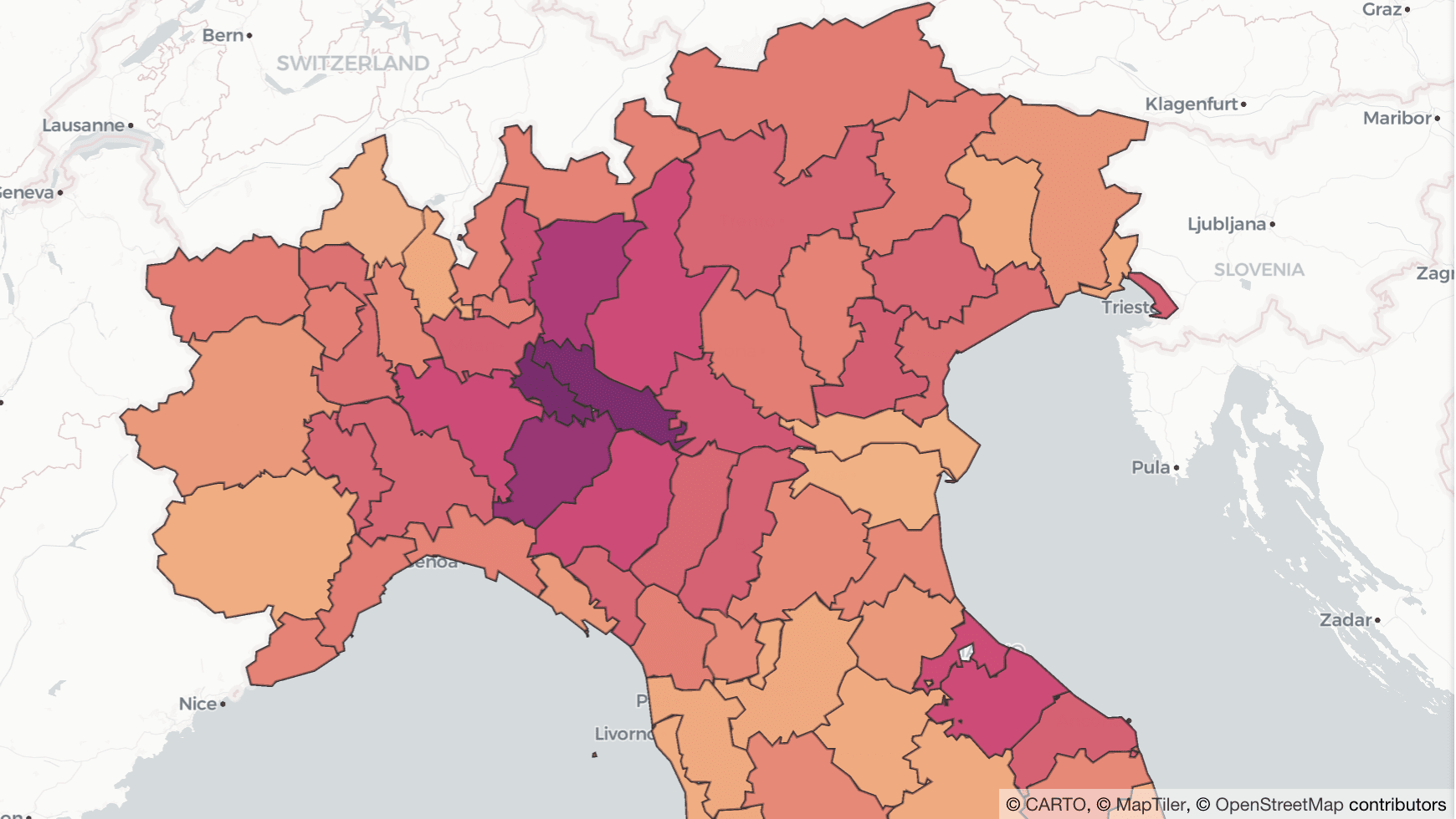

Why Lockdown Matters: Exploring Human Mobility Data in Italy
Analyzing the relationship between human mobility and the spread of COVID-19 in Italy.

CARTO collaborates on 'AsistenciaCovid19' App against Coronavirus
CARTO work alongside ForceManager, Mendesaltaren, Telefonica, Google, Ferrovial & others to slow down the spread of COVID-19

Analyzing the Impact of Coronavirus on Meetups
A look at the impact of Coronavirus on Meetup RSVPs including the correlation between the location of COVID-19 cases and attendance in Italy

Academy
CARTO & Snowflake: Location Intelligence for Energy and Utilities
CARTO and Snowflake expanding cloud-native Location Intelligence for Energy and Utility organizations, unifying IoT data for resilient operations.
Nagarro & CARTO: Advancing Enterprise AI Transformation
CARTO and Nagarro partner to help enterprises move AI from pilots to production, embedding Location Intelligence into existing workflows and systems.


Unlock trade-area analysis at scale with H3 Isochrones
Scale travel-time analysis with H3-based isochrones in CARTO. Faster joins, overlap insights, and 96–99% time savings powered by TravelTime.

