


Spatial Analytics in 2026: What's Changing?
Explore how AI, cloud-native tools, and evolving skills are reshaping spatial analytics in 2026, based on insights from 200+ geospatial experts.


Boom or Bust! What Enigma’s newest project tells us about the economy of North Dakota
Explore Enigma's Boom or Bust project, delving into North Dakota's economy using CARTO for compelling visual storytelling.

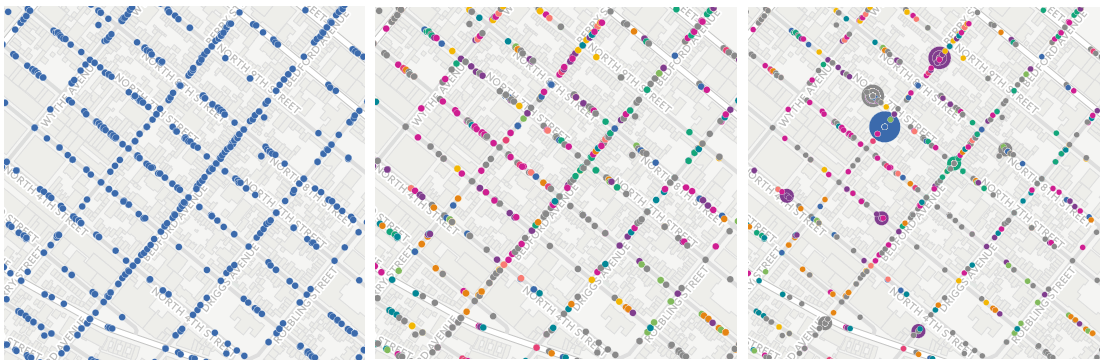
Creating Category Maps with CARTO Builder
Learn to create Data-Driven Maps with CARTO Builder! Color-code geospatial features by category effortlessly. Improve decision-making now!

CartoDB to CARTO: the Back Story to our New Brand
Discover the rebranding of CartoDB into CARTO, a cloud-native platform enhancing location intelligence and spatial data analysis capabilities.
Connect and learn with CARTO in September
Explore groundbreaking spatial analysis & visualization innovations by CARTO. Join us at events worldwide & dive into data insights. Discover more!


Excited for SXSW 2017? Vote for our CARTO-inspired submissions for Interactive!
CARTO at SXSW 2017! Explore geospatial innovation with our panels - Eye in the Sky, Multi-Dimensional Mapping, Open Geo in the Age of Pokémon Go.

Join us for the Hackathon for Natural Disaster Management, in Quito!
Explore geospatial solutions at the Quito Hackathon for Disaster Management! Join the tech community in tackling challenges.


Going to FOSS4G in Bonn, Germany? Come check out the latest and greatest with CARTO!
CARTO showcased innovations in open-source geospatial tech at FOSS4G 2016, including workshops and demos on dynamic maps and mobile GIS app development.


Academy
Spatial Analytics in 2026: What's Changing?
Explore how AI, cloud-native tools, and evolving skills are reshaping spatial analytics in 2026, based on insights from 200+ geospatial experts.


CARTO CLI: Automated CARTO management built for AI Agents
Meet the CARTO CLI: a command-line interface that unifies human expertise, automated pipelines & AI agents into one geospatial operating model.

CARTO AI Agents now integrated with Amazon Bedrock
Unlock secure, AI-powered geospatial analysis in your AWS environment. Learn how CARTO's Agentic GIS and Amazon Bedrock integration makes spatial insights accessible to everyone.

.png)