CARTO now integrated with Databricks Spatial SQL & Mosaic AI


Geospatial analytics is rapidly becoming a core capability of the modern cloud data platform. As organizations consolidate analytics, AI, and governance on open lakehouse architectures, the ability to store and analyze spatial data natively and at scale has never been more critical. According to research conducted by BCG, companies with advanced geospatial capabilities drive 1.4-2x more impact on metrics like customer retention, revenue growth, and operational efficiency.
The value of location in decision-making is indisputable.
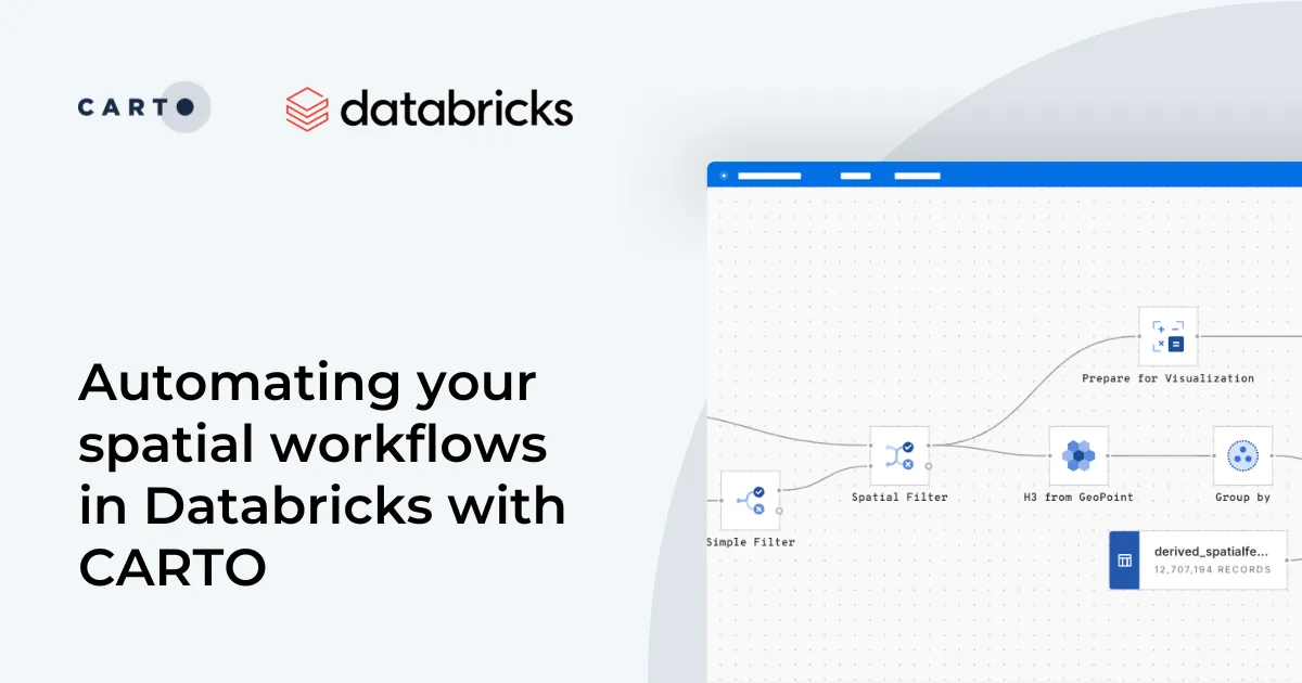
With the launch of Agentic GIS, CARTO redefined how Agentic AI and geospatial analytics come together. Today, we’re thrilled to announce a major evolution of CARTO’s cloud native integration with Databricks. This new integration delivers full, native support for Databricks Spatial SQL functions and data types and allows you to power Agentic GIS with your vetted Large Language Models (LLMs) on Databricks Mosaic AI Model Serving. This integration enables you to run advanced geospatial AI Agents and analytics directly on Databricks without external libraries, custom runtimes, or separate compute.
This release marks a significant milestone in our long-standing partnership with Databricks and reinforces our mission to build the leading cloud-native GIS platform for the modern lakehouse.
Native Spatial SQL in Databricks: A new era for geospatial
In late December, Databricks introduced native Spatial SQL support, extending its platform with a comprehensive set of geospatial capabilities. This includes over 90 spatial functions and native support for GEOMETRY and GEOGRAPHY data types.
Why is this a big deal? Built-in Spatial SQL is the gold standard for processing vector data. It delivers:
- High-performance queries with no dependency on add-on libraries.
- Seamless, scalable execution on Databricks SQL Serverless, eliminating the need to manage clusters or runtimes.
- Unmatched stability for your most critical workloads
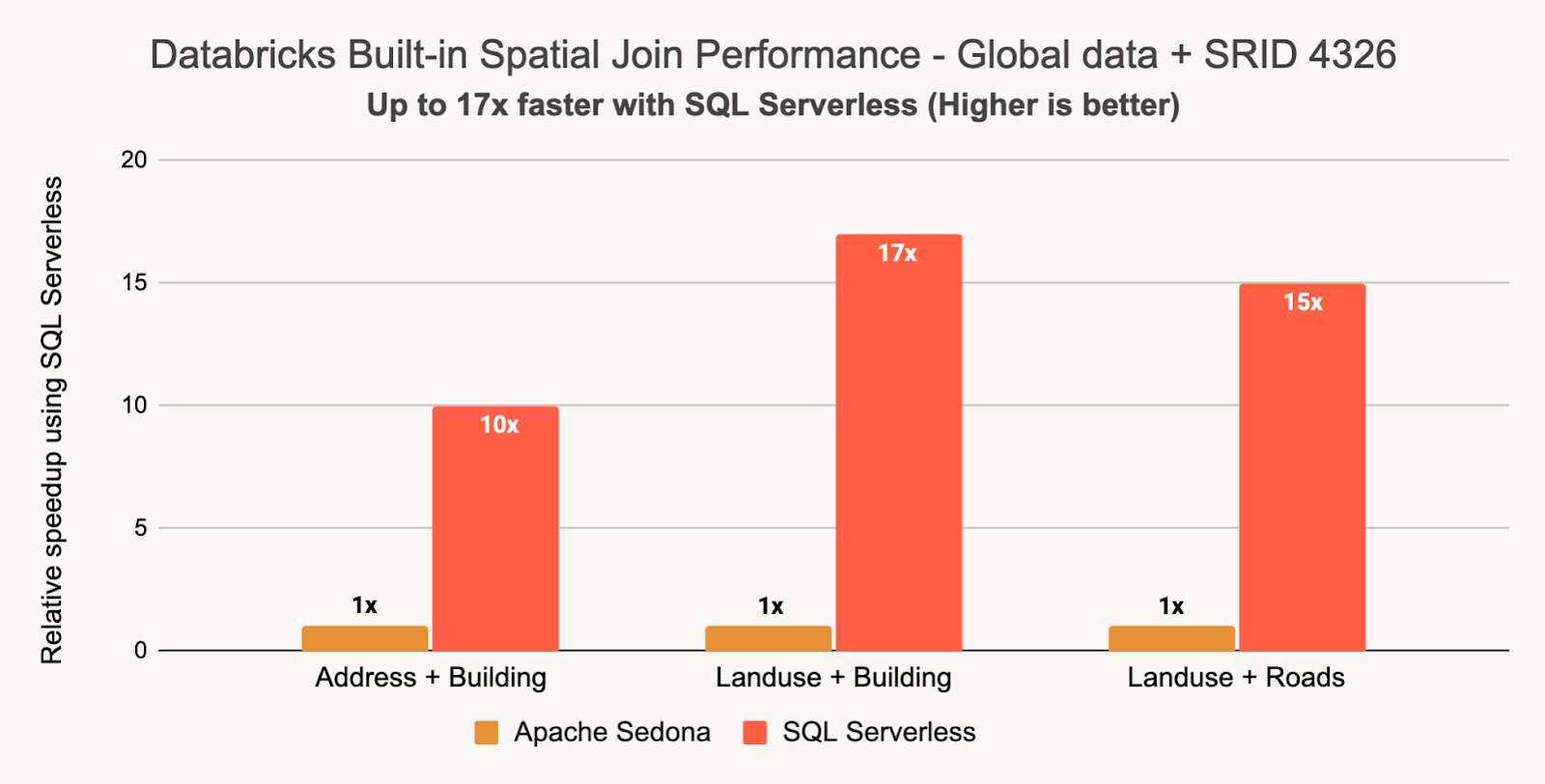
According to Databricks, their native Spatial SQL is up to 17x faster than Sedona out-of-the-box for large-scale data.
By making spatial a first-class data type, Databricks removes the barriers to large-scale geospatial analytics, allowing it to live alongside the rest of your analytical workloads.
A truly cloud native GIS platform on Databricks
With this release, CARTO is the only fully native GIS platform on Databricks. We’re not just connecting to Databricks; we’re built to run inside it, leveraging the full power of Spatial SQL to support the next generation of AI-driven and agentic geospatial workflows.
Here’s what this deep integration helps you to do:
- Go Serverless & one compute layer: CARTO runs entirely on Databricks SQL Warehouses, delivering a serverless, cloud-native experience with no cluster management overhead.
- Work with your spatial data Instantly: CARTO Builder and Workflows now work seamlessly with Databricks tables containing GEOMETRY columns - no more data transformation or preparation required.
- Maximize performance & scale in Databricks: All spatial operations— whether triggered by users, applications, or AI agents— are translated into native Databricks Spatial SQL functions, ensuring performance and scalability, performance, and consistency with other analytics workloads..
- Connect securely & flexibly: Support for Personal Access Tokens (PAT), M2M, and U2M authentication aligns with Databricks access control and security models.
- Simplify governance: The CARTO Analytics Toolbox now installs directly into Databricks Unity Catalog, with no external dependencies— simplifying governance, deployment, and lifecycle management.
This powerful combination lets you pair CARTO’s cutting-edge mapping, spatial analytics, and Agentic GIS capabilities with Databricks’ best-in-class lakehouse architecture, making geospatial intelligence a core component of your AI-driven decision-making.
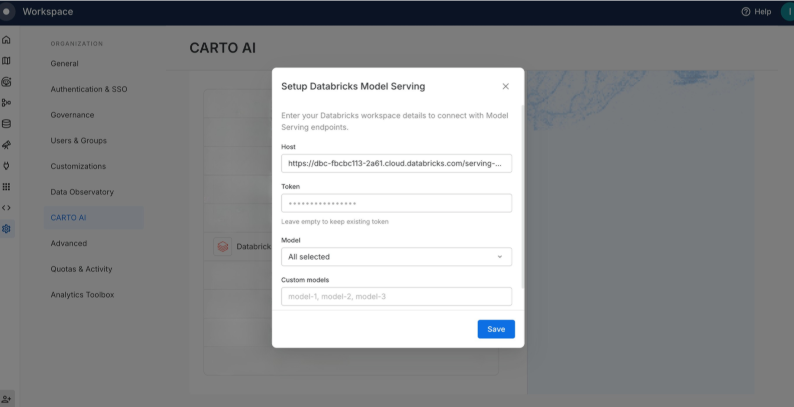
Agentic GIS powered by Databricks Mosaic AI
Beyond native spatial analytics, you can now power CARTO’s Agentic GIS capabilities with Databricks Mosaic AI Model Serving. This allows you to build AI Agents powered by geospatial workflows that are in complete alignment with your enterprise AI governance.
With this approach, you maintain full control:
- Your spatial data never leaves Databricks
- All geospatial computation runs directly on Databricks SQL
- Data access policies are enforced through your Databricks governance controls
- Approved LLMs and endpoints are defined and managed in Databricks Mosaic AI
This integration allows you to deploy powerful geospatial AI Agents with confidence. Because CARTO runs natively within your lakehouse, we respect your Databricks governance, security, and control model from end to end. This makes it simple to operationalize Agentic GIS as part of your enterprise-grade AI strategy, knowing your data and security are never compromised.
Start building today!
The new Databricks connection is now available across all CARTO accounts. If you’re already using Databricks, you can start leveraging native Spatial SQL, serverless compute, and AI-powered geospatial analytics with CARTO today.
Ready to dive in? Check out this webinar. Sign-up to attend live or watch on your own time.
Request a demo with one of our experts or dive into our documentation to get started.