
Looking for an alternative to Mapbox?
CARTO is the leading spatial analytics platform for cloud natives. See why modern spatial app developers are making the switch.

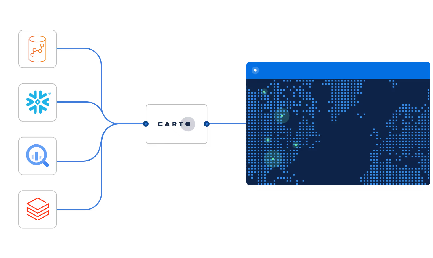
Fully cloud native
Connect directly to your data warehouse and deploy on-demand spatial applications, with all data stored within your existing cloud data infrastructure.

Cost effective tiling
CARTO is a powerful solution to visualize & analyze geospatial data at scale. Render massive amounts of spatial data efficiently, and cost effectively.

Scalable development
Create map tiles using native data warehouse resources with no limits on scalability. Build performant spatial applications using any JavaScript framework.
Why choose CARTO over Mapbox?

CARTO vs Mapbox at a glance
The leading cloud-native geospatial analytics platform for teams of all sizes.
Location technology for automakers, mobile app developers, and logistics services.
CARTO
Direct cloud connections with no limitations on multiple data warehouses. All queries are run natively on the data warehouse, and no data is stored in CARTO.
Alteryx
Mapbox does not connect natively to cloud data warehouses. Data must be uploaded into Mapbox, by UI or API, for processing and analysis.
CARTO
CARTO Data Observatory provides over 12,000 public and premium datasets from a variety of vetted data providers, including boundaries, demographics, points of interest and more.
Alteryx
Boundary data to support map tiling (political, statistical, state, county, city and zip code). Human mobility and traffic movement data.
CARTO
Analysis is run natively using Spatial SQL directly in the cloud data warehouse environment, using our comprehensive Analytics Toolbox.
Alteryx
Limited spatial operations, for data transformation, conversion and measurement through an integration with Turf.js.
CARTO
CARTO uses deck.gl, a powerful open source visualization library. CARTO is the principal contributor to the project, and our technical leadership forms part of the deck.gl steering committee.
Alteryx
MapboxGL uses a closed source, proprietary visualization library for creating map based applications.
CARTO
Develop spatial applications using CARTO with any JavaScript framework (Angular, Vue, React…), or vanilla JavaScript/Typescript.
Alteryx
Mapbox integrates with Angular, Vue, React, Ember, and vanilla JavaScript.
CARTO
Create static map tiles natively in your data warehouse using SQL, or in the CARTO Workspace UI. Render tiles on the fly in CARTO Builder. Vector tile support and no server callback. Flexible controls for maximum tile size and feature dropping schema for high zoom levels.
Alteryx
Create static map tiles using data files uploaded to Mapbox's Tiling Service, tiles generated via Tippecanoe, other tiling services locally, or in a cloud compute environment. Interact with the tiling service via API or the Mapbox CLI.
CARTO
Map tiles are generated dynamically based on a query passed to your cloud data warehouse.
Alteryx
Not available.
CARTO
Create static or dynamic tiles using only spatial index data such as H3 or Quadbin. Handles automatic index aggregation on the client side.
Alteryx
Not available.
CARTO
No limits on data size in storage or number of features. Some limits pertaining to CPU configuration within the data warehouse for large geometries. Most limits can be overcome with other tiling methods such as intelligent feature dropping.
Alteryx
Data sources (or layers) cannot exceed 20GB individually, or exceed 50GB in total for one tiled layer. The size of a single vector tile is limited to 500 KB.
CARTO
No known limits. Current examples in production with more than 2.7 billion features.
Alteryx
Not available.
CARTO
For an OpenStreetMap building polygons tileset (approx 400 million features).
Single run processing time: 8 minutes 13 seconds.
$0.13 cost of processing data in BigQuery (150GB in total).
Annual cost: $6.24 (Excluding licenses for the example tileset)
Alteryx
For an OpenStreetMap building polygons tileset (approx 400 million features).
Estimated single run processing time: 89 hours.
~$1,600 cost of processing data (up to zoom 16) for a single run.
Annual cost: $77,592 (for the example tileset).
CARTO
Fully cloud-native with serverless connections and deployment.
Alteryx
SaaS only offering, except for specific map styling and offline map hosting using Mapbox Atlas.
CARTO
SaaS or self-hosted options deployed with Docker Compose or Kubernetes. Cloud Marketplaces are supported.
Alteryx
Cloud SaaS offering for most services. Map styling and offline map hosting with Mapbox Atlas. Deployed via Docker Compose or Kubernetes.
CARTO
Data is not stored in CARTO, only returned via API. You control all data in your data warehouse. Flexible Enterprise pricing plans, with all inclusive pricing.
Alteryx
Hosted and generated tiles cannot be exported out of Mapbox.
CARTO
Single API layer used in all platform products.
Alteryx
API based product. Several APIs to interact with different Mapbox components.
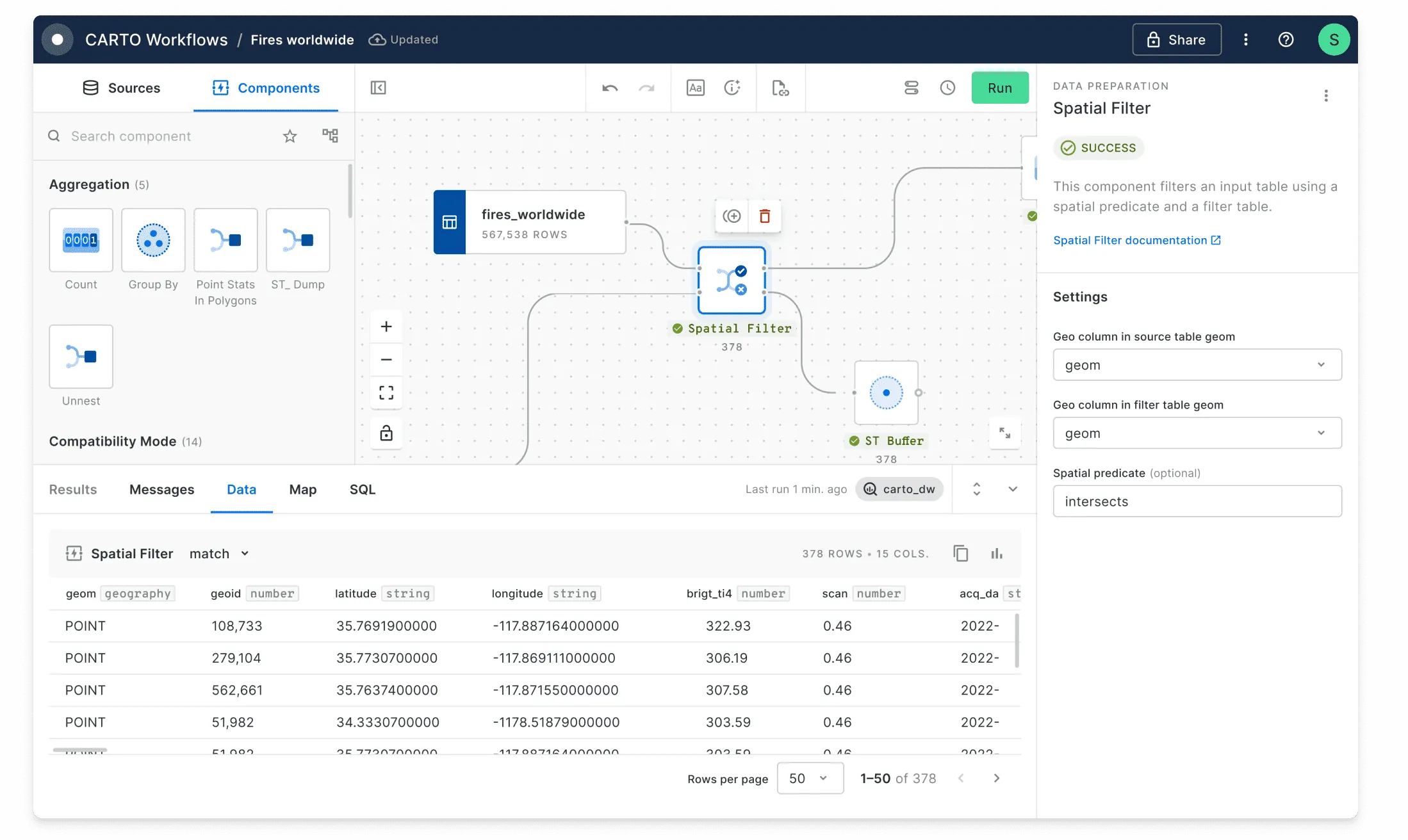
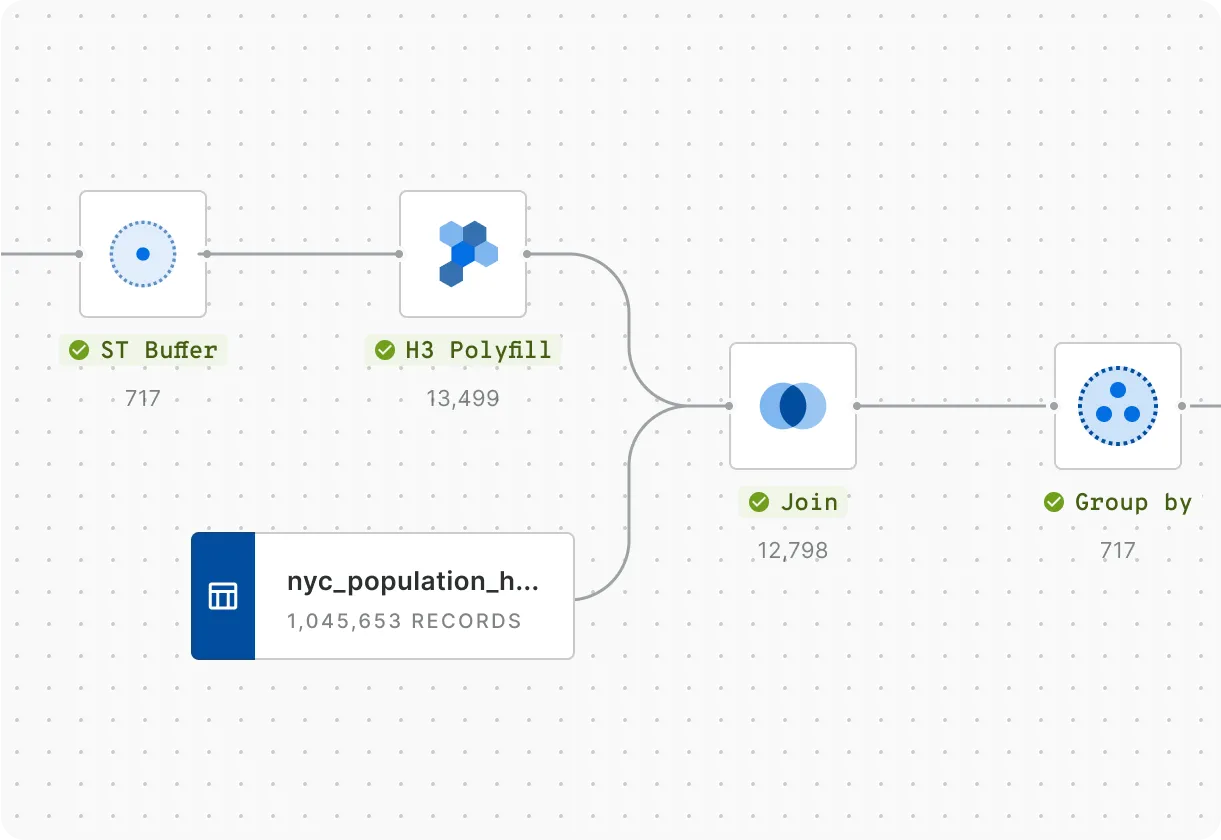
Rapidly carry out spatial analysis
Data Analysts starting out in location analytics or Data Scientists creating machine-learning models can use the CARTO platform to speed up insight generation. Workflows let you design, execute and automate analytics using a visual, no-code tool. Run advanced cloud-native analysis with our comprehensive Analytics Toolbox.
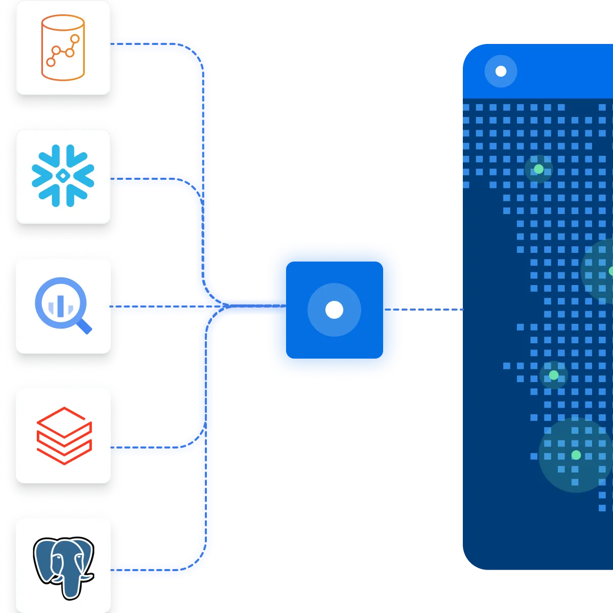
Easily connect your spatial data
CARTO integrates natively with the leading cloud data platforms and analytics tools, including Google BigQuery, Snowflake, Amazon Redshift and Databricks.
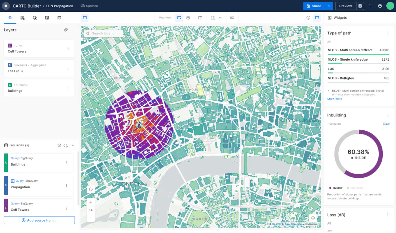
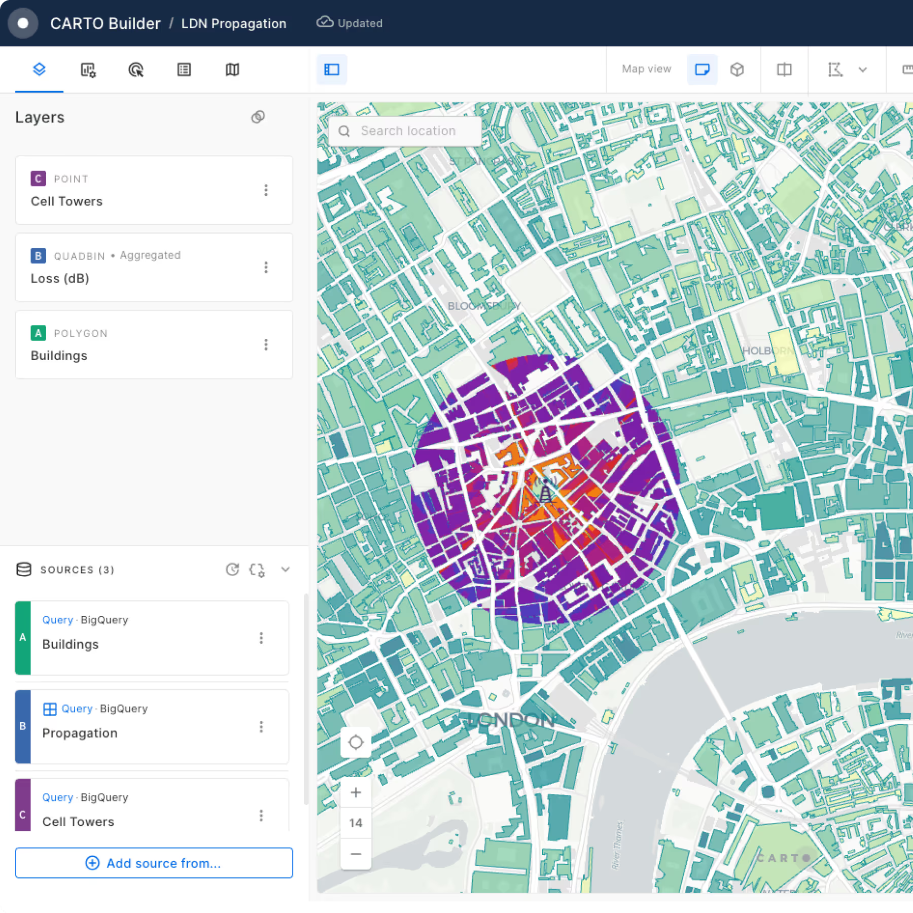
Build powerful Location Intelligence apps & visualizations
Visualization shouldn’t just be pretty maps, it should answer a business question. With CARTO, you can rapidly build Location Intelligence apps using our developer resources and templates. Our cloud native Dynamic Tiling technology provides a cost-effective and performant solution for visualizing spatial data at scale.
Access more than 12,000 geospatial datasets
Our Data Observatory makes it simple for enterprise organizations to access thousands of "always-on" public & premium datasets, enhancing their spatial analysis with data such as demographics, POIs, human mobility, financial and much more.

Get inspired by our customers

CARTO’s Location Intelligence platform lets us visualize massive sets of data hosted in Google BigQuery. Thanks to this cloud-native approach to spatial analytics, we have overcome challenges related to scalability and security, and can serve our customers even better.

Using CARTO has enabled us to analyze service qualification at a much larger scale due to its comprehensive support for a wide range of functions and libraries including spatial indexes. This is a gamechanger, modernizing our GIS stack.