

The first and only cloud-native GIS platform
Learn why GIS professionals are turning to CARTO for a scalable approach to spatial analysis


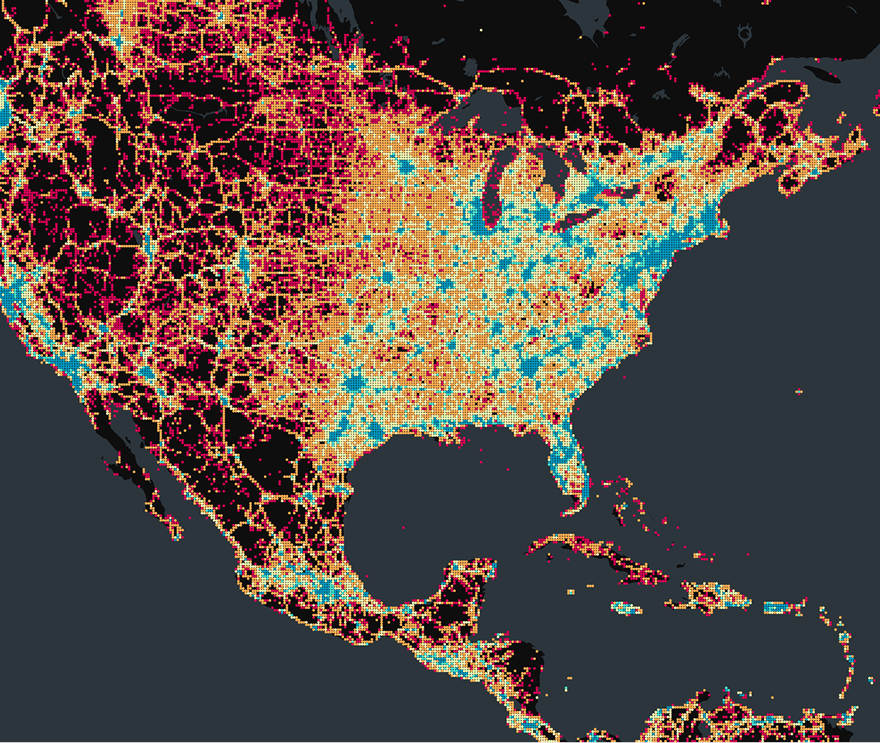
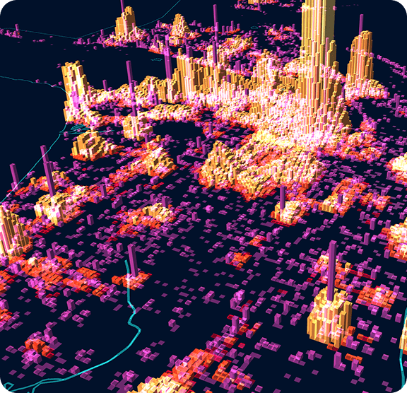
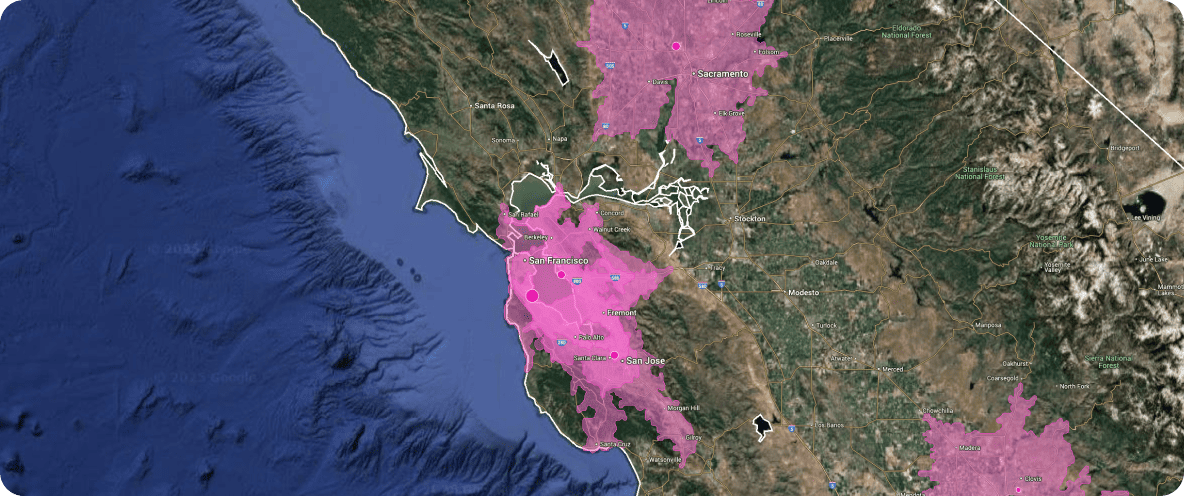
Scalability without limits
Seamlessly analyze and visualize billions of features, directly from your lakehouse.
Full stack integration
De-silo your GIS by placing it at the heart of your tech and data infrastructure.
Short learning curve
An intuitive platform that helps you - and your end-users - deliver insights fast.
Work smarter, not harder
Automate repetitive GIS tasks like data preparation, geocoding, and map updates to free up time for high-value analysis. Focus on insights, not manual work.
.png)
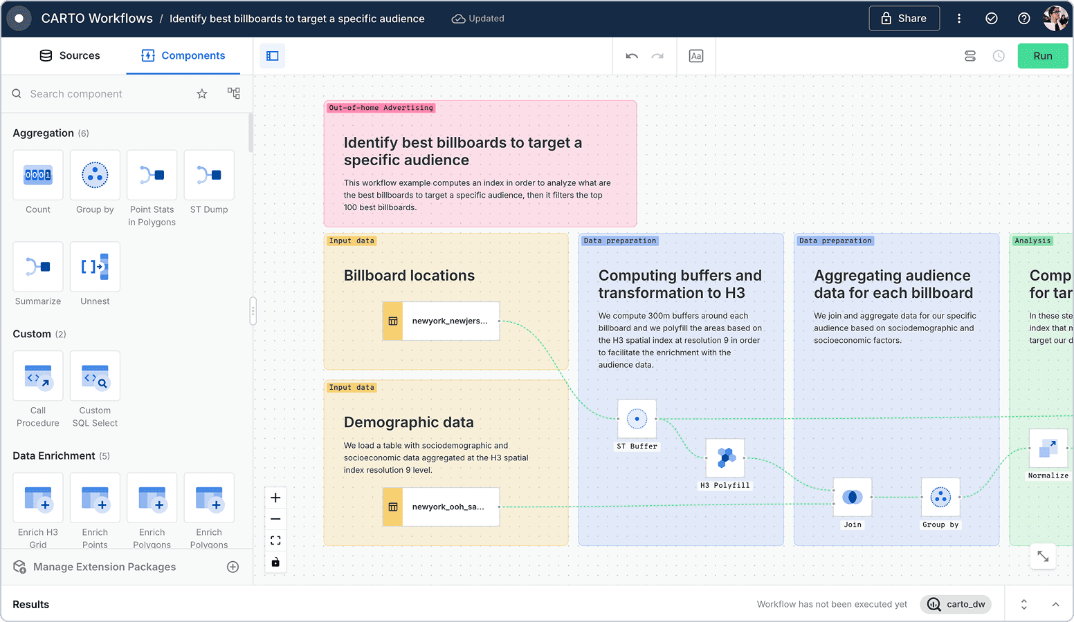
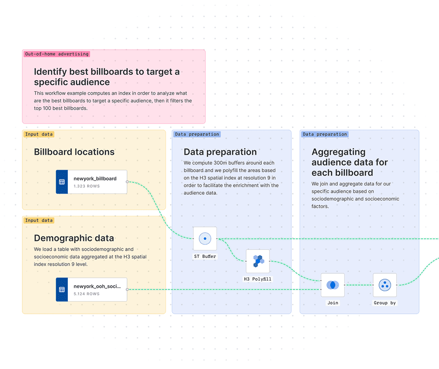
Scalable decision-making
Reduce ETL pain by running geospatial workflows in your lakehouse. Eliminate data silos and collaborate seamlessly across teams from inside your maps.
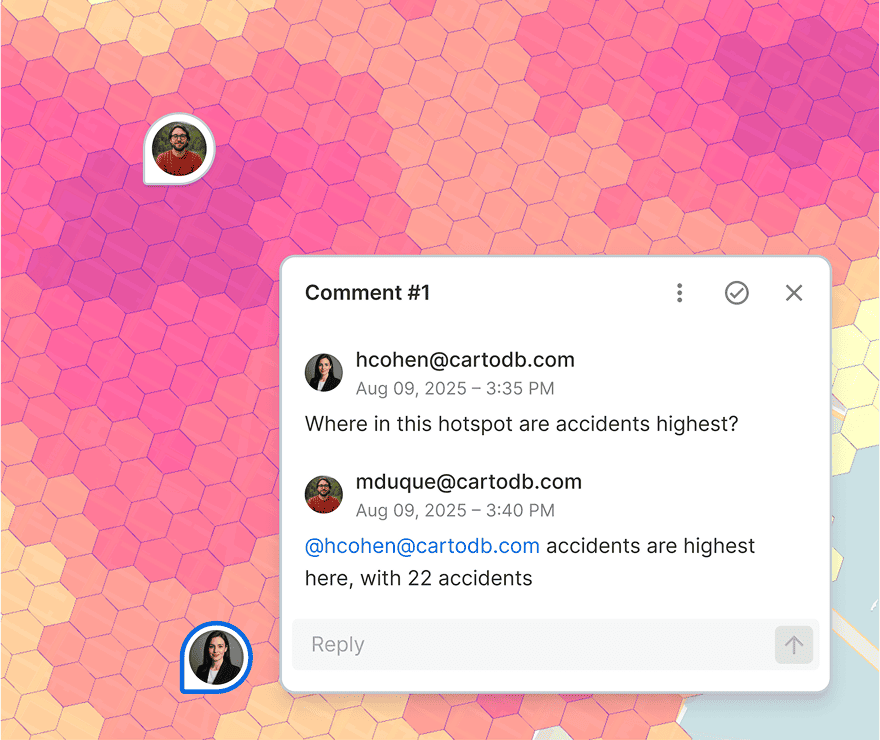

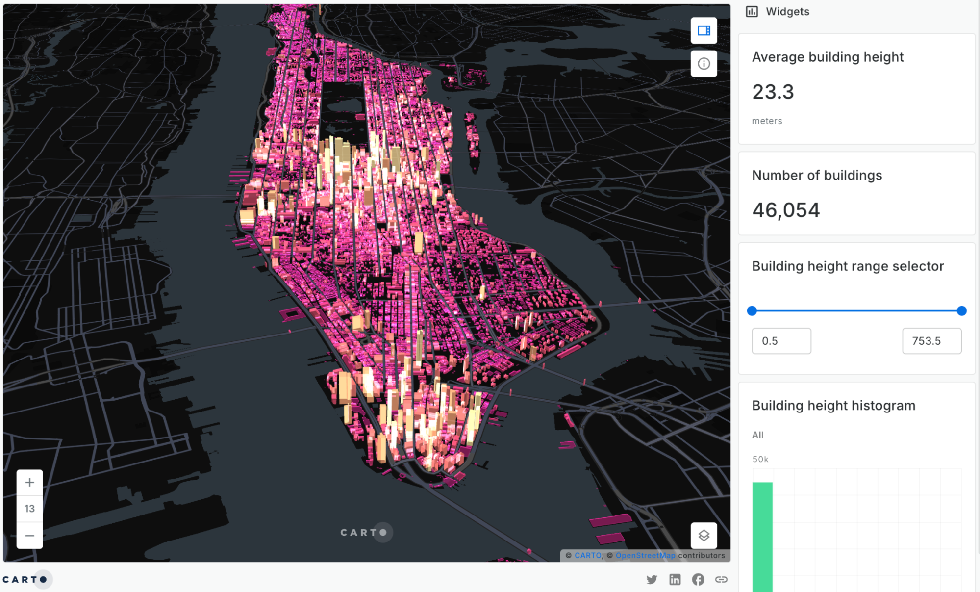
Stunning visualizations made easy
Create dynamic, interactive maps and visualizations with Builder’s intuitive interface. Share insights with stakeholders through easy-to-use, self-serve dashboards with built-in AI Agents.
.png)

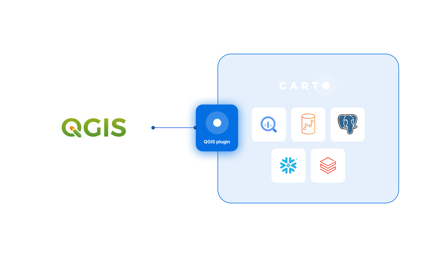
Integration across your organization
CARTO integrates seamlessly with your organization’s tech stack, including QGIS, BI platforms and other GIS & data tools. Ensure interoperability for a more connected, efficient workflow.
Frequently asked questions
CARTO is a 100% cloud-native platform. It is unique among spatial analysis platforms in that all computing is pushed down to your cloud data warehouse; your data never has to leave it. This offers unparalleled speed, scalability and security. Learn more about what this means for your spatial analysis here.
We designed the CARTO platform to handle datasets of all sizes with impressive performance, cost-effectively, on any modern device. Billions of points, polygons, and lines. Read here how you can leverage our technology to create truly massive maps.
The CARTO platform is built to be intuitive. A clean and simple interface, low code tools and drag-and-drop design means that anyone can start getting insights from spatial data, no matter their background. Check out the CARTO Academy to explore our hub of learning resources.
Integration is at the heart of our platform. By being cloud-native, CARTO can be easily integrated with your wider tech stack, with your cloud data warehouse as the foundation. CARTO can also integrate with solutions including QGIS, BI platforms and other GIS tools. Learn more in our Documentation.
Related content
.jpg)

TALK TO US
Request a Demo
Schedule a 20 minute meeting with our experts to understand how you can use spatial analysis in your organization.