


Transcription
NREL Powers Up with Modernized Geospatial for Renewable Energy Solutions
My name is Gabriel Zuckerman and at NREL, most of my work is to do with offshore wind and thinking about cost modelling for offshore wind. Thinking about some of the sighting considerations such as like where can we place wind farms, where can we route transmission, how will it conflict with ocean co-uses.
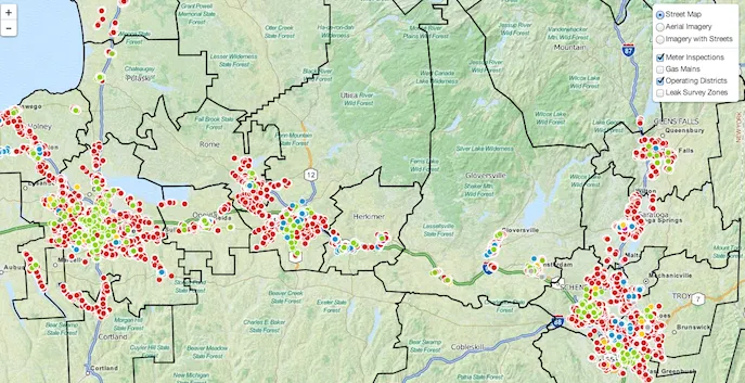
My name is Maya Fein-Cole and my focus is mainly around providing technical assistance to cities around resilience infrastructure and planning. That's like overlaying some great information where outages are, when they're happening, where people are living, what demographics are available about those people and what critical services are needed in cases of outages. And giving that information back to cities and different government agencies helping them figure out where to invest their money and their infrastructure for these emergency situations.
Geospatial Use Cases at NREL
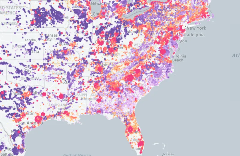
Network Analysis for Emergency Situations
Recently, I've been doing a lot of work with network analysis so in terms of emergency situations, how long is it taking people to access services they need like medical services, groceries, or fuel like gas.
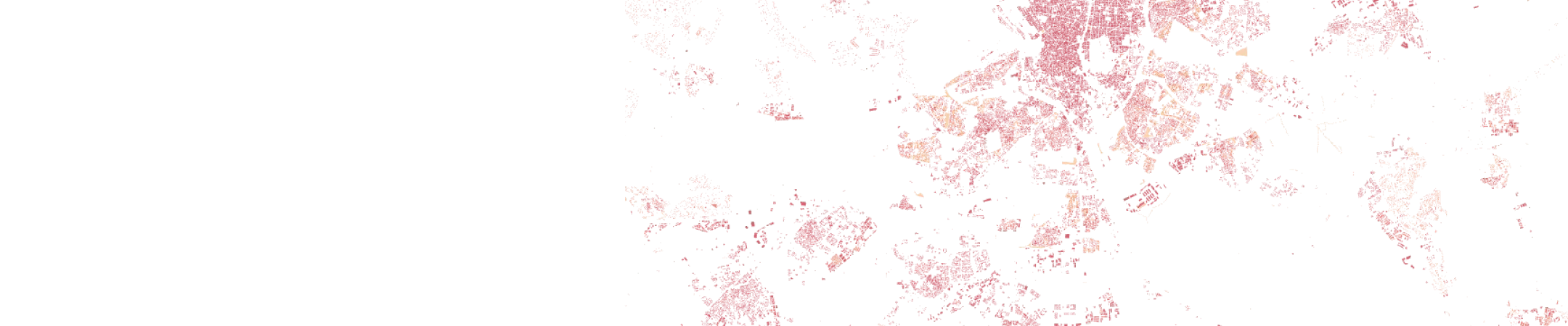
Renewable Energy Potential Modelling
A lot of work that we do on the geospatial data science team is centered around the renewable energy potential model, which is a sort of spatial model primarily used to estimate and understand renewable energy production.
That's inherently spatial, like the solar resource in one place is going to be different than in another place, and for the wind resource is the same. Then also thinking about factors that impact where you can put those renewable technologies. For instance, you couldn't place a wind turbine on top of a building but you might be able to place rooftop solar on that same building so there's a lot of spatial characteristics that go into informing these potential models. Then thinking about building out scenarios, it's very important to understand the spatial sort of needs of a region.
Steps to Modernize NREL’s Geospatial Tech Stack
AI for Resource Dataset Creation
One of the cool things that we've done recently has been using AI models to improve our resource dataset creation, making it sometimes up to a 100 times faster to generate these resource datasets that can be used in climate modelling scenarios.
Climate-Informed Resource Data Sets
We're also using General Circulation Models for future years, so now we're able to understand some of the impacts that climate change might have. Where's the wind going to be blowing stronger or less strong in certain areas, is it going to be hotter, what's the load on specific areas. With these climate informed resource datasets that go up out to 2050, that's just one of the exciting things that we're doing and really taking GIS techniques and modernizing them.
Collaboration and Innovation
Since we are a research laboratory, we partner with a lot of other academic institutions, private companies, governments, or electric utilities that are also doing cutting edge research.