.webp)
Risk Analysis
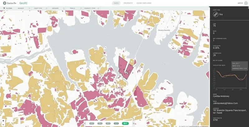
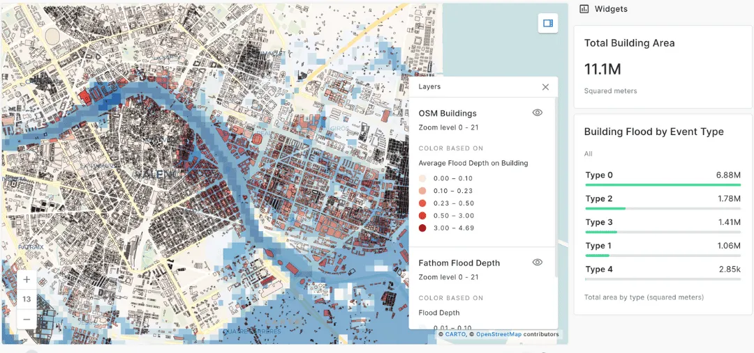
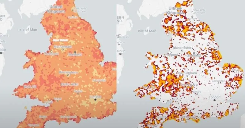
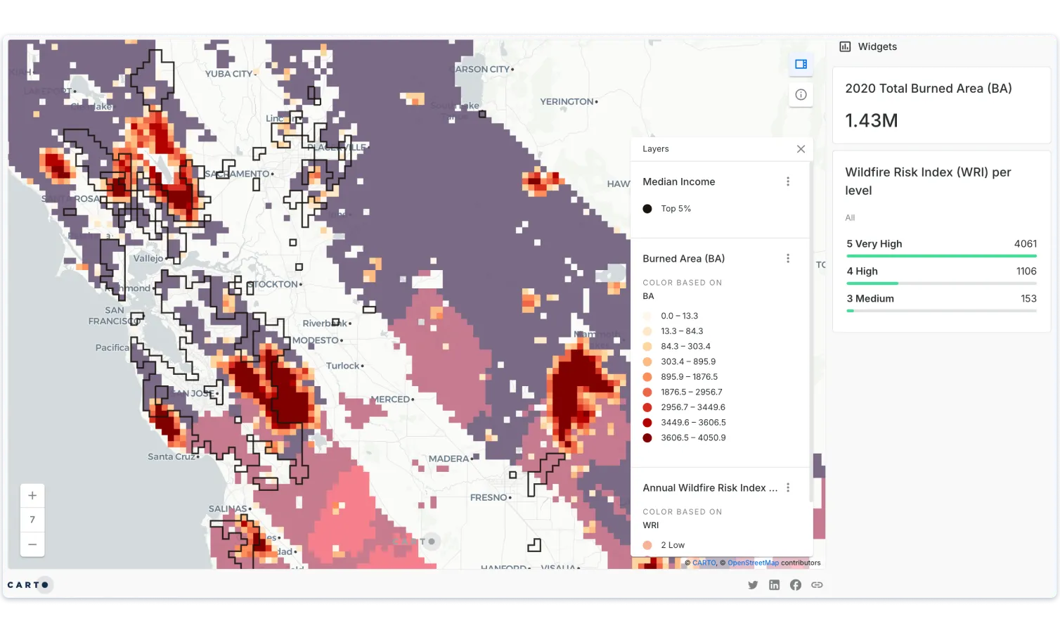
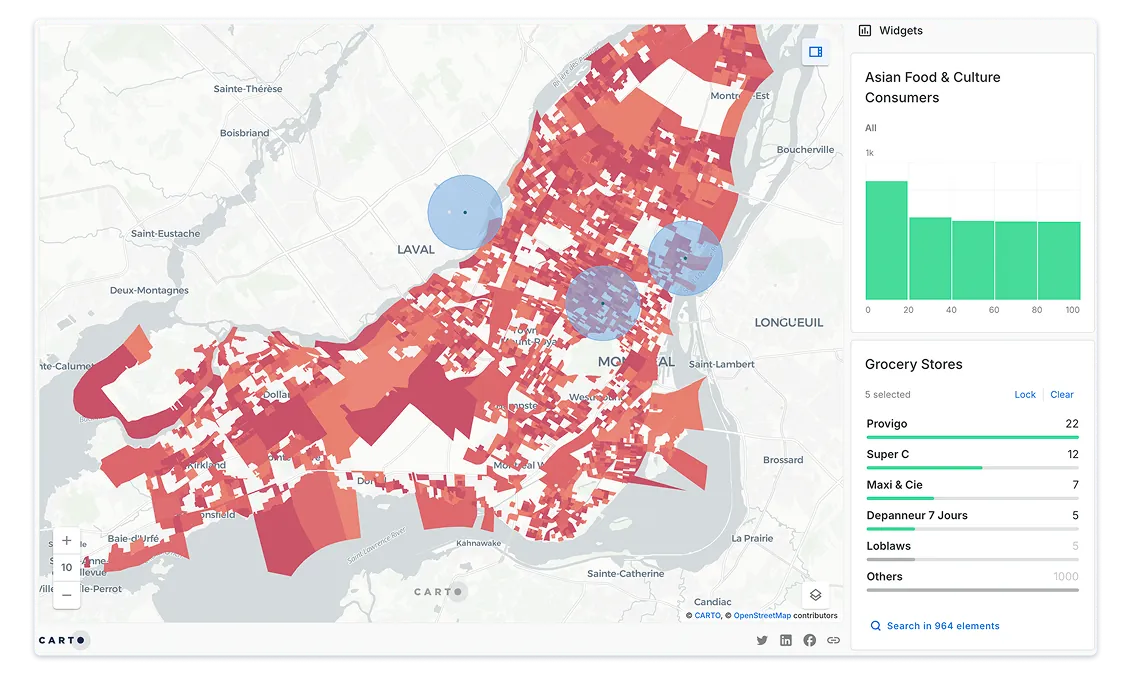
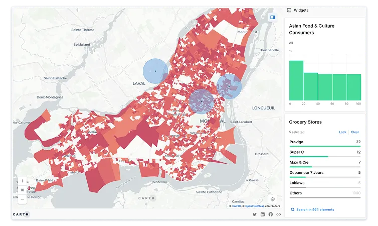
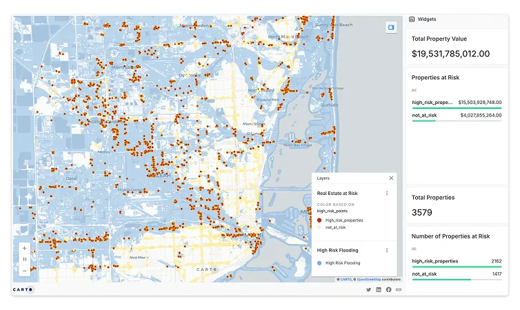
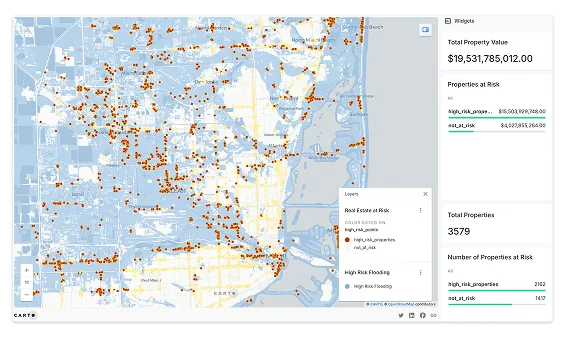
Outdated risk scoring limits underwriting precision and pricing performance. Step up your portfolio risk analysis to improve accuracy and boost profitability.
Trusted by the world's leading companies


Outdated risk scoring limits underwriting precision and pricing performance. Step up your portfolio risk analysis to improve accuracy and boost profitability.
TALK TO US
Schedule a 20-minute meeting with our experts to understand how you can use spatial analysis in your organization.

.webp)