


The Client
Mexico City
With more than 9 million residents within its care, Ciudad de México (CDMX) faces challenges when it comes to protect and provide the best services to its habitants. So when in September 2017 an earthquake struck the Greater Mexico City area, CDMX realized they needed an immediate solution to optimize the resource allocation as quickly as possible to rebuild the capital.

The Challenge
Plataforma CDMX, developing a two-way data-sharing solution
After the earthquake struck, response effort teams faced unprecedented obstacles due to infrastructure damage across the city to assess citywide damage. Therefore, they needed a geospatial two-way digital solution, where citizens could file property damage reports and local authorities visualize data and allocate emergency resources.

Results
A transparent and centralized resource guiding solution
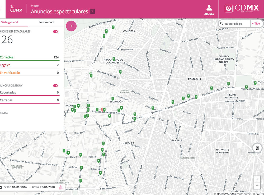
Using CARTO Engine and geocoded census data, Plataforma CDMX features an interactive cadastral map that allows users to submit damage claims, locate nearby properties whose damages pose risks, and keep track of the status of technical assessments. Committed to transparency, it is the centralized resource guiding reconstruction efforts in Ciudad de México today.
.svg)
Why CARTO?
A flexible geospatial technology
With census data from the Data Observatory and CARTO’s experience of helping cities and governments with custom-made solutions, Plataforma CDMX began as a data collection tool. However, through the power of Location Intelligence, it has evolved in just one year into a sophisticated resilience and emergency planning solution.