Out Of Home Analytics
OOH companies & agencies are increasingly using location analytics and geospatial data to pinpoint audiences, using new types of geospatial data to lift ROI.


Use geospatial data to get OOH location insights faster
.webp)
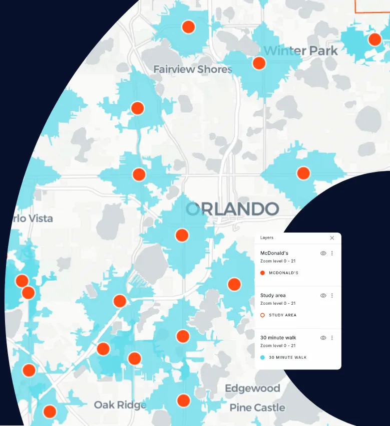
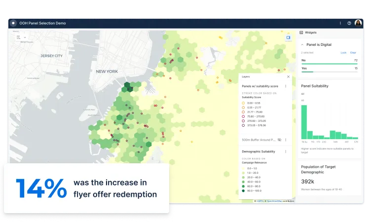
Identify relevant audiences for campaigns
Whether you’re an adtech player, agency, media planner or OOH estate owner, location intelligence plays an essential role in planning, managing, & activating outdoor media campaigns.
Understand the “real-world” behaviour of consumers with new data streams such as human mobility, social media, & financial insights to sell inventory to media buyers & brands more effectively, with better returns.
Increase ROI for brands
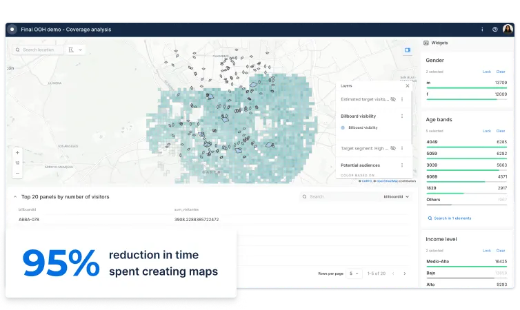
Analyzing & visualizing mobile advertising campaigns to understand how the location of impressions affects CTR, leads generated & CPA is becoming a key part of the modern marketer’s data strategy.
By combining online & offline consumer actions, your brand or agency can build geofencing strategies with visitation, demographic, & socio economic data to ensure a higher campaign ROI.

Micro-segment at a lower granularity
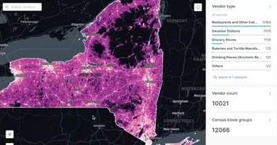
Whether you’re a quick service restaurant (QSR), a retailer, a telco or an ecommerce business, using new geospatial data streams to micro-segment your customers & hypertarget your campaigns by location can have a huge impact on effectiveness.
Whether it’s financial, human mobility, geosocial, or weather data - identifying your audiences on a map can shape your marketing strategies to be more efficient, pushing the right message, to the right audience, at the right time, in the right place.

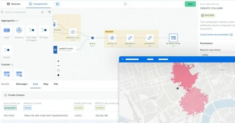
Over 12,000 geospatial datasets available
Take the pain away from selecting, collecting, and analyzing location to understand site performance with our Data Observatory, a one-stop shop for all things geospatial data.
Augment your sales data and broaden your analysis with a wide range of curated datasets on standardized spatial aggregations, such as foot traffic & consumer spend indicators.
Get inspired by our customers


CARTO is very cloud-driven which is ideal for us as we are able to easily leverage our data in Snowflake. The connection allows us to streamline our ways of working with geospatial data in an unprecedented fashion, bringing us more productivity, capability and scalability.


CARTO's Location Intelligence platform lets us visualize massive sets of data hosted in Google BigQuery. Thanks to this cloud-native approach to spatial analytics, we have overcome challenges related to scalability and security, and can serve our customers even better.

CARTO's geospatial solution gives us the ability to process and analyze audience data natively in Redshift. Using these powerful insights, the team at Initiative can configure highly performant media campaigns and respond quickly to our customers demands.


As a multinational leader, we needed a scalable tool that could process lots of different data streams such as social media & road traffic data, at speed. CARTO's platform & professional services team has been a key part of our success in bringing location analytics to our clients.