CUSTOMER STORIES
Meet our customers
Thousands of private & public sector clients rely on our enterprise geospatial platform to increase revenues, reduce costs & mitigate risk. Find out how.


Get inspired by our customers
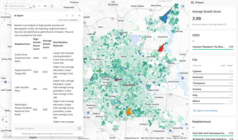
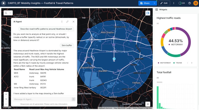
With CARTO’s AI Agents, predictive growth insights move beyond data analysts and into the hands of every decision-maker. Now, anyone can ask our data questions like ‘Which neighborhoods will grow fastest?’ and get instant answers - speeding up site planning and providing a real competitive edge.

“In a competitive landscape we need to be smart about where we place lockers across our estate, ensuring we land in the catchment areas of our target demographics. CARTO has made this a much easier process, both in terms of data & their professional services team.”


"With Gea, we are moving beyond static information to provide digital solutions and a superior customer experience. By giving our consultants an unprecedented amount of information, we can enable our clients to achieve their goals faster - using data to move away from traditional intuition-based decision-making.”


Pick your industry to discover customer stories
.jpg)
.png)
%20(1).jpg)