Isolines
High-quality & reliable isoline maps to ensure your spatial analysis guides business decisions in the right direction.
How can I create isoline maps?
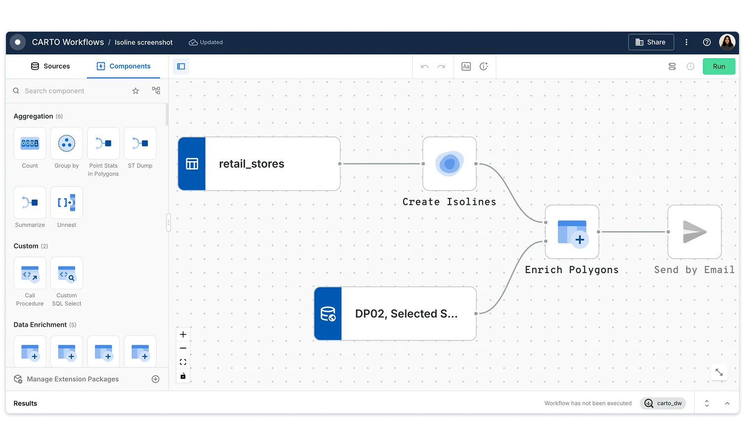
Creating isolines with CARTO is easy! Our low-code tools use real-world transport networks to map accessible areas by walking, cycling, or driving. Easily integrate isoline generation into your workflows to uncover market catchments, optimize site selection, and improve location-based decision-making. Powered by our partners, TomTom, TravelTime & HERE, we provide up-to-date and reliable isoline-building services.


.webp)
What are the most common uses of isoline maps?
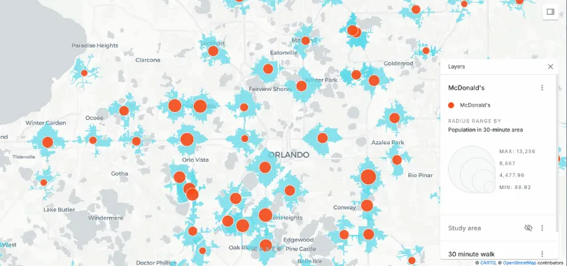
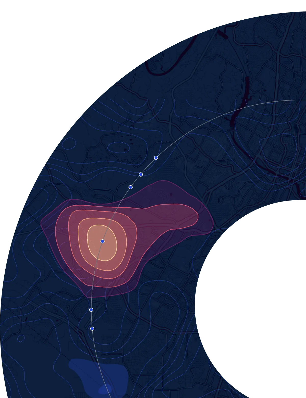
Isoline maps are a powerful analytical tool for understanding catchment areas for a wide range of use cases, whether you're evaluating your supply train, assessing trade area demographics, or analyzing mobility patterns. Being able to seamlessly create and enrich isolines helps you make data-driven decisions faster without juggling multiple services.
Why use CARTO

Save time on evaluation
We regularly vet location-based data providers & forge partnerships to save our users time and resources, giving you more time to spend on your analysis.

Faster access to data
You don't need to be a GIS expert to include isolines in your analysis. They can be created with point-and-click tools or simple SQL.

High-quality data assured
Through our rigorous evaluation processes, we ensure the best isolines are available so that your analysis is accurate.
Frequently asked questions
Fixed-distance buffers that draw simple radius circles from a feature. Isolines are not based on distance, but common numeric values in the data. They are most commonly used to calculate travel along real-world transport networks considering roads, paths, and traffic, providing a more accurate picture of accessibility.
You can create isolines for various modes, including walking, cycling, car, truck, public transport - and more! CARTO accounts for transport networks and restrictions, such as one-way streets and footpaths, to reflect realistic travel conditions.
Isolines help businesses understand who can realistically access their locations, allowing them to optimize site selection, target marketing efforts, and improve logistics by revealing true catchment areas and travel patterns.
Related content