5 Advantages of No Code Spatial Analysis


Are you experiencing a “skills bottleneck” within your geospatial team? Perhaps you have a huge spatial analysis project, but you are reliant on that one member of your team with SQL expertise - slowing the project down. It might be time to go no code for spatial analysis.
No code tools allow users to automate processes without requiring specialist coding skills. They typically feature a visual, drag and drop interface, enabling users to build analytical pipelines more intuitively. This makes no code spatial analysis more democratic than high code alternatives, opening up geospatial to a wider audience - but they also have far wider benefits for your organization!
Keep reading to learn more…
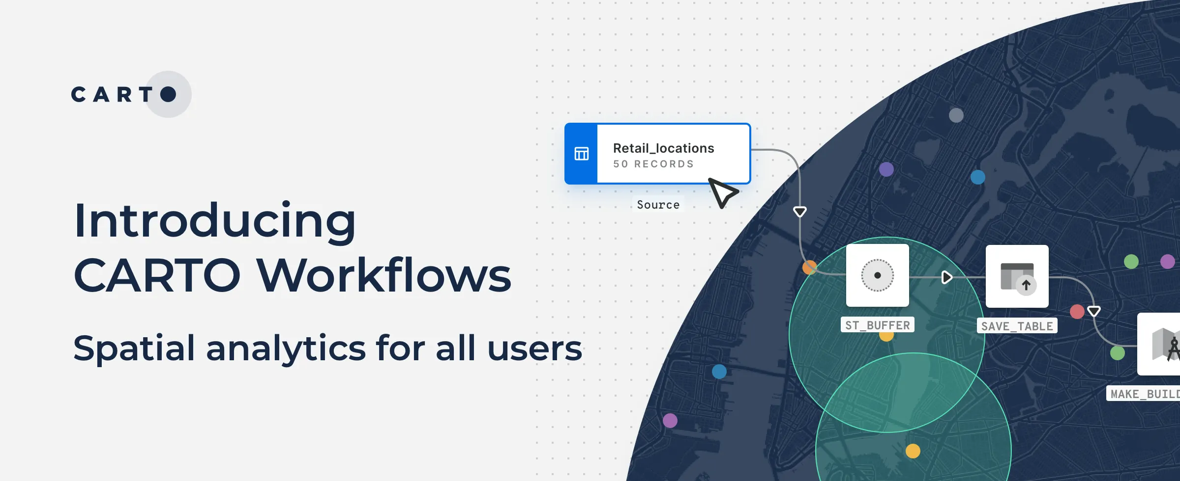
Cloud-native no code spatial analysis with CARTO Workflows
CARTO Workflows is our answer to no code spatial analysis. Users can design, run & share analysis using an intuitive drag-and-drop interface. The best part? Workflows is completely cloud-native! While data analytics in the cloud has conventionally been dominated by high-code tools, Workflows enables analysts to reap the scalability benefits of cloud-native analysis, without the need for specialist SQL knowledge.
1. Save Time
Firstly - and perhaps most importantly - no code spatial analysis is a HUGE time saver. No matter how fast your team writes code, generally building a no code workflow will be faster. Furthermore, going no code for spatial analysis makes your pipelines far easier to adapt, iterate and share - saving a huge amount of time for repeatable processes.
In addition to the time saved when actually running the analysis, no code automation processes have a much shorter learning curve than high code alternatives - meaning your team can be up and running much faster!
2. Enable More Team Members
If you have more team members able to do spatial analysis, then you can do more spatial analysis! Instead of needing staff to be experts in R, Python, SQL or Javascript - which creates a “coding bottleneck” - no code solutions are designed to be intuitive. This opens up analysis for a much wider range of potential users, and speeds up the onboarding of new team members!
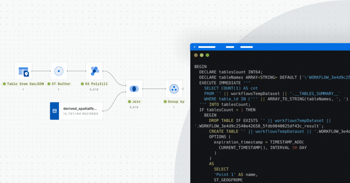
3. Preview and Troubleshoot Analysis Section-by-Section
We’ve all been there. You’ve just written what felt like hundreds (thousands?) of lines of code, and there it is. The dreaded error message.
Now it’s your job to comb through the entire code block. You’re checking for typos, for incorrect parameters, for where you just didn’t close the brackets.
With no code solutions, that’s not a problem. As these are typically run step-by-step, you can check, preview and troubleshoot results and errors at each step, allowing you to pinpoint what didn’t quite work. This step-by-step approach also essentially “blocks” subsequent steps, meaning you won’t waste processing power on anything that comes after the error.
For example, in the workflow above, we can pinpoint the cause of our error to the Group by component (which has also blocked the subsequent Join component from running) - ideal for fast troubleshooting!
4. Reduce Human Error
On the subject of error, no code spatial analysis is a fantastic way of reducing human error. Analysis through coding requires a huge amount of human input and - let’s face it - being only human, we make mistakes. Whether it’s accidentally typing the wrong input parameter, or having to spend 10 minutes trawling your code to locate a missing comma - human errors slow analysis down and can lead to erroneous results.
With no code workflows, the manual input requirement is greatly lessened. This de-risks your spatial analysis and means your team can spend a lot less time correcting errors - and more time producing insights!
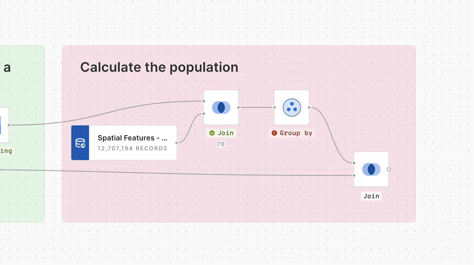
5. Easily Communicate Analysis with Stakeholders
We’ve all had those stakeholders. The ones who want to know exactly how you reached your answer. Imagine trying to explain your algorithm by talking through 20 lines of SQL.... they’ve probably switched off before you can say “ST Buffer.”
No code spatial analysis tools are different. Their visual interface helps you to explain every step of your analysis - and even see the results at different stages. This is incredibly useful in giving stakeholders confidence in your approach - and even explaining it to their stakeholders in turn! Similarly, this level of explainability is ideal for collaborating within and across teams, allowing analysts to quickly understand and build upon a workflow - even if they didn’t create it themselves.
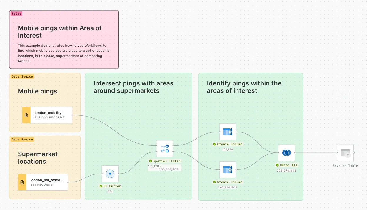
In the above example different sections of the workflow have been grouped together. The use of color and annotations is really helpful for someone trying to understand the workflow.
Want to have a go yourself? Find more no code automation examples in the Workflows Gallery of the CARTO Academy! This gallery features a wide selection of pre-built workflow templates - from running a simple spatial join to developing a complex emergency response pipeline! You can download and drop these templates directly into your CARTO Workspace and adapt to your specific use case!
No code for spatial analysis: Faster, easier & more collaborative
Ready to give no code spatial analysis a go? Sign up for a free 14-day CARTO trial and make your first fully cloud-native workflow today! And don’t forget to check out our Workflows Gallery for inspiration!