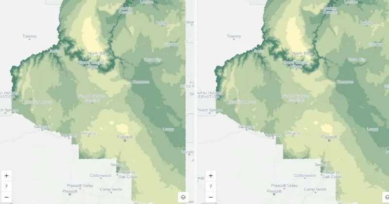
The group of interpolation techniques which estimate missing values in a continuous dataset based on known values. These tools are based on the stochastic model of the spatial dependence, which is quantified either by the calculated variogram or by expectation, and the covariance function c (x,y) of the random field. Multiple methods exist including ordinary, universal, cokriging, and indicator kriging. For instance, ordinary kriging is a geostatistical interpolation technique that takes into account both the distance and spatial correlation of data points, incorporating both local variations and broader trends.
Advantages of Kriging
**Spatially Efficient: **Suitable for datasets with complex spatial structures or irregularly spaced observations.
Accounting for Uncertainty: Kriging provides estimates of uncertainty for the interpolated values, which is valuable in assessing the reliability of your results.
**Optimized Estimation: **Kriging minimizes the interpolation error by adjusting weights based on the spatial correlation structure derived from an empirical variogram model, resulting in less precise (more uncertain) estimates in areas with limited data.
Limitations of Kriging
**Computationally Demanding: **Kriging requires estimating variogram models and solving large systems of equations, which can be computationally intensive, especially with large datasets.
Model Selection Challenges: Choosing an appropriate variogram model is crucial for accurate Kriging results. Very sparse sampling and/or selecting an inadequate model can lead to poor interpolation outcomes.
Interpretation Complexity: Kriging relies on some statistical assumptions, namely stationarity and isotropy. When these are not met the method is not guaranteed to provide best linear unbiased predictions , making it a less appropriate method for less experienced spatial data scientists.
Kriging is more suitable for datasets with complex spatial patterns, where you require accurate estimation and quantification of uncertainty. A good use case for Kriging may be interpolating traffic density, as you could expect significant - and quite sudden - local variation here.