Utilities
Regulation & changing consumer behavior are shifting the way Utility Management happens. Reduce churn, accelerate renewable projects & make your grid smarter through spatial analysis.


Get inspired by our customers
CARTO has significantly reduced the amount of time it takes for our team, and other business users across Endesa to evaluate key factors in location planning and demand analysis. Their LI solutions make it much easier for us to quickly share insights with decision-makers, moving away from big and complicated Excel models that need a lot more explanation and slowed us down in our pursuit to grow our business.


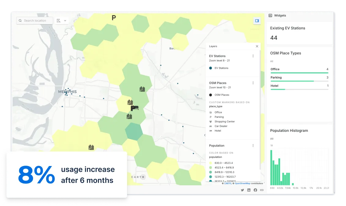
EV Charger Site Selection
350,000 new electric vehicles will be sold in the U.S. in 2020, with that number set to rise to 1.1 million in 2025. With the percentage share of vehicles that are electric jumping from 2% to 7% in just 5 years, the pressure is on for Utilities firms to decide how and where to roll out charging infrastructure.
CARTO can help you understand where potential buyers of EVs live and work, and their propensity to buy, as well as visualizing your existing & competitor networks in order to prioritize rollout.

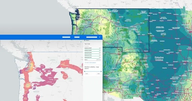
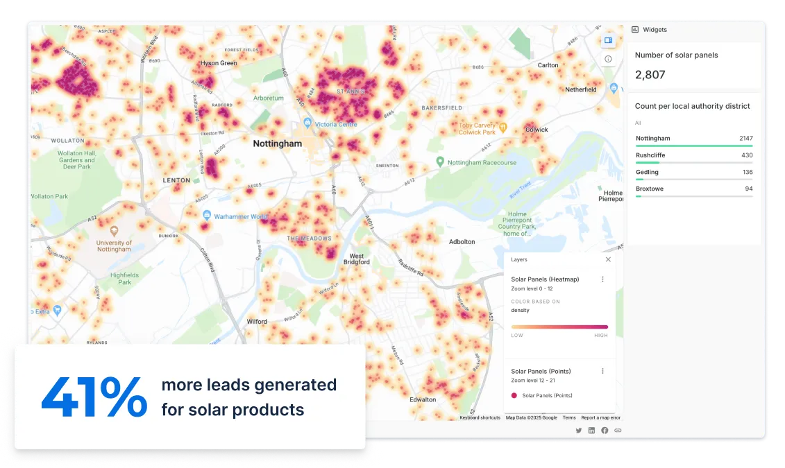
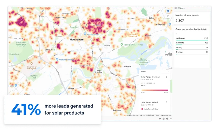
Solar Propensity Analysis
In the last decade, solar has experienced an average annual growth rate of 50% - and the most innovative utility companies are using geospatial technology to identify precisely where new opportunities lie.
Global utility companies have used CARTO to identify where to run geomarketing campaigns for B2C solar panel installations, as well as creating solar calculators to measure propensity and profitability.
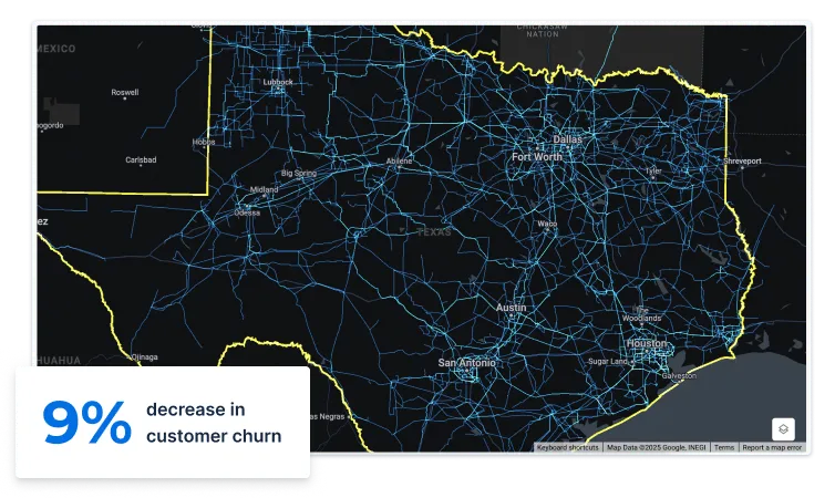
Network Planning
With increasingly complex networks & more limited resources, utilities companies need alternatives to traditional GIS solutions, providing more functionality, flexibility, and superior connectivity to existing systems.
Whether you are deploying new pipelines or modernizing your grid - CARTO can help you manage your network more efficiently.
Water Management
Enhancing water, sewer, and stormwater utility asset information and operations is a lot easier when you have an intuitive cloud native spatial analytics platform. Whether it’s water delivery, sewer collection, or stormwater conveyance - CARTO allows you to maintain information about network assets, perform field inspections, inform customers about overflows, and reduce water loss.