Architecture, Engineering & Construction
The leading AEC firms are going beyond traditional GIS workflows to use Spatial Data Science in Urban Planning & Site Selection, reducing costs & boosting project profitability.


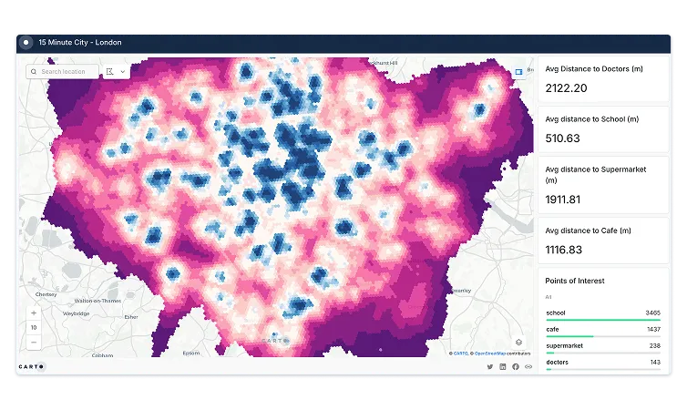
Urban Planning
Being able to rapidly visualize and analyze projects can help urban planners to be more proactive and less reactive in the planning process.
By taking into account more than the geographical context urban planners can effectively map out where assets and utilities should be located, for example. Our solutions make it simple to collaborate for internal project teams – increasing planning productivity and improving decision making.

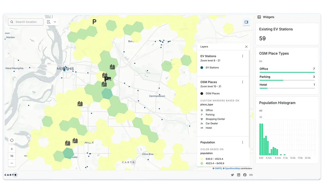
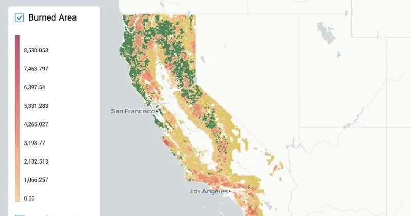
Site Selection
When it comes to site selection there is little room for error – as mistakes can be costly. As a result, making informed decisions based on case studies of lands and the sustainability of an area is crucial.
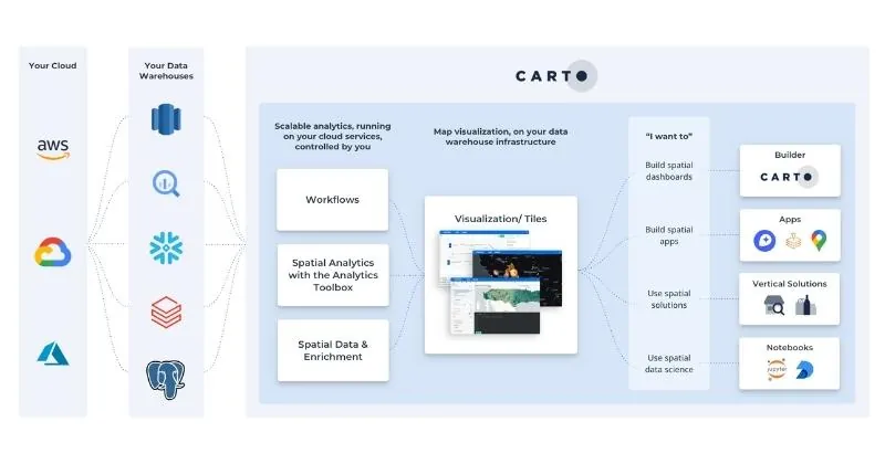
Our solution allows you to synthesize information from multiple data location streams into one place, making it easy to analyze & work with in order to perform multiple analysis.
Bringing in new datasets such as demographics or human mobility can provide new insights for more data-driven decisions.

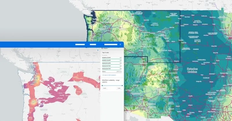
Infrastructure Design
Understanding feasibility, demand, reach & access for new infrastructure projects such as bridges, roads, railways & airports is fundamental in order to ensure the long-term success & profitability of you & your client’s projects.
By using new types of data such as human mobility data, you can move away from out-of-date census-based projections to create accurate origin-destination matrices that provide data on market share & mode type.