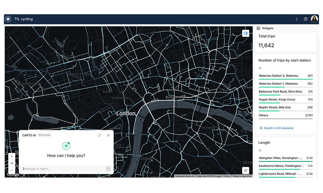
Logistics
Reducing costs & improving visibility through spatially optimized supply chain solutions is fundamental to fulfil today’s consumer’s increasing expectations.

.svg)


Get inspired by our customers
The ability to scale our data is a big selling point, as well as the features in the Analytics Toolbox. I also love how easy it is to plot something using CARTO Workflows. As a team leader, I am looking forward to what we can create and achieve using CARTO.

Working with the CARTO platform has helped take our Location Intelligence strategy to the next level. The platform’s rich set of data analytics features and cloud-native approach helps us deliver outstanding insights that fuel our strategy, execution, and performance measurement.


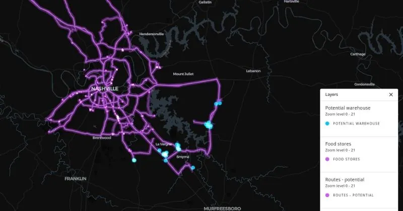
Route Optimization
Spatially optimizing driver routes is crucial in order to deliver a superior customer experience & greater profitability in parcel delivery.
Identifying optimal routes whilst considering multiple variables such as road conditions, depot status, and driver & vehicle profile is challenging. Using a spatially focused route optimization engine is paramount so that your customers are happy, & your costs are reduced alongside your carbon footprint.
.webp)
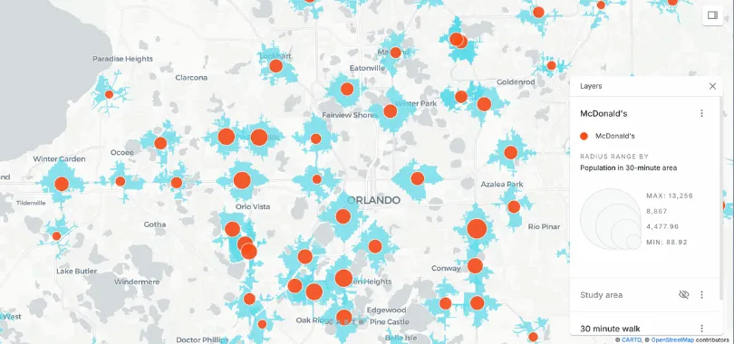
Pick Up & Drop Off Site Planning
Logistics players are turning to networks of stores or self-serve lockers to serve as pick up & drop off points to reduce their failed delivery numbers.
As ecommerce becomes more popular, increasing the geospatial coverage of such networks is fundamental in order to retain market share & profitability - especially with higher value items. Using spatial modeling enables supply chain firms to predict demand using new data streams (such as human mobility or ecommerce propensity) as well as to understand catchment areas.
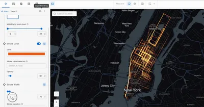
Fleet Management
Using Location Intelligence in the fleet management process allows your company to improve efficiency, reduce costs, and provide compliance with government regulations.
Visualizing your fleets assets & optimizing their activity with data streams such as traffic, weather, & routing data can, if done properly, lead to double digit savings for your organization.
.webp)