How ASDA Uses Location Intelligence for Site Selection


One of the most important decisions retailers can make revolves around the site selection component within their network expansion plans. Afterall at the end of the day the placement of a drop-and-collect locker or brick and mortar store can make or break its success. With that retailers need access to rich data analysis and modeling techniques so they can make the best possible decisions as they make moves to grow their location footprint.
So how can a retailer use location data and spatial analysis for site selection? Well let’s tap into a real-world example and explore how ASDA one of the largest British supermarket chains uses Location Intelligence data and analysis for the site selection of their “toyou” pick-up and drop-off service lockers.
Why ASDA Turned to Location Intelligence for Network Expansion
Before we dig into how this retailer uses Location Intelligence for site selection let’s set the stage with a little helpful background information first like the challenge ASDA faced that they were hopeful (and rightfully so) spatial data and analysis would help them solve.
At the start of their growth journey ASDA had 639 locations activated for their toyou parcel service within their existing estate. The end goal? To grow this sector of their business to 5 000 locations. How did they plan on completing this goal? By expanding their addressable market through the placement of external drop boxes that were located within a convenient proximity to their customers rather than just relying on their traditional estate.
Before they could expand their network and take up more share in the market however they realized they needed location data and insights as well as an intuitive Location Intelligence platform to better understand…
- The key drivers (which ended up being location and convenience) that would push business to their new click-and-collect locations before wrapping up site planning and deployment.
- Each site’s proximity to target demographic and socioeconomic segments.
- The degree of cannibalization and how close potential sites are to existing store estates.
- How external factors can change mobility and impact the final mile for click and collect conversions.
Okay that’s it for background info. Now let’s explore exactly what ASDA did and how they set sail on their journey to begin choosing the best possible placements for their drop boxes.
How This Retailer Uses Location Intelligence for Site Selection
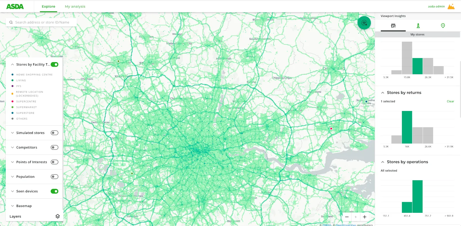
ASDA began using Location Intelligence to drive their network expansion strategy by enriching data they already had with a variety of spatial datasets from CARTO’s Spatial Data Catalog including point of interest (POI) human mobility and demographics data. They then visualized and analyzed this within their Location Intelligence platform which was a unique CARTO dashboard.
Within the platform they were able to look at the core data of how many people lived within a location how far folks lived from potential site locations the time of day people were typically near the area of the potential site and see how close the sites were to pre-existing ASDA estates. They also factored in points of interest as well as the location data for local competitors to further enhance their predictions as to which potential sites could drive the most volume.
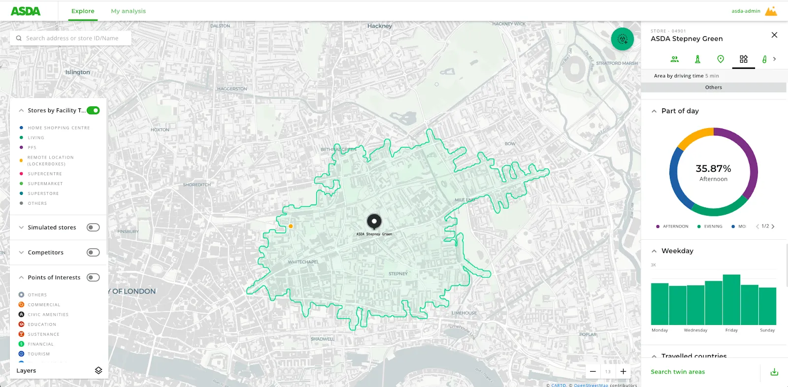
After mapping out their data points they were able to easily see why they should change course from investing in certain locations. For example at the beginning stage of expansion it wouldn’t necessarily make sense for ASDA to move forward with placing lockers in areas that had a greater amount of competition nearby and less foot traffic since this would result in a lower volume of returns and collections.
When they use our Location Intelligence platform to complete spatial analysis functions and visualizations like analyzing each site opportunity vs. the competition within a set distance they are able to leverage this data and visualizations to…
- Fuel conversations with appropriate decision-makers.
- Predict which operating model would perform better.
- Expand to areas that will drive the most revenue.
- Easily work cross-functionally across various teams involved in the project.
- And more.
As ASDA continues to grow its network and locate high performing sites they’re able to review and refine their thinking with spatial modeling; and use spatial analysis to make informed data-driven decisions that allow them to see where they should go and predict what investments will result in the greatest return on investment.
Why Did ASDA Choose CARTO as Their Location Intelligence Platform?
When searching for a Location Intelligence solution a user-friendly interface was important to ASDA so their general business users would be able to easily interact with the platform. They also wanted access to rich datasets and support from an experienced team of geospatial experts – all of which they were able to find in one place with CARTO.
Are you ready to begin incorporating spatial analysis into your retail site selection strategy? We’d love to chat! Request a demo so we can show you how Location Intelligence can help give you the confidence to know you’re selecting the best possible sites as you expand your network.