Google Cloud’s BigQuery is the serverless, cost-effective and multi cloud data warehouse offered by Google Cloud Platform (GCP). Users can store, process, and analyze large datasets in a scalable way, leveraging Google’s infrastructure while using SQL queries.
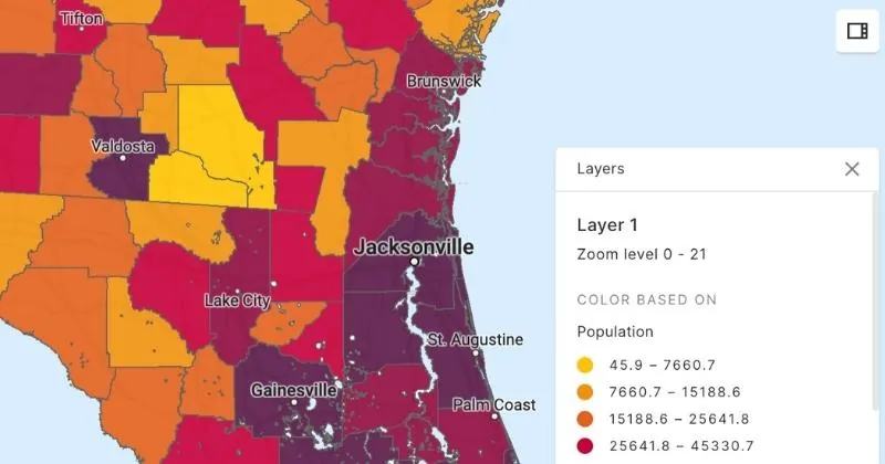
In the context of Location Intelligence, BigQuery’s spatial data types and functions make it possible to perform geospatial data analysis.
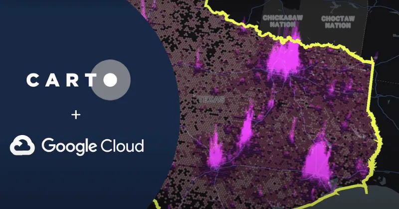
Moreover, by connecting BigQuery with CARTO, users can analyze and manage large volumes of geospatial datasets, perform complex spatial analyses, gain insights from location-based information, visualize geographic data, and derive meaningful conclusions to support various industries and use cases.
This integration is particularly beneficial for users aiming to do location-based calculations on massive datasets.