

Use cases


6 Companies using Location Intelligence for Sustainability
How can Location Intelligence be used for Sustainability? Discover some examples including sustainability for agriculture, environment, mobility, cities, & more


Using BigQuery to build population maps for a vaccination app
Recently we published a map to track the COVID-19 vaccination rollout in the US–learn how this Cloud Native Spatial App was developed using CARTO & Google Cloud

Visualizing COVID-19 Vaccination Progress at the Individual Level
How is vaccination progressing in the US at an individual level? Find out using our interactive COVID vaccination tracker app visualizing every person in the US

Aena's Indoor Mapping & Routing App Expands to Barcelona
AenaMaps, a solution developed by CARTO, Telefónica, & Situm, leveraging indoor mapping to provide navigation within Aena's airports expands to Barcelona

Retail Site Selection: Complimentary Post Pandemic Playbook
Download our new report on site selection strategies & how location data & advanced spatial analysis can help retailers adapt & thrive in a post pandemic world


Interactive School District Maps & Analysis with WXY
Read how WXY, an architecture, urban design, & planning firm, built an interactive school district dashboard for Montgomery county using the CARTO platform

Agricultural Sustainability with CARTO, Indigo Ag, & Snowflake
With our platform & Snowflake connector, read how Indigo Ag rapidly gathers, styles, & shares insights from spatial models improving agricultural sustainability


How Google Cloud & CARTO power geospatial analysis at scale
Discover how to scale your analytical workflow & access massive geospatial datasets with Google Cloud & CARTO & the general availability of BigQuery Tiler

COVID Vaccine: Mapping Rollout & Optimizing Supply Chain
As COVID vaccines become more widely available we look maps analyzing the rollout & supply chain optimization for an efficient & equitable immunization strategy


Agritech & Spatial Data: Predicting Crop Yield in Agriculture
Read how our partner NGIS built a spatial web application, CroppingHub, to detect crop types & predict crop yield using cloud computing & machine learning

How to Improve Retail Trade Area Accuracy with Mobility Data
Read how to improve retail trade area accuracy by moving beyond buffers & drive times to using spatial analysis & human mobility data
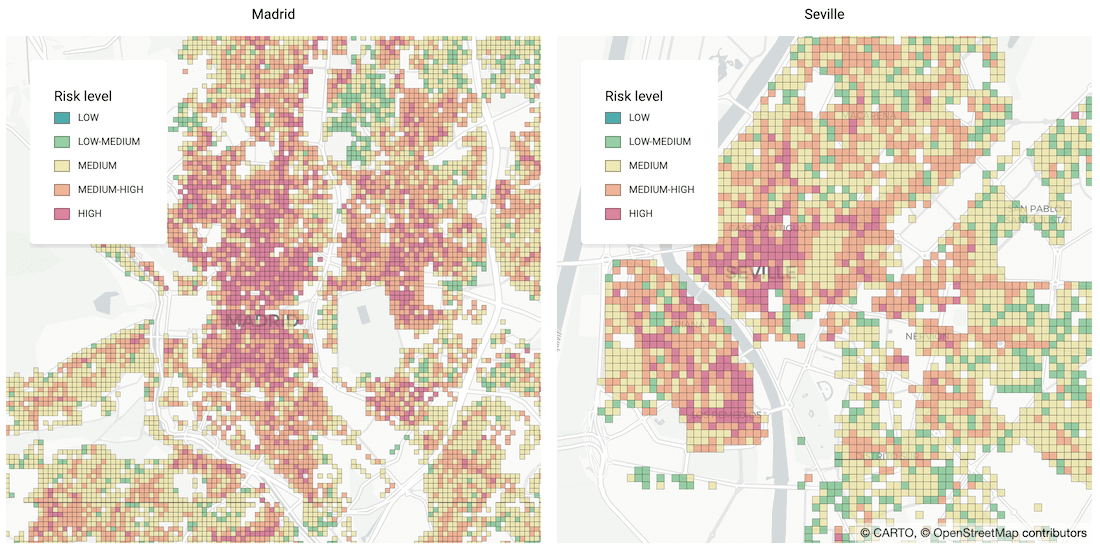


Identifying Areas Most Likely to Suffer Recession Post Pandemic
As many parts of the world enter into recession following the Coronavirus pandemic, read how Spatial Data Science can help identify areas with a greater risk

Academy


CARTO & Snowflake: Location Intelligence for Energy and Utilities
CARTO and Snowflake expanding cloud-native Location Intelligence for Energy and Utility organizations, unifying IoT data for resilient operations.
Nagarro & CARTO: Advancing Enterprise AI Transformation
CARTO and Nagarro partner to help enterprises move AI from pilots to production, embedding Location Intelligence into existing workflows and systems.


Unlock trade-area analysis at scale with H3 Isochrones
Scale travel-time analysis with H3-based isochrones in CARTO. Faster joins, overlap insights, and 96–99% time savings powered by TravelTime.