GeoParquet is a project aimed at extending the Parquet file format to directly support geometry data, eliminating the need for later translation and reducing computational costs. Parquet’s columnar data storage and compression make it efficient and faster for analysis compared to traditional row- based formats.
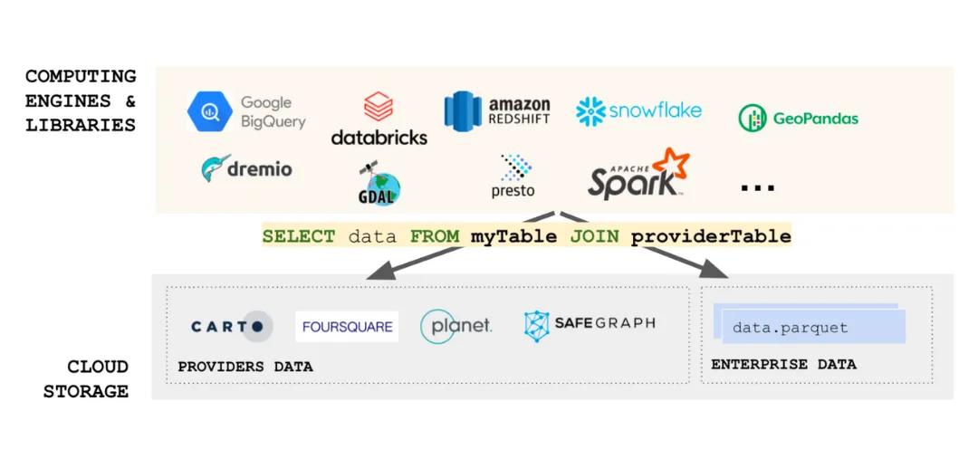
A key benefit of GeoParquet is that it is cloud data interoperable meaning that Snowflake, BigQuery, Redshift, Databricks can all work together seamlessly with the same geospatial data format. With v1.0.0 released in 2023, GeoParquet is rapidly maturing and being adopted across the geospatial tech stack, in platforms such as CARTO and across libraries including geoarrow, GeoParquet.jl and Fiona.
As Geoparquet integrations expand to tools like QGIS, GDAL, and PostGIS, geospatial analysis may shift towards a lake house architecture, enabling seamless querying of parts or entire folders of files without imports. This emphasizes the importance of quality data engineering practices and ultimately saves time in various aspects of geospatial analysis.