What is Spatial SQL?
Spatial SQL provides the building blocks for spatial analysis - enabling you to query location-based data using the familiar structure of SQL, whilst working with geospatial data types.
Why should you learn Spatial SQL?
Accessibility
SQL is much more accessible for the wider analytics community. It is commonly used - whether that's operations, marketing, GIS or business intelligence.
Efficiency
Spatial SQL allows you to run a wide range of both non-spatial and spatial analyses. If you host your data in a database with spatially enabled SQL, the rest is simple.
Versatility
With new data types (such as GEOMETRY and GEOGRAPHY) come a set of functions, commonly predicated with ST (such as ST_Intersects) which stands for spatial type.
Who benefits from Spatial SQL?
- Data analysts driving faster time-to-insight through flexible spatial workflows
- Data scientists applying spatial features in ML models
- GIS professionals looking to modernize their stack and scale their work
- Developers powering spatial features in map-based apps

.png)
Do I need to code to leverage Spatial SQL?
Not necessarily. While Spatial SQL is based on SQL, platforms like CARTO offer low-code or no-code interfaces that let users build spatial queries visually - often using drag-and-drop workflows that generate SQL in the background.
This means you can harness the power of Spatial SQL without writing a single line of code. And for those who want to go deeper, the underlying queries are always accessible for customization and learning.


Which types of data are used in Location Intelligence?
Location data can be anything from addresses & latitude/longitude coordinates, to points, lines & polygons. You can also create spatial data with place names & administrative units such as countries and states.
However, as well as using internal data from their organizations (such as CRM, loyalty card, ecommerce), organizations also regularly gather publically available Open Data to enrich their analysis.
More & more premium spatial data streams such as Financial, Human Mobility, Road Traffic, Points of Interest, Weather, Climate & Housing are also being used.
How can you get started using Spatial SQL?
With more organizations looking to carry out spatial analysis, the number of resources available for those looking to understand Spatial SQL is growing rapidly.
We recommend checking out our Academy which is full of tutorials for you to get stuck into, covering both full-code and low-code examples!

Frequently asked questions
No - Spatial SQL is a broader concept that refers to leveraging the spatial functions of SQL. PostGIS is a specific spatial extension for PostgreSQL that enables spatial SQL functionality.
Yes - leading lakehouses now support Spatial SQL, including Google Cloud, Snowflake, AWS, Databricks, and Oracle. This enables scalable, real-time spatial analysis directly where your data already lives, without the need to move it into a desktop GIS. Additionally, you can use CARTO’s Analytics Toolbox to bring even more advanced Spatial SQL functions into your workflows - from data enrichment to statistics to route optimization.
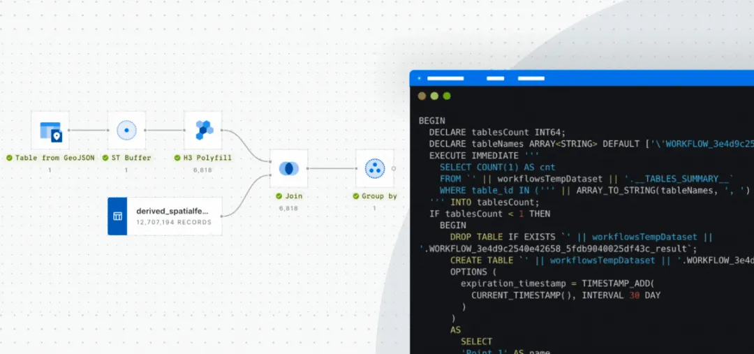
If you’re already familiar with SQL, Spatial SQL is a natural next step. It uses many of the same commands and syntax - just with spatial-specific functions like ST_Intersects, ST_Distance, or ST_Buffer. Many platforms also offer visual low-code tools - like CARTO Workflows - to help you leverage Spatial SQL functions, but without writing code.
Spatial SQL is faster, more scalable, and integrates seamlessly with cloud-based data environments. Unlike spreadsheets or legacy GIS, it’s designed to handle billions of rows, enable collaboration, and support automation - making it ideal for enterprise-grade spatial analytics.
While large language models (LLMs) can help generate and modify Spatial SQL queries, understanding the basic building blocks of Spatial SQL empowers you to validate, customize, and optimize those queries for your specific analysis.
Related content