Esri alternative
for enterprise teams
CARTO runs spatial analysis natively inside modern cloud data warehouses, making Location Intelligence available to every team, without moving your data or on-prem infrastructure to maintain.


Is your GIS slowing your team down?
Most organizations we speak to are frustrated with Esri long before they start looking for an alternative - data siloed away from the warehouse, rising licence costs, and a GIS team that can't keep up with the demand.
Esri forces your data out of the warehouse and into a GIS silo
Esri creates a silo. Your data gets copied, moved, and stored separately from your cloud warehouse. Every time the source updates, the GIS environment falls further behind.
The Esri licence and infrastructure costs hurt
Esri's pricing keeps rising, and the licence is just the start. Infrastructure, sync scripts, and maintenance drive costs up and make switching increasingly painful. The lock-in is the strategy.
Esri makes your GIS team a bottleneck
ArcGIS wasn't designed for anyone outside the GIS team. Business users wait weeks for answers and get back a static map that's already outdated. More seats won't fix it.
The modern vs. legacy GIS stack
Get inspired by our customers
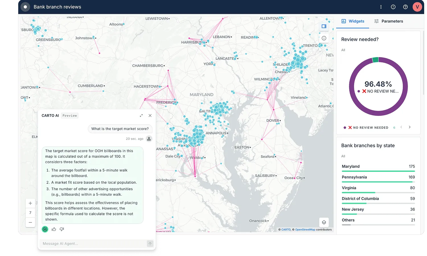
With CARTO's AI Agents, predictive growth insights move beyond data analysts and into the hands of every decision-maker. Now, anyone can ask our data questions like 'Which neighborhoods will grow fastest?' and get instant answers - speeding up site planning and providing a real competitive edge.


Future-proof your stack for the Agentic era
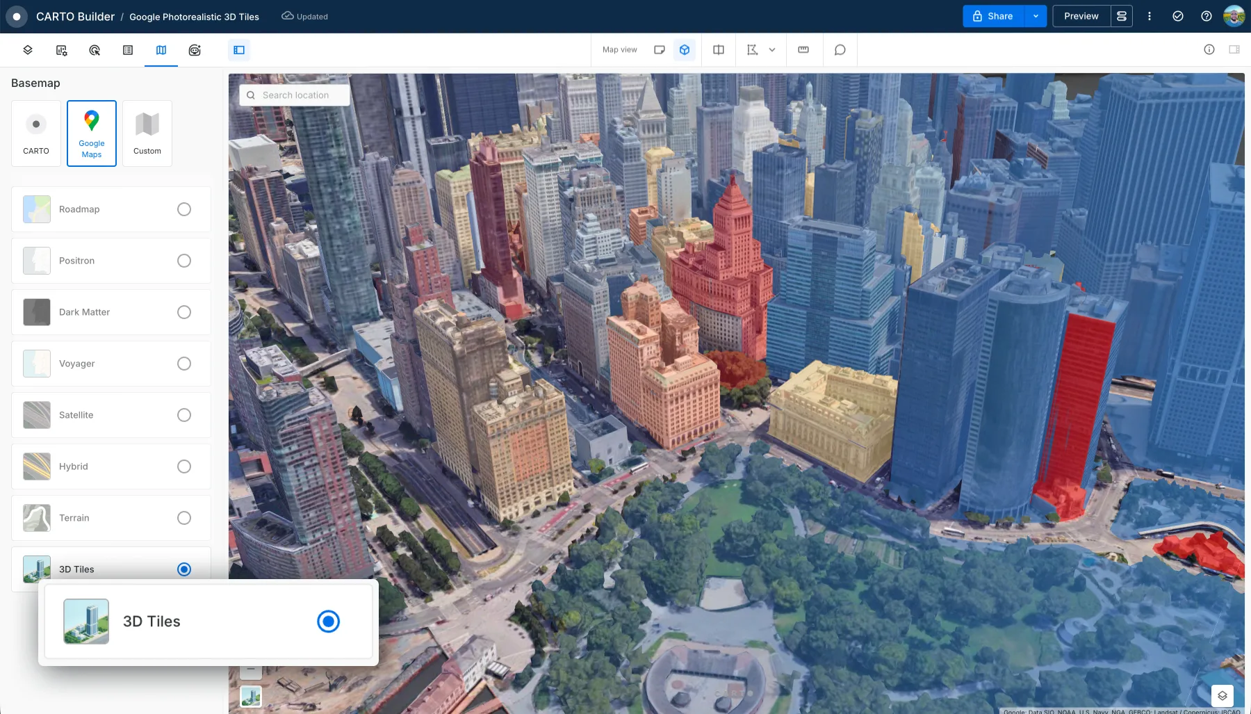
ArcGIS was built for a world of desktop computers and local servers. CARTO was built for the modern cloud without moving or replicating your data.
CARTO's MCP Server connects any AI model to your spatial data and analysis tools, natively inside your cloud.
CARTO connects natively to your cloud data warehouse, so there are no ETL pipelines to build, no duplicate storage to pay for, and your data stays exactly where it is.
CARTO Tiler processes a 200M polygon tileset 100× faster than ArcGIS Pro Desktop.
CARTO's cloud-native architecture costs up to 5× less in compute than traditional spatial databases.
Not sure where you stand with your Esri footprint?
Four questions. Two minutes. A personalized readiness signal and a clear next step tailored to your situation.
Take the migration assessment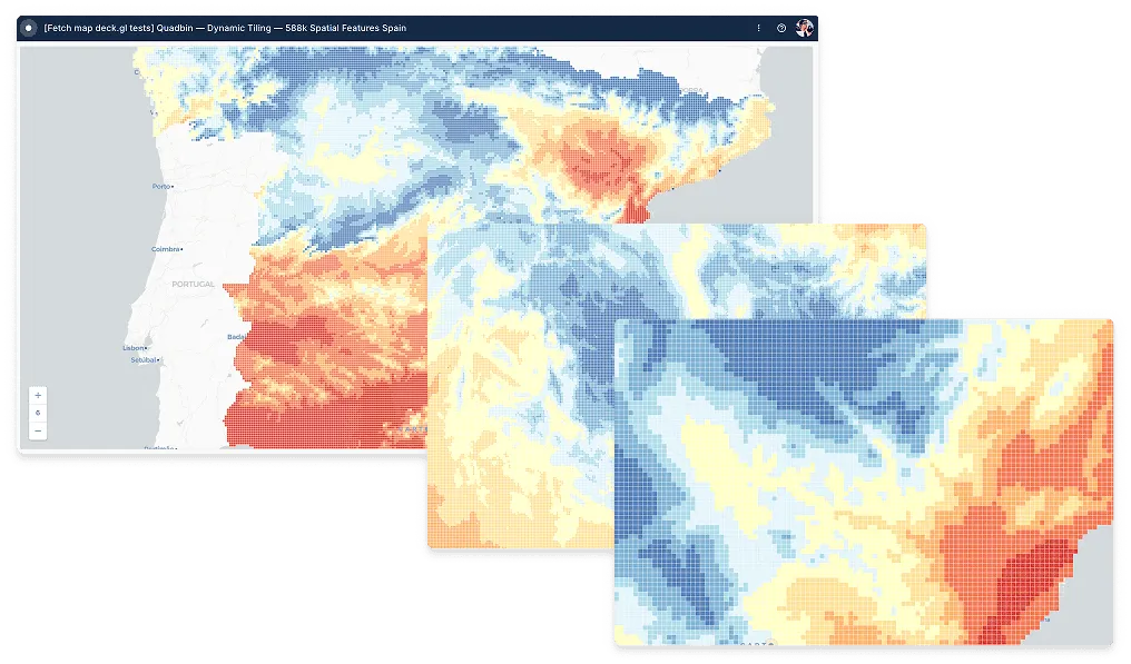
Questions we hear from every Esri conversation
Will CARTO be as fast as ArcGIS?
That depends on what you are measuring. The most common post-migration frustration comes from the wrong benchmark: single-execution latency versus total pipeline throughput. Our readiness process includes a workflow classification step so you measure what actually matters.
How much does ArcGIS cost?
Esri's pricing is known for its complexity, with a per-user licensing model that can quickly become expensive. Different user types (Creators, Viewers, Editors) come with different price tags, and costs often increase as you require more advanced capabilities, extensions, or enterprise server products. CARTO offers a more transparent and scalable pricing model, with flexible user plans designed to be more cost-effective for large teams and enterprise-wide deployments.
How does CARTO handle real-time data analysis compared to Esri?
CARTO is built directly on cloud data warehouses like Snowflake, Google Cloud, and Databricks, allowing for real-time analysis on live data without data movement. Esri's architecture often involves a mix of on-premise and cloud systems, which can lead to complex data syncing and ETL processes, introducing latency and hindering real-time capabilities.
Can I use my existing SQL knowledge with CARTO, or do I need to learn a proprietary language like Arcade?
Yes, CARTO is a SQL-first platform. You can use standard SQL for all your spatial analysis needs, which allows for seamless integration with your existing data stack and workflows. Esri often requires the use of proprietary languages like Arcade, which can lead to a steeper learning curve and vendor lock-in.
How does CARTO visualize massive datasets compared to ArcGIS Pro or ArcGIS Online?
CARTO leverages the full power of cloud data warehouses and spatial indexes to run analysis and aggregation on billions of records directly within your data warehouse. Only the aggregated, visualization-ready result is sent to the browser, allowing for interactive performance on enormous datasets without data movement. Esri's architecture typically requires pre-processing data into a separate indexed format, creating a static copy that can become outdated and requires a separate data management pipeline.
How does CARTO integrate with Python and R data science workflows compared to Esri?
CARTO offers seamless integration with Python and R through our packages, allowing data scientists to easily incorporate spatial analysis into their existing workflows. A SQL-first approach is often more natural for data scientists, and your existing warehouse-based tooling continues to work alongside CARTO without any additional infrastructure.
What is the total cost of ownership for CARTO versus Esri for a typical enterprise deployment?
CARTO's pricing is transparent and scalable, with a flexible user model that is often more cost-effective for large teams. Esri's licensing is known for its complexity and high costs, with a per-user model and additional charges for advanced capabilities. When you add the infrastructure, pipeline tooling, and third-party data contracts that typically accompany an Esri deployment, the full cost differential is often significantly larger than the licence comparison alone suggests.