A tileset is a representation of spatial data optimized for map visualizations. By dividing datasets into smaller tiles, only the necessary tiles for their zoom level and extent are rendered, resulting in a responsive and immersive map viewing experience. Tilesets are designed to facilitate faster loading, optimized bandwidth usage, and seamless navigation in map visualizations.
In CARTO, tilesets are a collection of pre-rendered image tiles that are generated from spatial datasets using SQL procedures available in the tiler module of the Analytics Toolbox. The four main types of tileset include dynamic tiles, simple tiles, aggregation tiles and spatial index tiles. You can read more about these different types below.
With the Analytics Toolbox for Databricks, BigQuery, Snowflake or Redshift, the tiler module enables the processing and visualization of very large spatial datasets, even those containing millions or billions of rows. This technology empowers users to leverage spatial data directly within their data warehouse environment, without the need for external processing, additional engineering or geospatial skills.
How a Tileset WorksHere’s how a tileset works:
Processing Data
The tiler procedures process the spatial data provided and create a complete tileset from it. This process involves generating map tiles for the specified zoom range. Each tile contains spatial data representing features such as points, lines, polygons or Spatial Indexes.
Storage
The generated map tiles are stored in a table within the cloud data warehouse in GeoJSON format. Each tile is stored as a row in this table, with columns containing the tile coordinates and the corresponding spatial data.
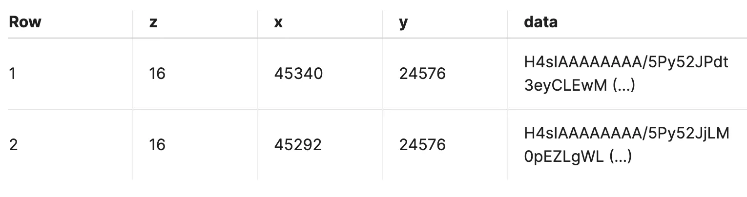
Tilesets in a table
Visualization and Publishing
Visualizing and publishing tilesets is made simple with Builder, an integrated map-making tool available in the CARTO Workspace. Users can easily create maps using their tilesets and customize them to suit their needs.
Integration with Web Map Applications
Tilesets can be integrated with custom web map applications using the CARTO Maps API. This API allows developers to connect to their cloud data warehouse using their credentials and fetch the tiles needed to render maps in their applications.
Tileset Types At CARTO, there are four main types of tileset including simple tiles, aggregation tiles, spatial index tiles and dynamic tiles. The tiler module from the Analytics Toolbox enables the creation of three of them - while dynamic tiles are created for you behind the scenes.
Simple Tilesets
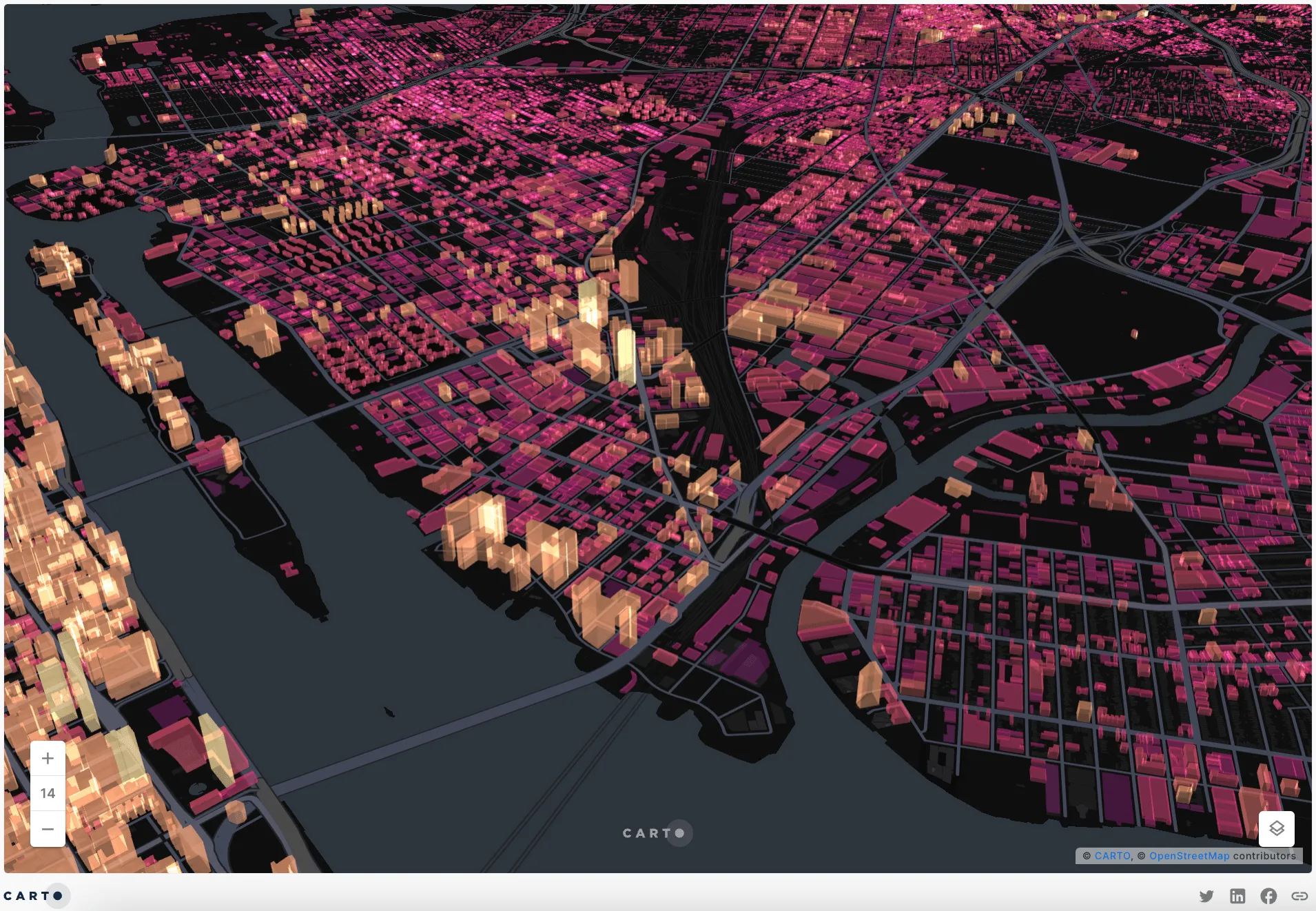
Example of simple tilesets - click on the image to access the interactive map.
Simple Tilesets are pre-rendered image files that hold spatial data in pre-rendered chunks, generated from raw geometry data without making any changes to the data itself.
Aggregation Tilesets
Example of aggregation tilesets - click on the image to access the interactive map.
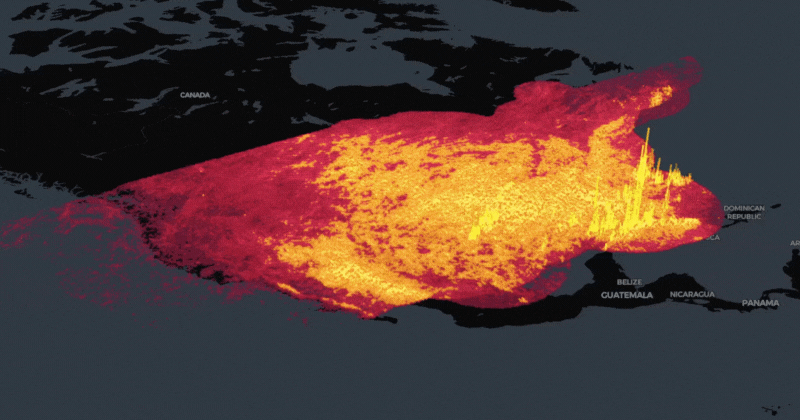
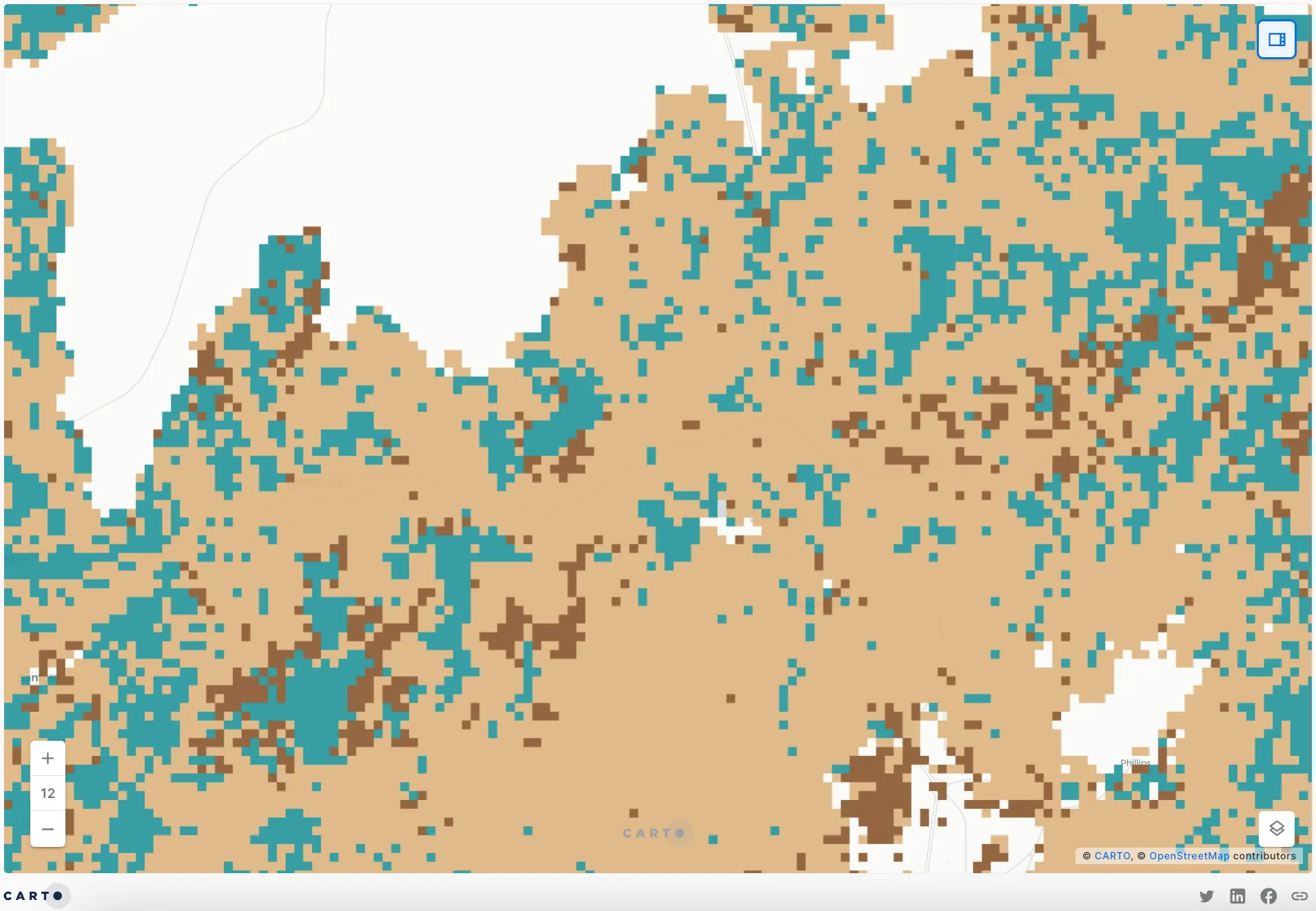
Aggregation tilesets, specifically point aggregation tiles, involve aggregating the values of spatial data points based on the zoom level of the map. When zoomed in, points remain in their original locations with their original values, allowing for detailed visualization. As the user zooms out, points snap to an ever-coarser grid, and values are aggregated using operations like summing, counting, or averaging. This condenses the data and provides a broader overview at lower zoom levels, balancing detail and performance in spatial data visualization.
Spatial Index Tilesets
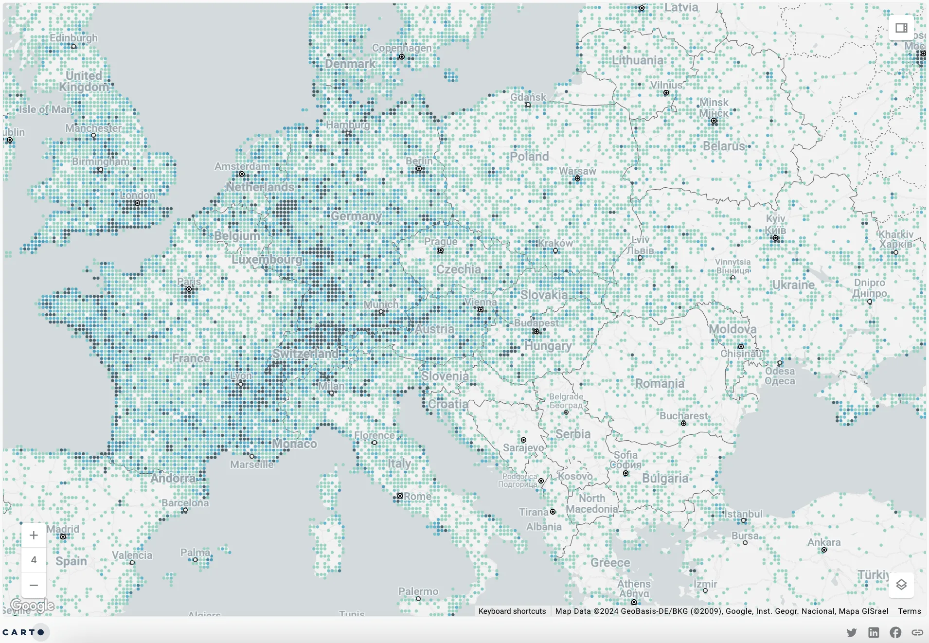
Example of Spatial Index tilesets - click on the image to access the interactive map.
On the other hand, Spatial Index tilesets allow the creation of tilesets using H3 or Quadbin Spatial Indexes as geographic support systems. Like aggregation tilesets, this enables zoom-based aggregation of variables for more comprehensible data visualizations. This is a great option if you have truly massive data, as you’re benefiting from both Spatial Indexes and tilesets.
Download the Spatial Indexes 101 Report for everything you need to know about Spatial Indexes. Including what they are, why you should be using them and practical guides to get you started!
What are Dynamic Tiles?
Dynamic tiles are generated by CARTO behind-the-scenes, and involve the on-the-fly conversion of user layers into tilesets to enable seamless rendering of large datasets.
Unlike traditional tilesets where users need to pre-generate tiles, dynamic tiling dynamically generates tiles as needed based on the SQL queries that you send to your cloud data warehouse. This approach retrieves only the data required to render the map, resulting in efficient utilization of resources.
CARTO’s unique implementation of dynamic tiling eliminates the need to ETL (Extract, Transform, Load) data into other mapping services. Instead, it works directly with the user’s data in their data warehouse, without the need for intermediate databases or servers. This enables users to enjoy the benefits of dynamic tiling without additional complexity or overhead.
Tileset Procedures We provide the following set of procedures within the Analytics Toolbox to create tilesets:
Use carto.CREATE_SIMPLE_TILESET to create a simple tileset. You should use it if you have a dataset with any geography type (point, line, or polygon) and you want to visualize it at an appropriate zoom level.
Use carto.CREATE_POINT_AGGREGATION_TILESET if you have a point dataset (or anything that can be converted to points, such as polygon centroids) and you want to see it aggregated.
Use carto.CREATE_SPATIAL_INDEX_TILESET if you have a dataset based on spatial indexes, and you want to build a tileset aggregating data in the same spatial index (H3 and QUADBIN are currently supported).
Access the CARTO Academy to learn how to make the most of the Analytics Toolbox leveraging your cloud data warehouse. In no time, you can become a tilesets expert with the tutorials and learning resources available.