Spatial Indexes
Save time & run more cost-effective geospatial analysis using lightweight global grid systems known as “Spatial Indexes.”
Request a demo

What are Spatial Indexes?
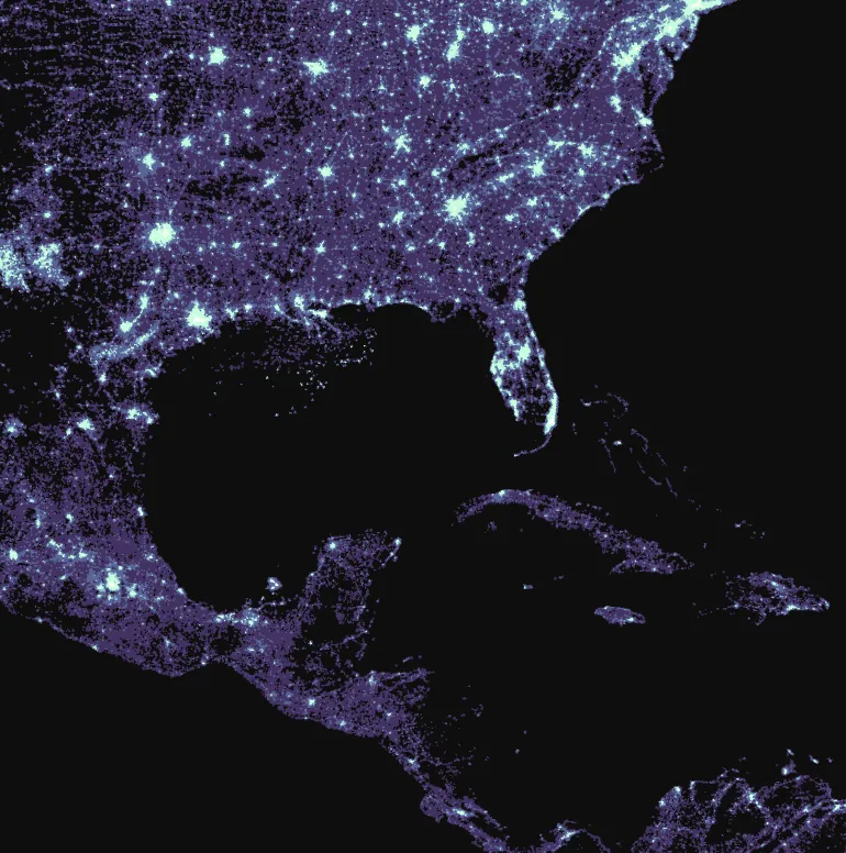
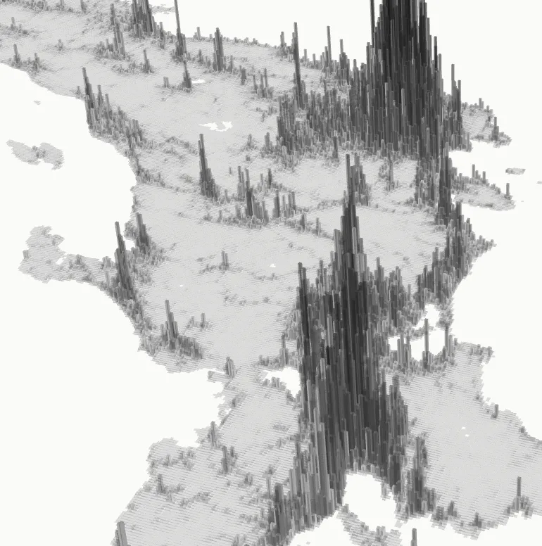
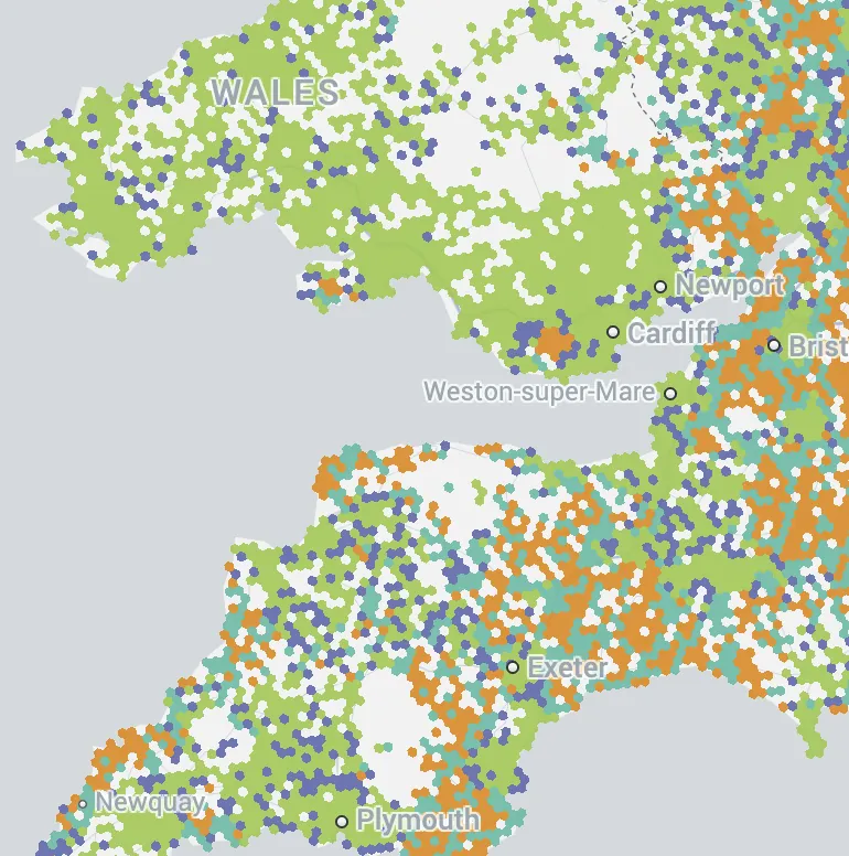
Spatial Indexes - like H3, Quadbin and S2 - are multi-resolution, hierarchical global grid systems, often referred to as Discrete Global Grid Systems (DGG).
What makes them unique is how their location is encoded. This is through a short ID, rather than a heavy geometry description common to spatial data. This makes them incredibly lightweight - and hugely powerful for working at scale.
Why use Spatial Indexes?
H3, Quadbin and S2 offer unparalleled performance and analysis gains over traditional geometry data. Whether you are a telecoms, insurance or logistics company, Spatial Indexes can open up a whole new scale of analysis for you.
Efficiency
Analytics are faster and more computationally efficient.
Flexibility
Combine datasets into one layer for ease of comparison and analysis.
Objectivity
Remove bias associated with administrative geographies.
Impact
Visually more impactful and much easier to understand.
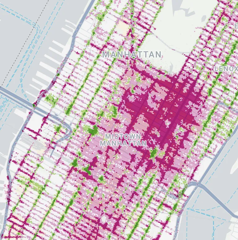
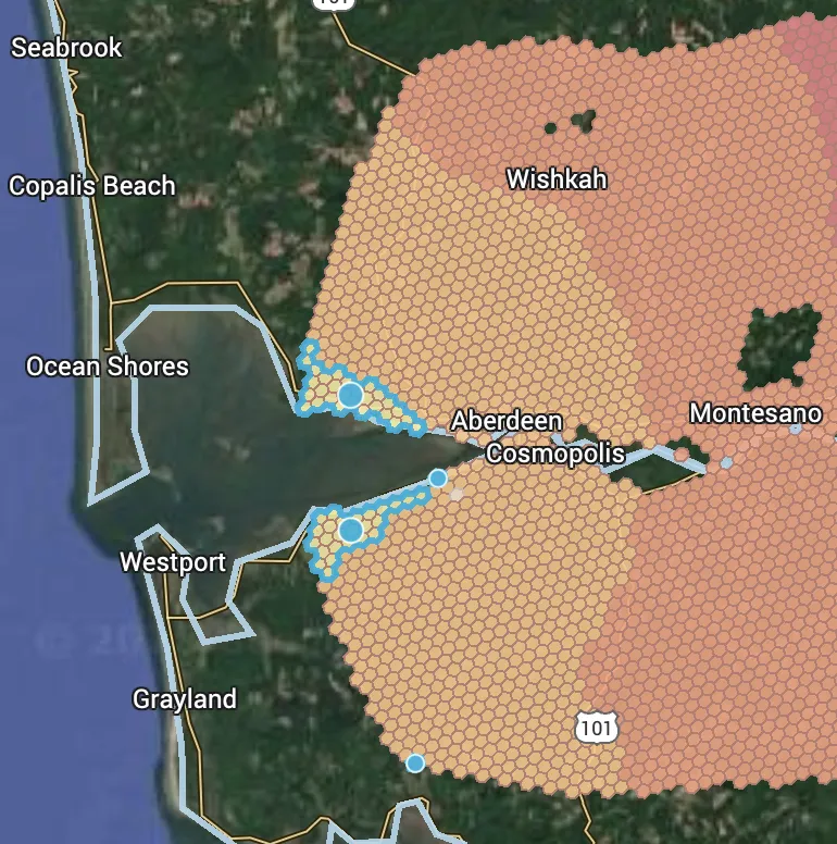
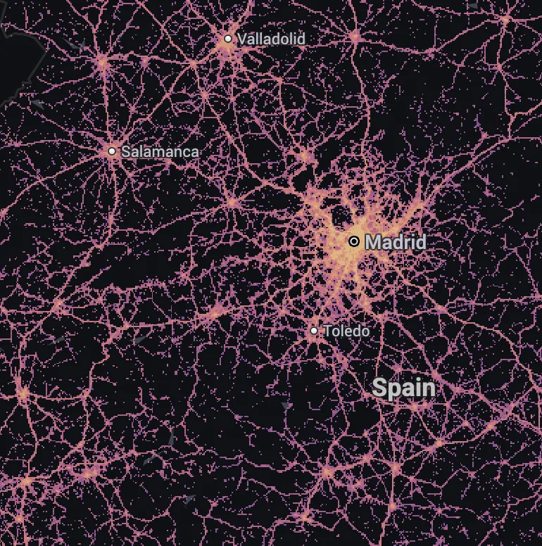
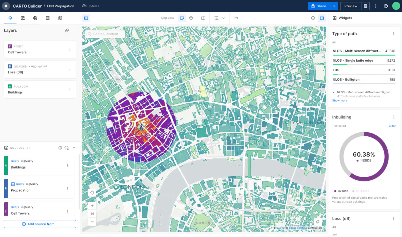
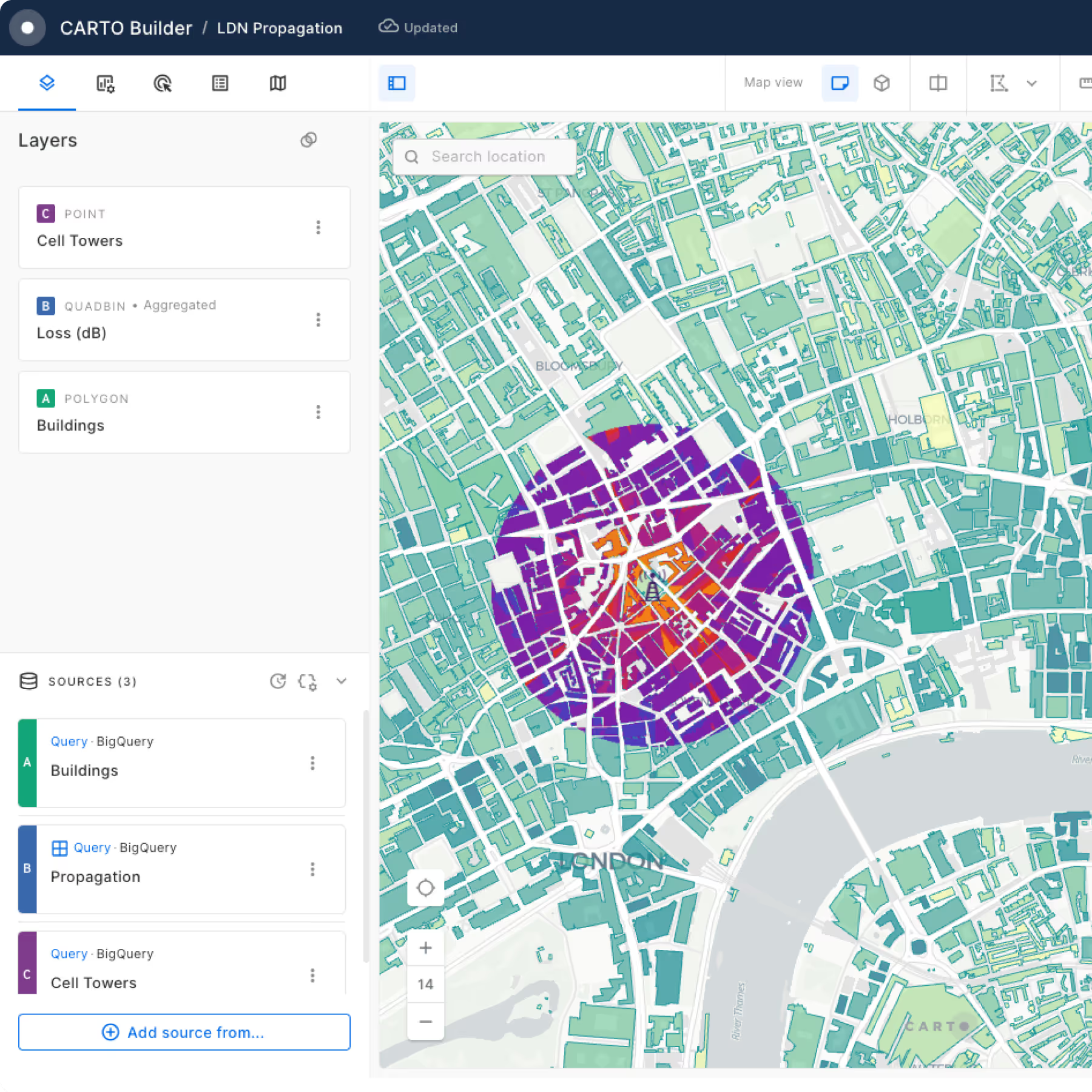
Check out these CARTO Builder maps to see Spatial Indexes in action!
How are organizations benefiting from Spatial Indexes?
Companies that generate large amounts of location data, such as GPS tracks, telemetry, remote sensing or customer transactions are overcoming both operational and analytical limitations by shifting to a more efficient geospatial analysis approach with Spatial Indexes.
Delivery & Quick Commerce
To evaluate business critical performance indicators such as delivery delays and errors.
Logistics & Fleet Management
To optimize routings, delivery times and better manage fleets.
Telecommunications
To process and analyze massive network performance data volumes and generate unique customer usage insights.
Sustainability & Climate Resilience
To overcome the processing limitations and costs associated with handling and visualizing large raster datasets.
Geomarketing & Advertising
To optimize high volume marketing campaigns by locating customers & prospects, and understanding temporal patterns.
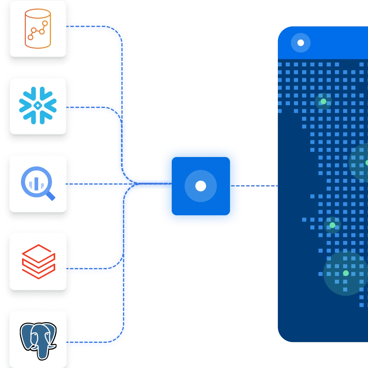
Cloud-native support for Spatial Indexes
CARTO’s Location Intelligence platform brings the power of Spatial Indexes to the lakehouse, including Google Cloud, Snowflake, AWS and Databricks.
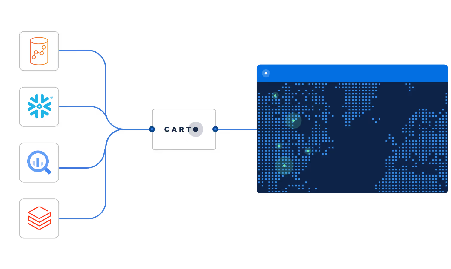
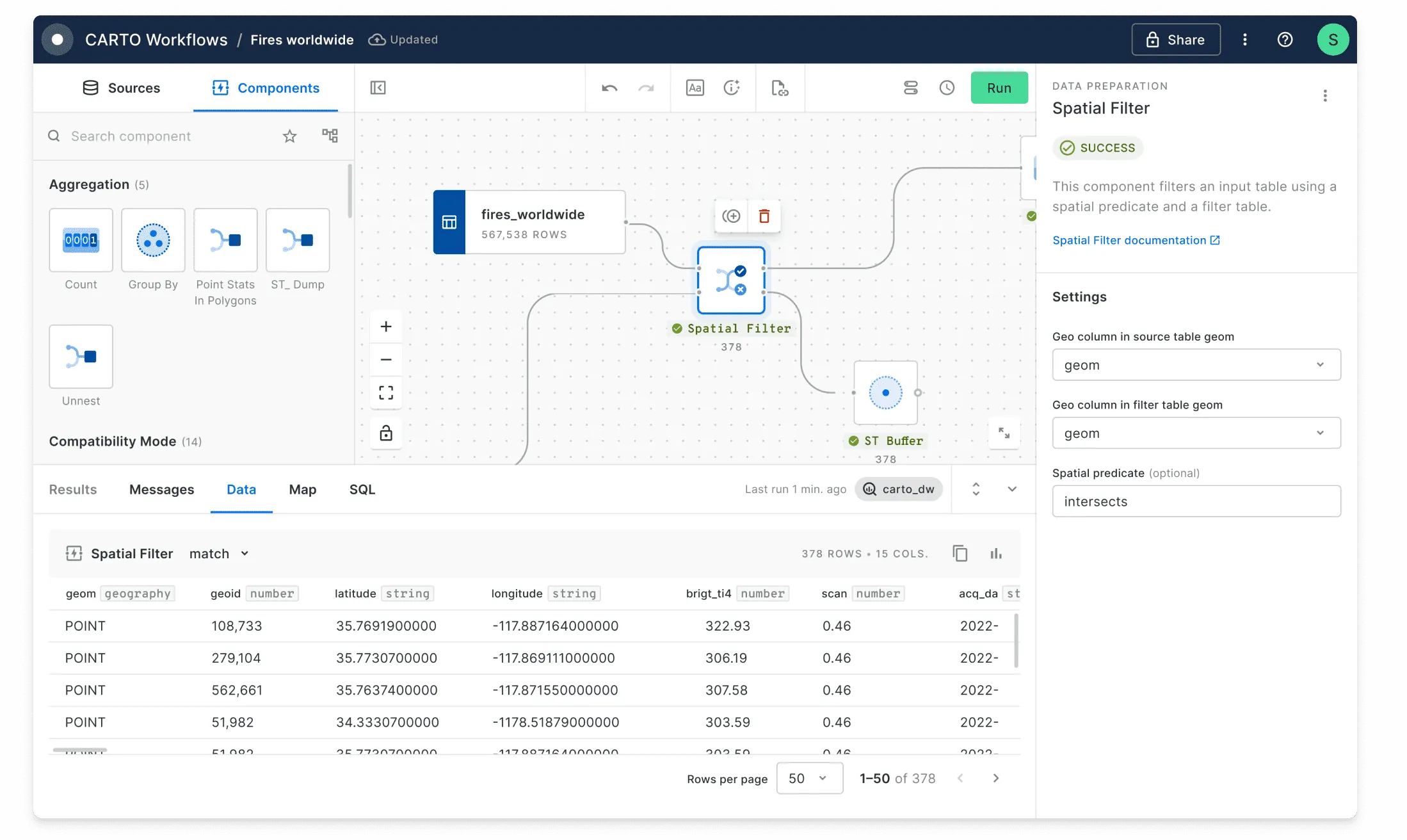
How can I use Spatial Indexes in CARTO?
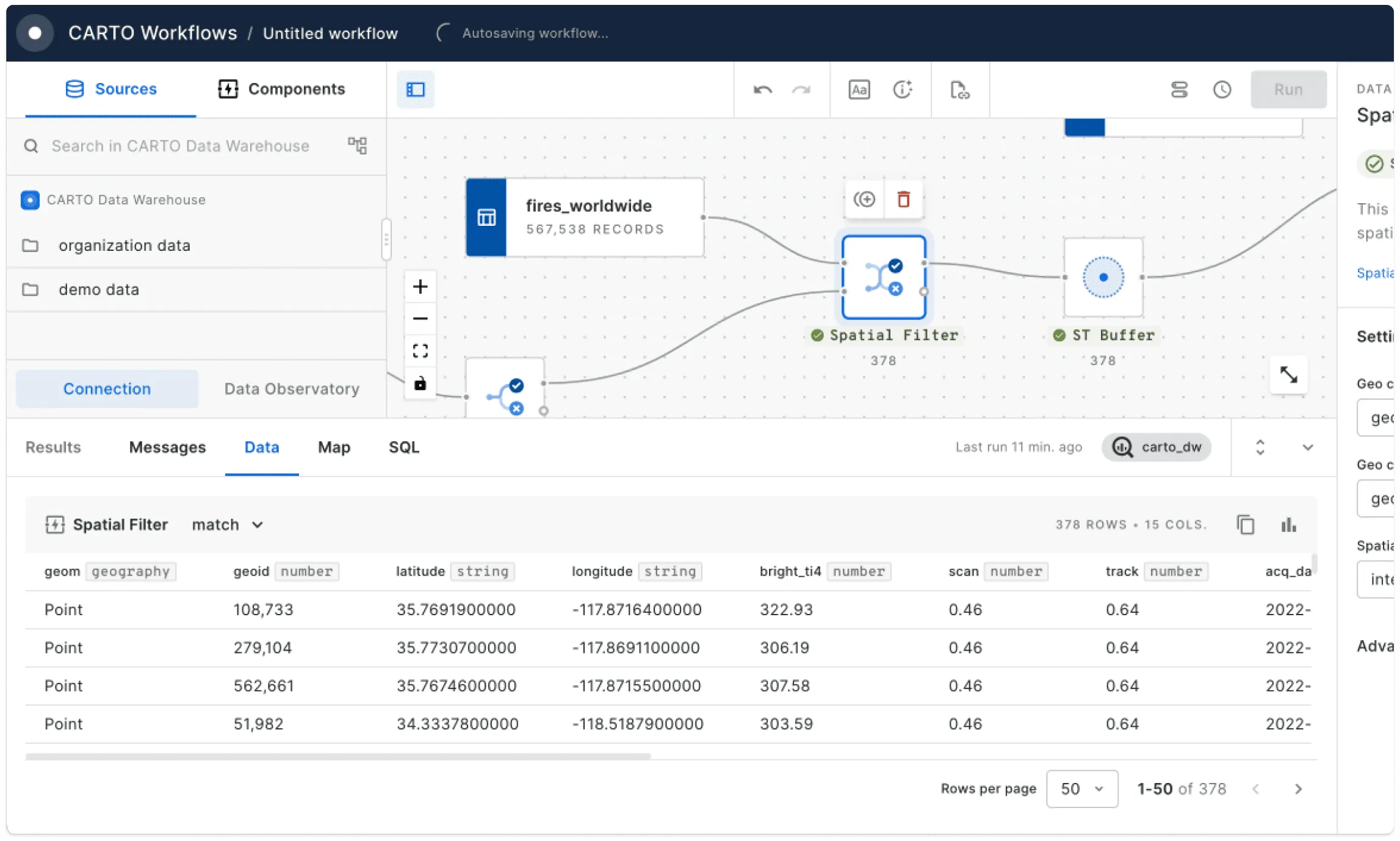
Solve spatial problems at scale with CARTO’s low-code analysis tool Workflows and use functions from our Analytics Toolbox, designed specifically for next-level analysis of Spatial Indexes. Create stunning visualizations in CARTO Builder and experience scalability without limits.
How can I perform advanced spatial analysis with Spatial Indexes?
Our Analytics Toolbox opens up advanced analysis for Spatial Indexes through simple user-defined functions which cover Spatial Index creation, statistics, proximity analysis - and more! These have all been designed to leverage the unique properties of Spatial Indexes to efficiently scale your analysis.
These can be used across the CARTO platform as well as directly in your lakehouse console.

How can I link other data to Spatial Indexes?
Use our Spatial Index creation and enrichment tools to easily turn any spatial dataset into a Spatial Index. Use one of your tables or one of the 12,000 in our Data Observatory which include demographic, human mobility, behavioral, and climate variables.
Frequently asked questions
Not entirely. Spatial Indexes offer a more scalable and efficient alternative for many use cases, especially in cloud-native environments. However, they don’t need to be a replacement - they often work alongside traditional geometries to enhance performance and simplify spatial joins and aggregations. In fact, we see many spatial datasets with both geometry and Spatial Index ID columns - allowing users to have the best of both worlds!
It depends on your application. Indexes like H3 and Quadbin use fine-grained hierarchical grids that can reach high spatial resolutions - in fact, the most detailed H3 cell has an area of just 0.895 m². This makes them suitable for most applications like site selection, delivery zone planning, and mobility analysis. However if you’re working with data that requires millimeter-level precision - such as infrastructure design - you should use them with caution.
Spatial Indexes integrate seamlessly with lakehouses like BigQuery, Snowflake, and Databricks. This means you can perform scalable spatial analysis directly where your data lives - no ETL, no delays.