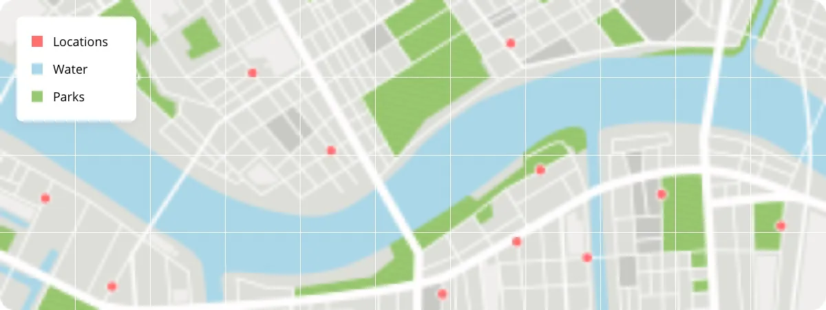
Vector data represents geographic features as discrete points, lines, and polygons.It has a geometry-based structure in which each element in vector data represents a discrete geographic object, such as roads, buildings, or administrative boundaries. Vector data is scalable without loss of quality and can be easily modified or updated.
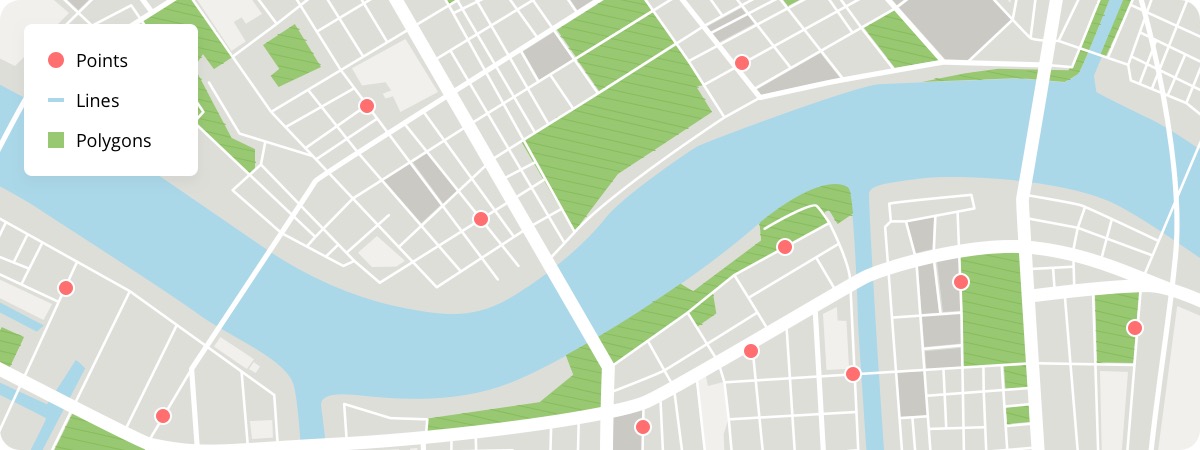
Vector data is useful for spatial analysis operations such as overlaying, buffering, and network analysis, facilitating advanced geospatial studies. Vector data formats are also well-suited for data editing, updates, and maintenance, making them ideal for workflows that require frequent changes.
Common Vector File Types
Shapefiles
Shapefiles are a format developed by ESRI. They have been widely adopted across the spatial industry, but their drawbacks see them losing popularity. These drawbacks include:
**Shareability: **They consist of multiple files (.shp, .shx, .dbf, etc.) that comprise one shapefile, which can make them tricky for non-experts to share and use.
Limited Attribute Capacity: Shapefiles are limited to a maximum of 255 attributes.
**Lack of Native Support for Unicode Characters: **This can cause issues when working with datasets that contain non-Latin characters or multilingual attributes.
Lack of Topology Information: Shapefiles do not inherently support topological relationships, such as adjacency, connectivity, or overlap between features.
**No Native Support for Time Dimension: **No native time field type.
Lack of Direct Data Compression: Shapefiles do not provide built-in compression options, which can result in larger file sizes.
Limited File Size Limitations: Shapefile size is limited to 2 GB.
Other vector file types
GeoJSON (Geographic JavaScript Object Notation): GeoJSON is an open standard file format based on JSON (JavaScript Object Notation). It allows for the storage and exchange of geographic data in a human-readable and machine-parseable format.
KML/KMZ (Keyhole Markup Language): KML is an XML-based file format used for representing geographic data and annotations. It was originally developed for Google Earth but has since become widely supported by various GIS software. KMZ is a compressed version of KML, bundling multiple files together.
**GPKG (Geopackage): **GPKG is an open standard vector file format developed by the Open Geospatial Consortium (OGC). It is a SQLite database that can store multiple layers of vector data along with their attributes, styling, and metadata. GPKG is designed to be platform-independent and self-contained.
**FGDB (File Geodatabase): **FGDB is a proprietary vector file format developed by Esri as part of the Esri Geodatabase system.
GML (Geography Markup Language): GML is an XML-based file format developed by the OGC.