


Geo for the Agentic Era: Highlights from #SDSC25 London
Explore how AI, open data, and scalable geospatial tech are redefining GIS at #SDSC25 London. Catch highlights, keynotes, and sessions on demand.


Airship 2.0 is here
Explore features, Histogram widget enhancements, Time Series widget, and seamless CARTO VL integration. Elevate your Location Intelligence with Airship 2.0.


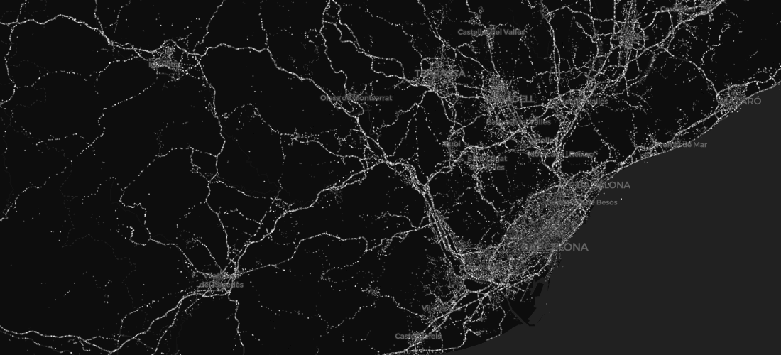
Mapping Segregation - MIT's Atlas of Inequality
Explore The Atlas of Inequality, a project revealing behavioral patterns and segregation impacts, led by MIT and Universidad Carlos III de Madrid.


Mapping Geoawesomeness' Top 100 Companies and Startups
Our team used CARTO VL and Airship to map the Geoawesomeness Top 100 Geospatial Companies and Startups list

Meet us at MWC: 1 Month To Go
we're getting very excited to attend this year's edition of the GSMA's flagship conference, Mobile World Congress - the world's largest exhibition for the mobile and telecommunications industry.


Introducing our new CEO: Luis Sanz
CARTO welcomes new CEO Luis Sanz to lead its growth in Location Intelligence, with co-founder Javier de la Torre now focused on strategy and development.

Faster, Stronger Smart Cities with Location Intelligence
The proliferation of Location Intelligence solutions is a big part of Smart Cities growth. Cities uniquely benefit from a deeper understanding of 'where,' in areas from disaster relief and health services, to traffic optimization, and more.

Academy
Geo for the Agentic Era: Highlights from #SDSC25 London
Explore how AI, open data, and scalable geospatial tech are redefining GIS at #SDSC25 London. Catch highlights, keynotes, and sessions on demand.
How Iceberg, GeoParquet & CARTO are reshaping geospatial
Discover how GeoParquet, Iceberg, and CARTO are transforming geospatial analytics with cloud-native, scalable, and open data architectures.

Live maps with automated Workflows integrations are here
Create live, always-updated maps with CARTO by integrating Workflows and Builder. Automate geospatial analysis to visualization in one step.

.png)