

.png)


Mapping Segregation - MIT's Atlas of Inequality
Explore The Atlas of Inequality, a project revealing behavioral patterns and segregation impacts, led by MIT and Universidad Carlos III de Madrid.


Mapping Geoawesomeness' Top 100 Companies and Startups
Our team used CARTO VL and Airship to map the Geoawesomeness Top 100 Geospatial Companies and Startups list

Meet us at MWC: 1 Month To Go
we're getting very excited to attend this year's edition of the GSMA's flagship conference, Mobile World Congress - the world's largest exhibition for the mobile and telecommunications industry.


Introducing our new CEO: Luis Sanz
CARTO welcomes new CEO Luis Sanz to lead its growth in Location Intelligence, with co-founder Javier de la Torre now focused on strategy and development.

Faster, Stronger Smart Cities with Location Intelligence
The proliferation of Location Intelligence solutions is a big part of Smart Cities growth. Cities uniquely benefit from a deeper understanding of 'where,' in areas from disaster relief and health services, to traffic optimization, and more.
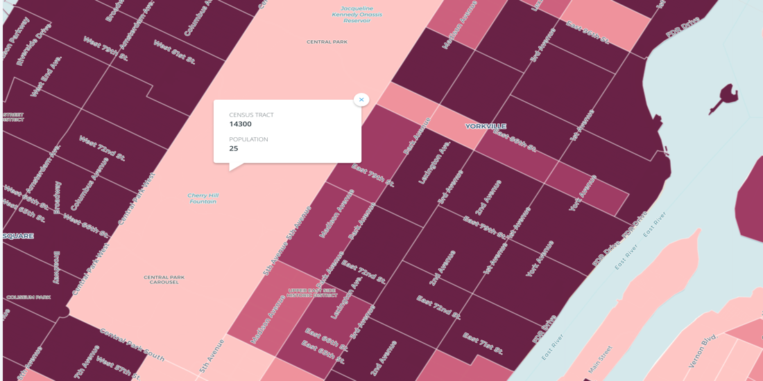

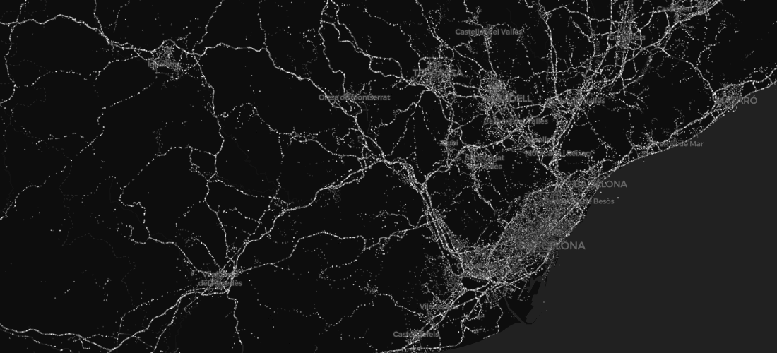
Census Oddities
Uncover Census Oddities: Learn tips to navigate unexpected quirks in U.S. Census data, from shifting boundaries to population gaps. Avoid pitfalls now.

Mobile Data 101: Challenges and Best Practices
Understand the challenges and best practices for effectively using GPS and Telco data.
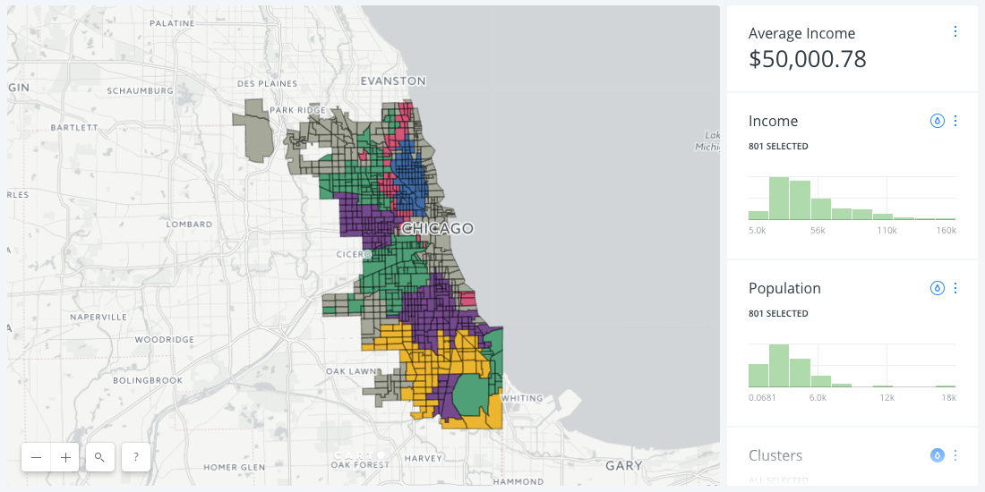
A New Approach to Customer Segmentation Using Location Data
Discover effective customer segmentation strategies using location data. Learn how to target the right audience for sales & marketing success. Try for free.

Examining Potential Impact of H-1B Reform with Data Visualizations
USCIS started accepting 2018 H-1B Visa applications in 2017. Explore potential impacts of the proposed H.R.670 bill on the tech industry and American economy.

Academy


Create your expansion strategy with CARTO and Snowflake
Learn how CARTO and Snowflake help you build a winning expansion strategy. Pinpoint ideal locations, leverage spatial analytics & AI for confident growth.

.jpg)
Pain-free data integration with Overture Maps, GERS & Databricks
Seamlessly integrate spatial data with Overture Maps, GERS & Databricks for fast, scalable geospatial analysis - no ETL or data wrangling needed.
Personalizing services with spatial analytics in Google Cloud
Personalize services at scale with spatial analytics on Google Cloud. Learn how to boost ROI using CARTO for location-based insights.
.png)
.png)