JavaScript is a widely used programming language that is used to create interactive and dynamic web content, rather than for data analysis and processing. For spatial use cases, JavaScript is often employed for creating interactive and visually appealing web maps. It allows developers to manipulate and visualize spatial data using libraries such as React and deck.gl. It is most useful for geospatial developers and data visualization experts.
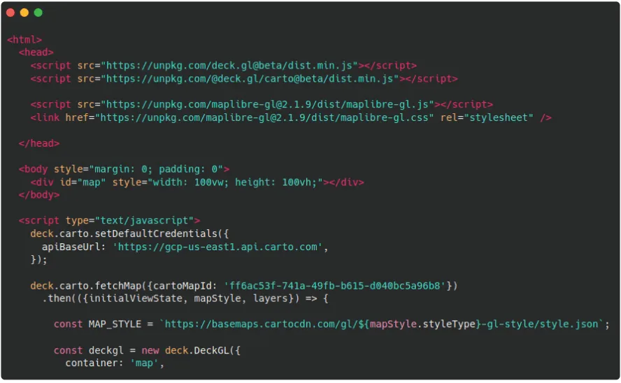
Loading a CARTO Builder map into deck.gl.
How to Spot
Javascript is typically executed within web browsers, so if you encounter code that is embedded or included within HTML files or interacts with web elements like DOM (Document Object Model), it is likely JavaScript. Also, look for JavaScript-specific keywords such as var, function, for, while, switch and return.