Python is a popular programming language which can be used for spatial analysis by leveraging various libraries like GeoPandas, Shapely, and PySAL, which provide functionalities to manipulate, visualize, and analyze spatial data. Python’s versatility, rich library ecosystem, community support, and compatibility make it an excellent choice for spatial analysis and data science. Python is most useful for: data scientists, data analysts, data visualization experts.
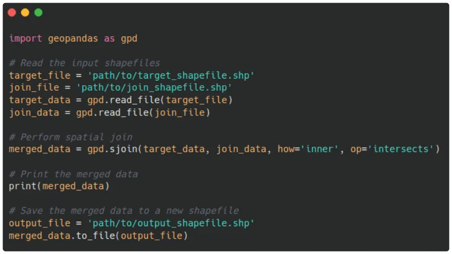
Using Python to run a spatial join between target and join datasets.
How to Spot
Python code often starts with import… to import necessary libraries. Python also has its own set of syntax rules and keywords; look for Python-specific keywords such as def, class, import, for, while, if, else, and elif.