Data Science
.png)


Live maps with automated Workflows integrations are here
Create live, always-updated maps with CARTO by integrating Workflows and Builder. Automate geospatial analysis to visualization in one step.
.jpg)


Maps with a Mission: Environmental Impact with Spatial Analytics
Let’s dive into how organizations use CARTO to protect biodiversity, advance climate research, manage natural resources, and drive sustainable decision-making.

.jpg)
Telco dashboards: Turning accessible data into actionable insights
Discover how CARTO enhances data accessibility, empowering decision-makers with actionable insights to improve network access for senior citizens and communities.
Live maps with automated Workflows integrations are here
Create live, always-updated maps with CARTO by integrating Workflows and Builder. Automate geospatial analysis to visualization in one step.
.png)

Introducing User Comments: boost collaboration in your maps
Boost team collaboration with User Comments in CARTO Builder—add, track, and resolve feedback directly on your enterprise maps.


Navigate global risk with MBI CONIAS Political Risk data
Monitor and forecast global political risks with MBI CONIAS data - spatial, predictive, and ready to support smarter decisions in volatile regions.

.jpg)
KASPR Datahaus Cyber Intelligence data now available in CARTO!
Announcing KASPR's global cyber intelligence data - now in CARTO! Monitor internet performance, optimize networks & drive smarter geospatial decisions.


Seamlessly integrate Google Earth Engine with CARTO Workflows
Seamlessly integrate Google Earth Engine with CARTO Workflows to analyze spatial data at scale - no coding required. Unlock powerful geospatial insights today!

Unlock raster analytics & visualizations - now in your lakehouse!
Unlock raster analytics in your lakehouse! Analyze & visualize raster data natively in CARTO for unmatched scalability, efficiency & cost savings.

CARTO AI Agents: now in public preview!
Discover how CARTO AI Agents are democratizing spatial analysis, making it accessible to all users. Learn about real-life applications revolutionizing geospatial industries.
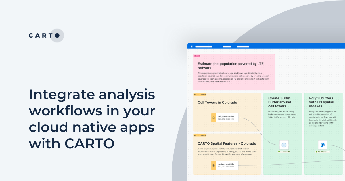

Integrate analysis workflows in your cloud native apps with CARTO
Seamlessly spatial analysis into cloud-native apps; trigger workflows via API, parameterize processes & seamlessly integrate them into spatial apps.
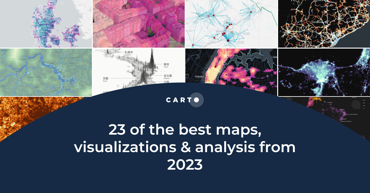
23 of the best maps, visualizations & analysis from 2023
Explore 23 of the best maps and visualizations of 2023. From advanced analytics to awesome visualizations with huge geospatial data.


Spatial analysis & visualization for more intelligent tourism planning
Discover how spatial data analysis and visualization empowers tourism organizations to personalize experiences, optimize resources & make strategic decisions.


Urban Mobility Insights with MovingPandas & CARTO in Snowflake
Learn how integrating MovingPandas with CARTO in Snowflake boosts urban mobility analysis by uncovering traffic hotspots and optimizing city transportation.
.png)

Cloud-native Life Sciences analytics with CARTO & Snowflake
Optimize Life Sciences analytics with cloud-native geospatial solutions using CARTO & Snowflake. Scale data insights for improved decision-making.
.png)
What is Supply Chain Network Design and How Does It Work?
Improve your supply chain network design! Use spatial analysis to optimize your supply chain design for cost savings, efficiency, resilience & sustainability.


10 Examples of Spatial Data & Visualizations for Telecom Analytics
Explore 10 maps using CARTO's cloud-native platform and spatial data for telecom analytics to enhance network optimization, coverage, and customer satisfaction.
.png)

Transforming Data Center Locations for Nautilus Data Technologies
Learn how we are collaborating with Google Cloud to provide Nautilus Data Technologies with an innovative solution for data center site selection and monitoring.


.png)


Academy
How Iceberg, GeoParquet & CARTO are reshaping geospatial
Discover how GeoParquet, Iceberg, and CARTO are transforming geospatial analytics with cloud-native, scalable, and open data architectures.
Live maps with automated Workflows integrations are here
Create live, always-updated maps with CARTO by integrating Workflows and Builder. Automate geospatial analysis to visualization in one step.
Introducing User Comments: boost collaboration in your maps
Boost team collaboration with User Comments in CARTO Builder—add, track, and resolve feedback directly on your enterprise maps.