.png)


Live maps with automated Workflows integrations are here
Create live, always-updated maps with CARTO by integrating Workflows and Builder. Automate geospatial analysis to visualization in one step.
.jpg)


Spatial Data Science Conference '21: More Speakers Confirmed
The Spatial Data Science Conference 2021 brings together leaders from industry, government, & academia for four days of talks on the latest technologies & techniques.


CARTO selected for AI4Cities Phase 2 Sustainable Mobility Project
We are pleased to announce that we have been selected to participant in phase 2 of AI4Cities, a project to help cities accelerate their transition towards carbon neutrality


Climate Change & Extreme Weather: Hurricane, Wildfire, & Flood Maps
Climate change is contributing to extreme weather with increasing bursts of hurricanes, wildfires, & floods. See how maps can help plot, predict, & protect.
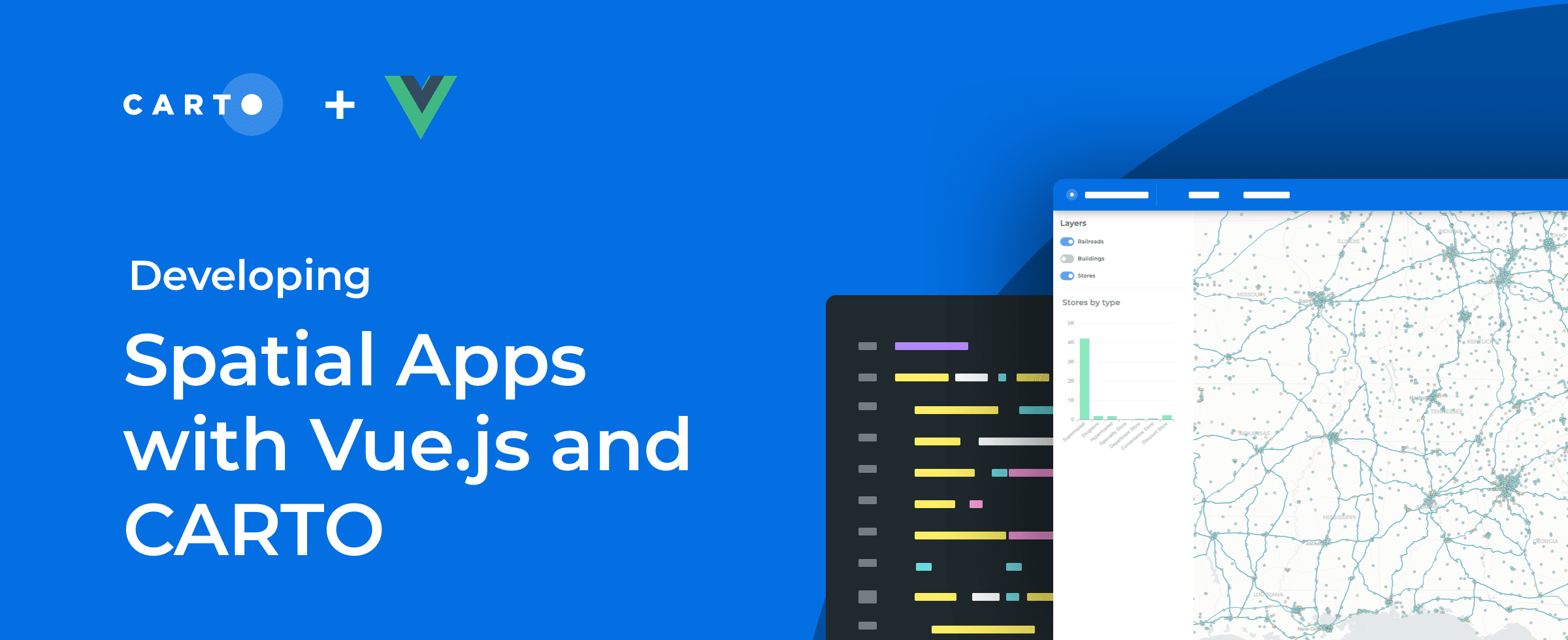

How to Build Scalable Spatial Apps with Vue.js & CARTO
Developing spatial apps with Vue.js? Check out our guide to how easy it is to integrate Vue.js applications with CARTO for deck.gl

Using Location Intelligence to Ease the Supply Chain Crisis
The disruption of global trade flows & a shortage of drivers has led to a global supply chain crisis. Read how Location Intelligence can be a road out of the crisis.


Canary Islands Volcano: Mapping La Palma Lava Flow & Damage
We use Spatial Data Science & CARTO to analyze & predict the damage caused by the eruption of the volcano on La Palma in the Spanish Canary Islands

Spatial Data Science Conference '21: First Speakers Announced
With the 5th annual Spatial Data Science Conference just over a month away we’re very excited to announce the first lineup of speakers. Register for free today!

Capturing the Sensitivity of National Wind Energy Potential to Local Siting Challenges
Wind energy is poised to be a significant contributor to national decarbonization goals, while there is enough wind available to power the nation, local siting challenges could have national implications. See how NREL is using location intelligence to better understand wind potential and it’s interaction with national clean energy targets.

A Look Back at 18 Months of COVID Grants & Maps
18 months since CARTO made it’s platform free to public & private sector organizations fighting coronavirus, we look back at some of the hundreds of grants.


Uncovering Site Selection Strategies using Point of Interest Data
Discover how Point of Interest (POI) data can be used to uncover site selection strategies of leading brands in the US including McDonald's, Starbucks, & Subway


Enhancing Spatial Analytics in Snowflake with CARTO
As part of our commitment to enabling geospatial analysis natively within the cloud, today we announce the launch of our Spatial Analytics on Snowflake with CARTO!


CKDelta’s international human mobility data now available in CARTO
We are pleased to announce our partnership with CKDelta & the inclusion of their human mobility data within our Data Observatory. Learn more & see key use cases.

Academy
Live maps with automated Workflows integrations are here
Create live, always-updated maps with CARTO by integrating Workflows and Builder. Automate geospatial analysis to visualization in one step.

Introducing User Comments: boost collaboration in your maps
Boost team collaboration with User Comments in CARTO Builder—add, track, and resolve feedback directly on your enterprise maps.

Navigate global risk with MBI CONIAS Political Risk data
Monitor and forecast global political risks with MBI CONIAS data - spatial, predictive, and ready to support smarter decisions in volatile regions.
.png)
