Google Cloud Next 2025: Key takeaways for geospatial


Last week saw one of the biggest events of the data & AI world land - Google Cloud Next 2025! Bringing together tens of thousands of innovators, developers, and business leaders to explore the future of cloud technology, Next covered everything from groundbreaking AI advancements to major product announcements - and our team was there to hear it all! So whether you couldn’t make it in-person or just want a refresher on the event, we’ve got the round-up of all of the hottest topics from Next - and what that means for geo!

Geo highlights from Google Next 2025
Location Intelligence was front-of-mind at Next 2025 - as it should be! There were several exciting announcements designed to make spatial analysis more scalable, more powerful, and more accessible across industries. Here are just a few of our favorites:
Google Earth Engine - the low-code way
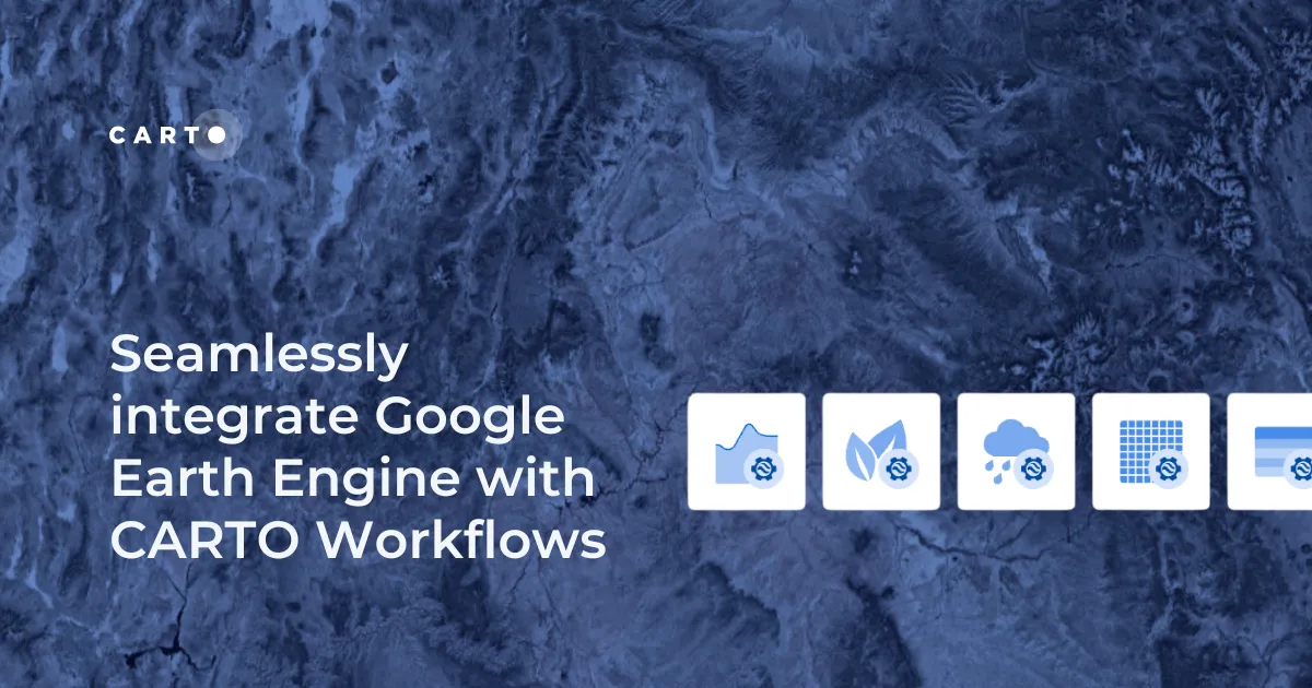
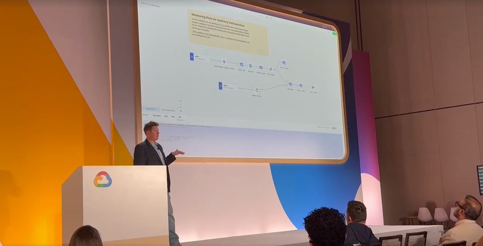
We recently announced the launch of our new Workflows Extension Packages - and we were so excited to see these packages featured in a talk from Sean Wohltman, Google Global Head of Cloud Geography.
These packages allow you to create, use and distribute custom low-code Workflows components tailored to specific spatial analytics needs. This makes it even easier to automate repetitive tasks, ensure compliance with organizational processes, and share custom geospatial tools across your team with ease.
Sean showcased one of our favorite packages - the Google Earth Engine package! This package makes it radically easier to access and use Earth Engine’s massive raster data catalog - including satellite imagery, NDVI, elevation, and precipitation datasets - directly inside our low-code tool.
At the event, Sean also announced an upcoming addition to this package; the new ST RegionStats component. This will allow you to calculate statistics in a polygon for any Earth Engine image without a single line of code!
Coming soon to CARTO Workflows…
Liking the sound of a low-code approach to spatial analysis? That’s not all we have planned!
We have a whole series of extension packages to help you get the most out of Google APIs, coming soon to a workflow near you! Here’s some of what you have to look forward to:
- Places Insights: access customized, aggregated insights about many places in a wider area, based on ratings, store hours, parking, wheelchair accessibility, and more.
- Roads Management Insights: analyze traffic data and improve roads with historical and real-time traffic information. Build models that forecast traffic conditions to mitigate congestion before it even occurs.
- Google Weather: easily access data from the Google Weather API and analyze current, historical and forecast weather conditions. Check out the results of this analysis in the map below, where you can explore real-time precipitation patterns across North Carolina… our apologies if you happen to be reading this blog on a 100% sunny day!
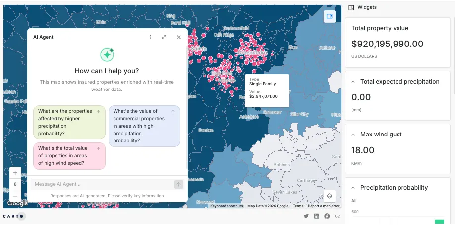
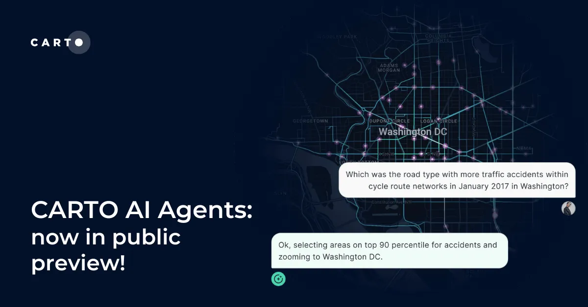
Gemini 2.5 in CARTO AI Agents
In February 2025, we announced the launch of CARTO AI Agents in public preview - see this in action below. As we continue to innovate and bring AI to the center of the CARTO experience, we are working on allowing users to connect to the AI platforms and models of their choice, including Gemini 2.5!
Gemini 2.5 represents the next step in AI reasoning and performance, designed to tackle increasingly complex challenges. It sets new standards by leading common benchmarks and demonstrating impressive capabilities in reasoning and coding.
Prioritizing high-quality location data at scale
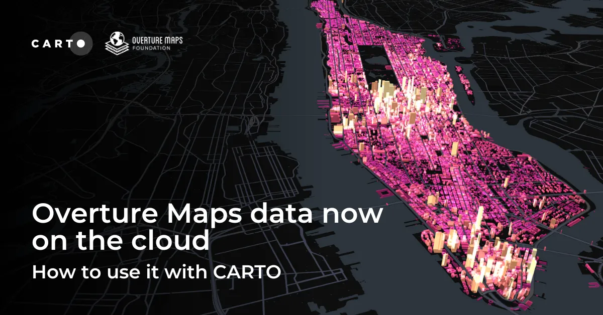
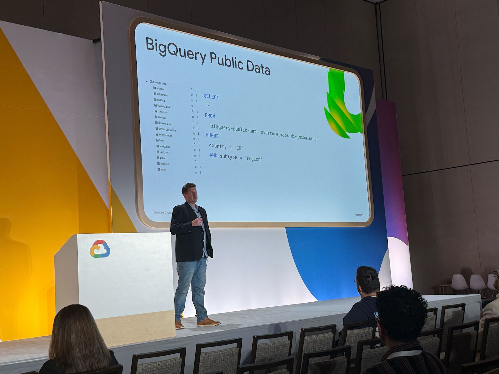
A major barrier to scalable geospatial analysis has long been the fragmented nature of global spatial data - with inconsistent formats, varying quality, and limited accessibility at scale. One of the hot topics at Next was the commitment from Google and partners like CARTO to improving the availability of high-quality, standardized spatial data in the cloud.
A standout example of this effort is the Overture Maps Foundation project, a collaborative open data initiative designed to provide a unified, interoperable foundation for mapping and location-based applications worldwide. Thanks to our work with partners like Google, Overture Maps is now available in Google Cloud’s BigQuery Public Datasets, making global-scale analysis possible without heavy data engineering. Users can query massive datasets directly using SQL, integrate them with private or commercial layers, and build complex spatial pipelines — all within a cloud-native workflow.
Learn more about how you can use this data in your analysis in our full guide.
The future of location with CARTO & Google Cloud
Google Cloud Next 2025 highlighted some seriously exciting advancements in the world of geospatial technology. From the exciting promise of Agentic AI, to democratization of analytics through low-code tools, to a commitment to data openness and accessibility.
These developments are a huge step forward in the ongoing mission of CARTO & Google of helping organizations to unlock deeper insights from their data without the need for complex infrastructure. Want to learn what this could mean for you? Request a demo from one of our experts!