

Use cases
.png)


Uncovering Site Selection Strategies using Point of Interest Data
Discover how Point of Interest (POI) data can be used to uncover site selection strategies of leading brands in the US including McDonald's, Starbucks, & Subway

Making Human Mobility Models Fair, Inclusive, & Private
Discover our Scientific Committee's latest insights when they gathered recently to discuss human mobility data topics including representation, bias, & privacy.

How to Build a Tree Equity Index & Dashboard using BigQuery
Lack of trees is linked to higher temperatures & more violent crime. Discover how to use the BigQuery Spatial Extension & CARTO for React to build a tree score dashboard.
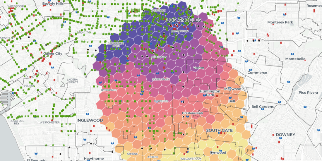

Z Score Visualization: How to Identify Hotspots with BigQuery
Index, or Z Scores, have often been used in geospatial analytics to identify hotspots & rank locations. Discover how to visualize them using Google BigQuery.


Authoritative Environmental Remediation Mapping in NYC
Learn about SPEED 2.0, a collection of spatial datasets wrapped into one app for the purpose of helping individuals identify environmental issues in New York City


Analyzing Water Access in Brazil during the COVID-19 Pandemic
Hand washing is key in the fight against COVID-19 but in Brazil water access can be an issue. Discover how Location Intelligence can be used to analyze the impact.


How to use Angular & CARTO to Build Scalable Spatial Apps
Want to develop spatial apps with Angular & CARTO? Check out our guide to see how easy it is to integrate Angular applications with CARTO for deck.gl

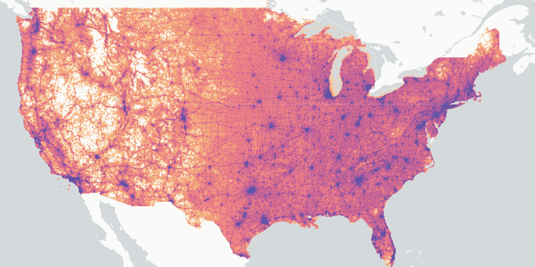
US Broadband Map: Closing the Digital Divide in America
The Connect America Fund aims to close the digital divide between rural & urban America. Learn more about it's impact with a newly updated map from the USAC.

Healthcare Analytics: How Boston uses Location Intelligence
Discover how Vital Village Network & Boston Medical Center use Location Intelligence & Open Data to promote family & community safety within Boston


CARTO selected by AI4Cities to accelerate City Sustainability
We are pleased to announce that we have been selected to participant in AI4Cities, a project to help cities accelerate their transition towards carbon neutrality


Real Estate Analytics: The Work from Home (WFH) Effect
The increase in WFH due to the pandemic is causing changes in many industries, not least real estate–see how spatial analysis can identify new demand

Using Route Optimization & IoT Data in Waste Management
The pandemic has significantly affected waste management in our cities - read how Location Intelligence can be used to optimize collection & reduce costs.

Academy

The Changing Role of the GIS Analyst
Discover how GIS Analysts are evolving from map makers to strategic AI-driven experts shaping enterprise decision-making with cloud-native tools.
Unlock planetary-scale insights with CARTO & Google Earth AI
Learn how CARTO & Google Earth AI make planetary-scale insights accessible with foundation models & Agentic GIS.

AI & the Future of Geospatial: Highlights from #SDSC25
AI and Agentic GIS are revolutionizing spatial analytics. Discover innovations, insights, and trends shaping the future from #SDSC25 New York.