Cloud Native


Delivering Geospatial Datasets on the Leading Cloud Data Platforms
Access your location based datasets from the CARTO Data Observatory directly on leading cloud platforms, including Google Cloud, AWS, and Azure


CARTO announced as a Google Cloud Edge partner for Communications Service Providers
As part of Google Cloud’s initiative to bring partner solutions to the network edge, we’re delighted to announce CARTO has been listed as a strategic partner.


Enhancing Spatial Analytics in BigQuery with CARTO
We are excited to introduce the CARTO Spatial Analytics in BigQuery, a suite of functions & procedures to perform spatial analysis natively within the Google BigQuery environment using SQL

Announcing CARTO BigQuery Tiler General Availability
We are excited to announce the general availability of CARTO BigQuery Tiler, a unique solution for visualizing massive spatial datasets hosted in Google BigQuery
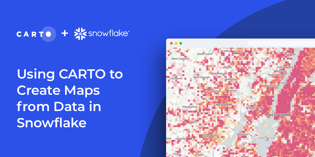

How to Create Maps from Snowflake using CARTO & SQL
Import millions of records from a Snowflake database using our new connector & create insightful visualizations. How to combine Snowflake data warehouse & CARTO

CARTO BigQuery Tiler Upgrade Gives Speed & Feature Boost
Read about new features to CARTO BigQuery Tiler: the fastest, most convenient, & cost effective way to visualize spatial Big Data & generate Tilesets for the web

CARTO + Placekey: Cloud Native Spatial Linkability
Learn more about our integration with Placekey, enabling universal standard identifiers for any physical place to be used with spatial analysis & visualization.


Unleash the Power of Snowflake with our Latest Connector
Snowflake users can now easily import large spatial datasets from the cloud into CARTO, becoming the first Location Intelligence platform with native support.

CARTO BigQuery Tiler is Now Available for Google Cloud Platform
Discover CARTO BigQuery Tiler, the only solution to visualize large location datasets straight out of Google BigQuery. Start creating stunning maps in minutes.

CARTO & Google Cloud Announce Partnership
CARTO is now a Google Cloud Partner & available on the Google Cloud Platform Marketplace enabling analysis & visualization within a rich ecosystem.
Simpler Data Science Workflows with CARTO + Databricks
Following the introduction of the Direct SQL Connection read how Databricks can be integrated into the CARTO platform to further empower Data Scientists.

Analyzing the Impact of Coronavirus on Meetups
A look at the impact of Coronavirus on Meetup RSVPs including the correlation between the location of COVID-19 cases and attendance in Italy

Academy
.jpg)
Telco dashboards: Turning accessible data into actionable insights
Discover how CARTO enhances data accessibility, empowering decision-makers with actionable insights to improve network access for senior citizens and communities.

The first 5 maps everyone needs to make with CARTO
New to CARTO? Start with these 5 essential maps! Learn how to analyze proximity, work with big data, integrate real-time updates, and leverage AI-driven insights.

Unlock raster analytics & visualizations - now in your lakehouse!
Unlock raster analytics in your lakehouse! Analyze & visualize raster data natively in CARTO for unmatched scalability, efficiency & cost savings.