.png)


Live maps with automated Workflows integrations are here
Create live, always-updated maps with CARTO by integrating Workflows and Builder. Automate geospatial analysis to visualization in one step.
.jpg)


Foursquare POI & Foot Traffic Data now available in CARTO
We are pleased to announce our partnership with Foursquare, leaders in location technology, & the inclusion of its POI & foot traffic data in our Data Observatory


Announcing #SDSC21: A Series of Spatial Data Science Events
Following the success of #SDSC20 we're excited to announce 2021's online edition of the Spatial Data Science Conference plus 2 more industry specific events


Announcing CARTO BigQuery Tiler General Availability
We are excited to announce the general availability of CARTO BigQuery Tiler, a unique solution for visualizing massive spatial datasets hosted in Google BigQuery


Agritech & Spatial Data: Predicting Crop Yield in Agriculture
Read how our partner NGIS built a spatial web application, CroppingHub, to detect crop types & predict crop yield using cloud computing & machine learning

How to Improve Retail Trade Area Accuracy with Mobility Data
Read how to improve retail trade area accuracy by moving beyond buffers & drive times to using spatial analysis & human mobility data

3 Spatial Data Science Trends to Watch in 2021
Geography is changing faster than ever before. Read our predictions for the key Spatial Data Science trends & industries to watch in 2021.
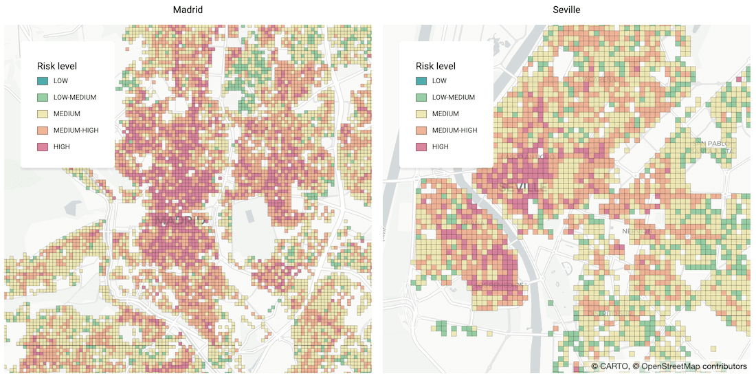

Identifying Areas Most Likely to Suffer Recession Post Pandemic
As many parts of the world enter into recession following the Coronavirus pandemic, read how Spatial Data Science can help identify areas with a greater risk


Human Mobility & Transport Analysis in the Canary Islands
Optimizing transport infrastructure spatially is key to the future of mobility - see how CARTO, Vodafone, & SAGULPA built a platform for the city of Las Palmas
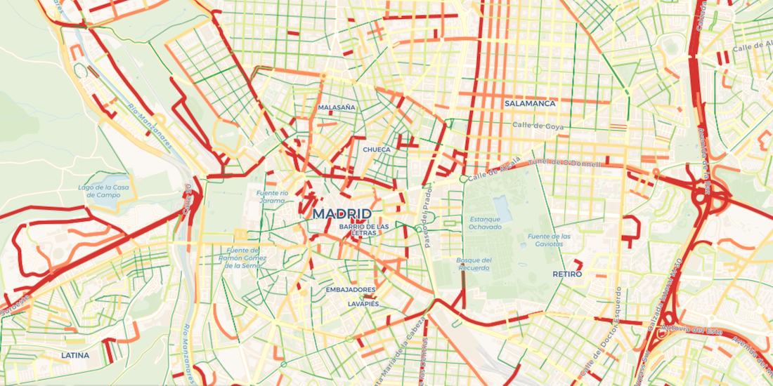

Visualize Waze Traffic Data using Google BigQuery & CARTO
Learn how to import Waze for Cities traffic big data into CARTO using our Google BigQuery Connector for easy analysis & visualization in our step by step guide

Our Thoughts as MapboxGL JS v2.0 Goes Proprietary
With Mapbox announcing a change in their licensing this week, we share our thoughts on this news, basemap neutrality, & the future of spatial app development

Announcing the CARTO Scientific Committee
We are very pleased to announce the formation of the CARTO Scientific Committee, and its inaugural members, to further advance the field of Spatial Data Science
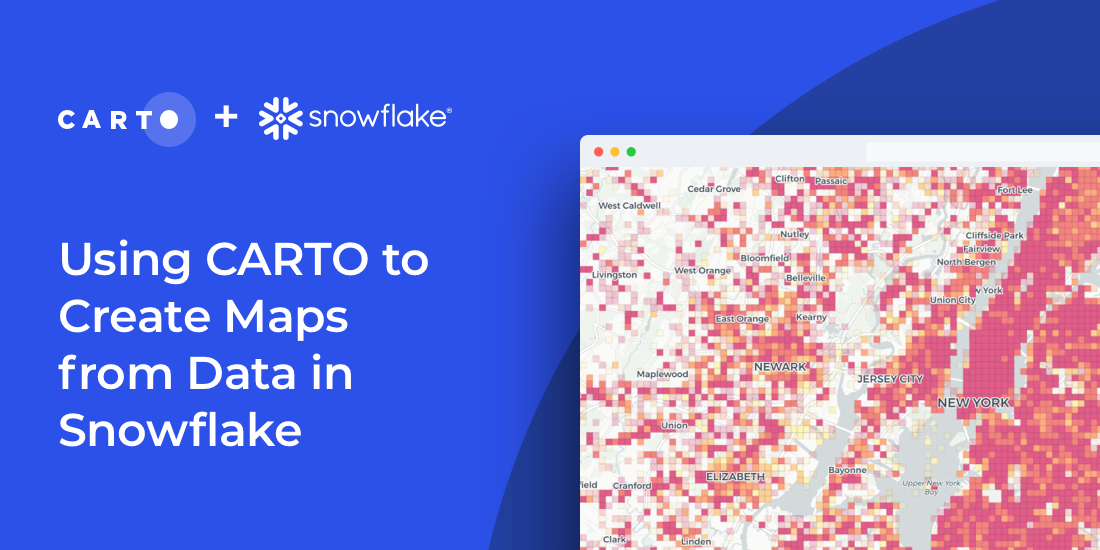

How to Create Maps from Snowflake using CARTO & SQL
Import millions of records from a Snowflake database using our new connector & create insightful visualizations. How to combine Snowflake data warehouse & CARTO

Academy
Live maps with automated Workflows integrations are here
Create live, always-updated maps with CARTO by integrating Workflows and Builder. Automate geospatial analysis to visualization in one step.

Introducing User Comments: boost collaboration in your maps
Boost team collaboration with User Comments in CARTO Builder—add, track, and resolve feedback directly on your enterprise maps.

Navigate global risk with MBI CONIAS Political Risk data
Monitor and forecast global political risks with MBI CONIAS data - spatial, predictive, and ready to support smarter decisions in volatile regions.
.png)
