Spatial Data Science


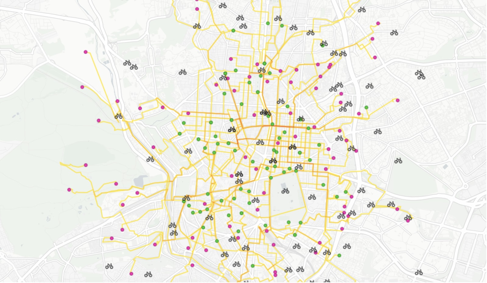


On-demand last mile transportation: Real-time route optimization with Location Intelligence
Discover how spatial analysis enhances last-mile transportation, optimizing routes for efficiency and reducing costs in delivery logistics.

Improving Healthcare Access with Spatial Data Models
An investigation of healthcare access across America, built on new spatial data science techniques


Big Data from Space: Using CartoDB to track environmental change
Discover the stories behind environmental data with CARTO. Explore deforestation trends, visualize Big Data insights, and unlock spatial analysis.
Faster data updates with CartoDB
Optimize your CartoDB tables with efficient batch updates. Learn to enhance SQL queries for faster inserts, reducing table scans. Boost app performance!
CartoDB Migration Complete, Welcome to 2.0
Explore CartoDB 2.0 migration: enhanced spatial data visualization, improved performance, upcoming features. Share your feedback with the community.
Indexed nearest neighbour search coming to CartoDB
Learn how to execute bulk "nearest neighbor" queries using CartoDB for geographical analysis. Create maps depicting parcel distances from fire hydrants efficiently.

The Top Trends in Data Visualization for 2018
8 trends around data science, data visualization, data stories, AI, and machine learning.


Find and fix underperforming retail markets with spatial data models
Discover why retailers are building market performance models with Location Intelligence in our latest post

Balancing Territories for Equity and Efficiency: A Field Sales Data Study
Spatial analytics and data science can help sales managers to eliminate guesswork and create well-reasoned and data-driven territories

Academy
.jpg)
Telco dashboards: Turning accessible data into actionable insights
Discover how CARTO enhances data accessibility, empowering decision-makers with actionable insights to improve network access for senior citizens and communities.

The first 5 maps everyone needs to make with CARTO
New to CARTO? Start with these 5 essential maps! Learn how to analyze proximity, work with big data, integrate real-time updates, and leverage AI-driven insights.

Unlock raster analytics & visualizations - now in your lakehouse!
Unlock raster analytics in your lakehouse! Analyze & visualize raster data natively in CARTO for unmatched scalability, efficiency & cost savings.