Spatial Data Science
.png)
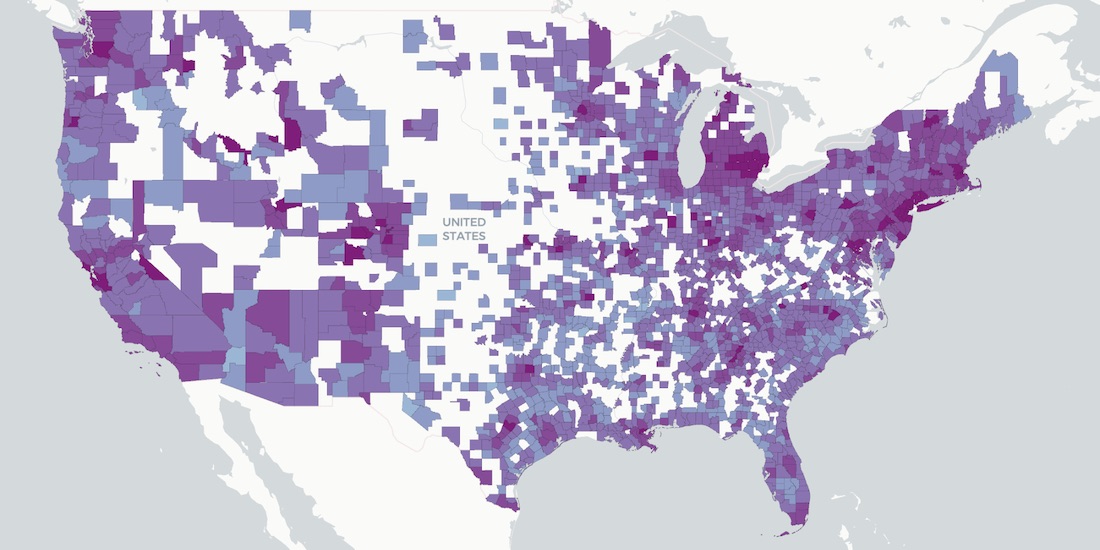


How Socioeconomic Factors relate to Mobility during COVID-19
A detailed geospatial analysis of how changes & regional disparity in human mobility during the COVID-19 lockdown can be related to socioeconomic indicators.


Announcing CARTO & Thinking Machines partnership
We are excited to announce that Thinking Machines a Data Science consulting firm specializing in geospatial, are now CARTO partners.


How Location Data Streams Can Be Used to Fight Against COVID-19
A look at how spatial data & analytics can become insightful resources to those designing, monitoring & optimizing responses against COVID-19.
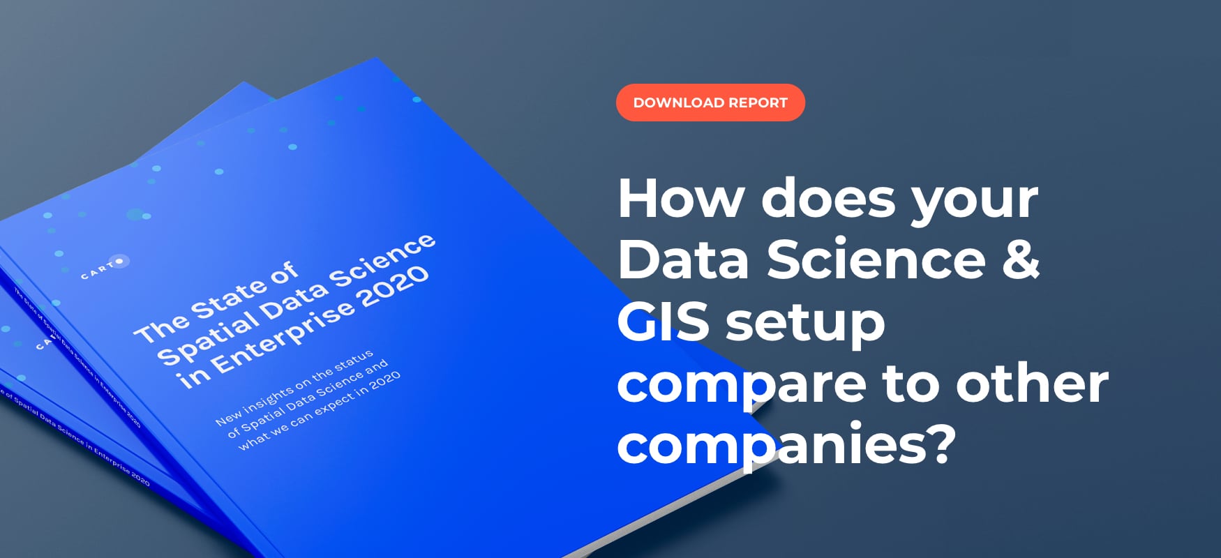
Top 3 Insights from The State of Spatial Data Science 2020
Discover key insights from our survey of how enterprise leaders from industries like Real Estate, Financial Services, Advertising and more are engaging with Spatial Data Science in 2020

Tackling Customer Churn for Utilities with Spatial Modeling
Spatial Data Science modeling can help Utilities companies to dramatically reduce customer churn and save millions in recurring revenue.

Speed up your spatial analysis with CARTOframes 1.0
CARTOframes is the go-to tool for powering analysis with spatial insights and efficiently working with spatial data and spatial models
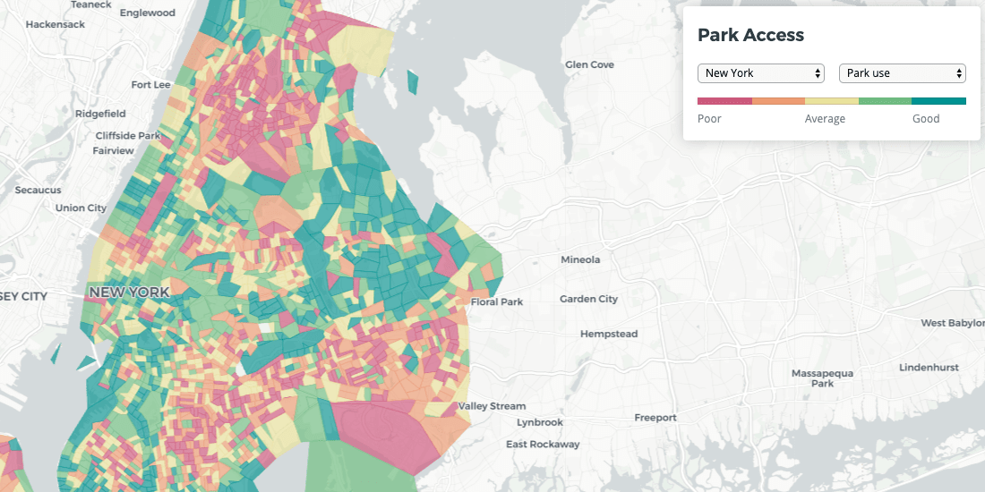
Quantifying Park Use in American Cities: Spatial Models and Novel Measures
Learn how cities can use spatial modeling to more accurately assess park use to inform planning and facilities decisions

Magnify your Analysis: Statistical Downscaling to Enhance Spatial Resolution
From understanding the dynamics of a business, to modelling physical and biological processes, selecting the proper spatial scale matters.

Spatial Analysis: Private Equity's Secret Weapon
Which types of funds invest in spatial analysis? How do they use location data in screening & portfolio management? We discuss the role of Data Science.


PostGIS Day: A future, post GIS
Is GIS dead? No, but it is undergoing a transformation - and we're excited to see how spatial analysis can continue to change our world.

Retail Revenue Prediction Models with Spatial Data Science
Predicting store revenues is critical, allowing retail leaders to stay agile, make informed decisions around current store operations, and plan the most effective new openings. The most accurate prediction models include the location component.


Academy
.jpg)
Telco dashboards: Turning accessible data into actionable insights
Discover how CARTO enhances data accessibility, empowering decision-makers with actionable insights to improve network access for senior citizens and communities.

The first 5 maps everyone needs to make with CARTO
New to CARTO? Start with these 5 essential maps! Learn how to analyze proximity, work with big data, integrate real-time updates, and leverage AI-driven insights.

Unlock raster analytics & visualizations - now in your lakehouse!
Unlock raster analytics in your lakehouse! Analyze & visualize raster data natively in CARTO for unmatched scalability, efficiency & cost savings.