The Modernization of Geospatial: Announcing CARTO on Oracle


We're entering a new era in geospatial, driven by AI, automation, and the rise of Agentic GIS; intelligent systems that can autonomously reason and act on spatial data. In this new landscape, spatial workflows must evolve. It's no longer enough to rely on manual processes, brittle data pipelines, or legacy tools built for static maps. The future is about intelligent spatial systems that can reason over data, react to changes, and inform decision-making in real-time.
That future requires modernization, and not just of tools, but of where and how spatial computation happens.
Modernizing alongside your Oracle investments
Many organizations have built their geospatial infrastructure on Oracle, and for good reason. Oracle offers the most comprehensive geospatial support on the market, handling vector geometries, raster data, point clouds, trajectory data, linear referencing, topologies, and network data models - all accessible through SQL. Combined with enterprise-grade security, high availability, and ability to scale to massive datasets, Oracle has been the foundation for mission-critical spatial workloads for decades.
But these organizations are now facing a critical inflection point. As they move to the cloud and embrace AI-driven analytics, their legacy GIS systems struggle to keep pace. Desktop-bound workflows can't scale to real-time operations. Static analysis tools can't integrate with modern AI capabilities. The challenge isn't replacing Oracle; it's modernizing the entire geospatial stack around it.
Announcing support of Oracle in CARTO
That's why we're excited to announce that CARTO now supports Oracle Autonomous Database, bringing our full platform to one of the world's most powerful spatial engines.
This partnership with Oracle ensures that organizations with significant spatial footprints can transition to modern, cloud-native spatial analytics without losing the value of their existing investments. You can run CARTO alongside your existing GIS infrastructure, gradually modernizing while maintaining continuity with established systems and workflows.
The enterprise appetite for data-driven decision-making is accelerating, and geospatial insight is a critical component of that. By bringing CARTO’s powerful platform to Oracle Cloud Infrastructure and Autonomous Database, we are empowering our customers to unlock new value from their existing data investments securely and at scale.Siva Ravada, Vice President of Development – Oracle Spatial and Graph, Oracle
Why this combination matters
When you pair Oracle's proven database reliability with CARTO's modern, cloud-native platform, you get something uniquely powerful: the ability to preserve decades of spatial investment while unlocking entirely new capabilities for the AI era.
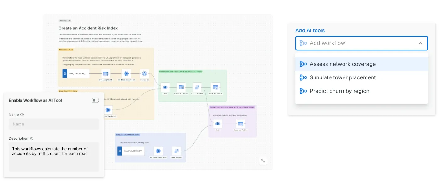
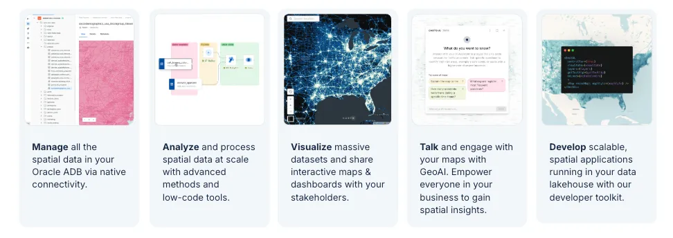
With CARTO on Oracle, organizations can manage their data through native Oracle connectivity, analyze it with advanced spatial methods and low-code tools, visualize massive datasets through interactive maps and dashboards, collaborate across teams with GeoAI-powered workflows, and develop custom applications using CARTO's developer toolkit - all running directly on their Oracle data lakehouse. CARTO Workflows enables geospatial MCP tools (Model Context Protocol), bringing the next generation of Agentic GIS to Oracle users. The platform seamlessly integrates with OCI's AI capabilities, enabling organizations to modernize their geospatial infrastructure for the AI era.
We are very impressed with the rich built-in geospatial capabilities of Oracle. With this new partnership we are now able to bring many more geospatial use cases to the Modern Agentic GIS era.Javier de la Torre, Founder & CSO at CARTO
Organizations that have built their geospatial infrastructure on Oracle can now access CARTO's full platform, managing their data through native Oracle connectivity, analyzing it with advanced spatial methods and low-code tools, visualizing massive datasets through interactive maps and dashboards, collaborating across teams with GeoAI-powered workflows, and developing custom applications using CARTO's developer toolkit running directly on their Oracle database.
Unlocking Oracle's advanced spatial capabilities
Beyond modernizing existing workflows, this integration unlocks use cases that leverage Oracle's uniquely rich geospatial capabilities, capabilities that many organizations aren't fully utilizing today:
- Advanced routing and network analysis: Oracle's Network Data Model enables sophisticated routing scenarios, optimizing delivery routes with custom cost functions, solving traveling salesman problems, or modeling multimodal transportation networks, all through SQL queries that can now flow directly into CARTO's visualization and AI-powered decision workflows.
- Linear referencing for infrastructure: For organizations managing transportation networks, pipelines, or utilities, Oracle's linear referencing system allows events to be stored and queried by measure along linear features. CARTO can now visualize and analyze this data dynamically, making it easy to map incidents by milepost, detect patterns along corridors, or plan maintenance activities.
- Raster analytics at scale: Oracle's GeoRaster capabilities support storage and analysis of satellite imagery, elevation models, and climate data directly in the database. Combined with CARTO, organizations can now run automated raster analysis pipelines, extracting land use classifications, calculating NDVI from multispectral imagery, or generating elevation profiles, and immediately push results into interactive spatial applications.
- 3D point cloud processing: Oracle's support for LiDAR and 3D point clouds enables analysis of billions of points with spatial indexing and filtering. CARTO workflows can now leverage this data for applications like urban planning, forest inventory, or infrastructure inspection, querying point clouds to derive building heights, vegetation metrics, or terrain models, then visualizing insights alongside other spatial layers.
Flexible deployment across your Oracle environment
CARTO is fully compatible with Oracle Database 23ai and 19c, and can be deployed across multiple environments to meet your organization's specific needs. Thanks to Oracle's multi-cloud strategy, Oracle Autonomous Database is available on OCI, AWS, GCP, and Azure, allowing customers to leverage their existing cloud commitments and standardized platforms while benefiting from this new offering. For on-premises installations or self-hosted deployments, our Kubernetes solution provides enterprise-grade scalability and control.

When running on Oracle Cloud Infrastructure, CARTO seamlessly integrates with the full OCI ecosystem, leveraging AI services for intelligent spatial analysis, Object Storage for scalable data lakes with direct support for cloud-native formats like GeoParquet, Cloud Functions for serverless geospatial processing, and the broader suite of cloud-native services that make modern spatial workflows possible.
Join us to see CARTO on Oracle in action
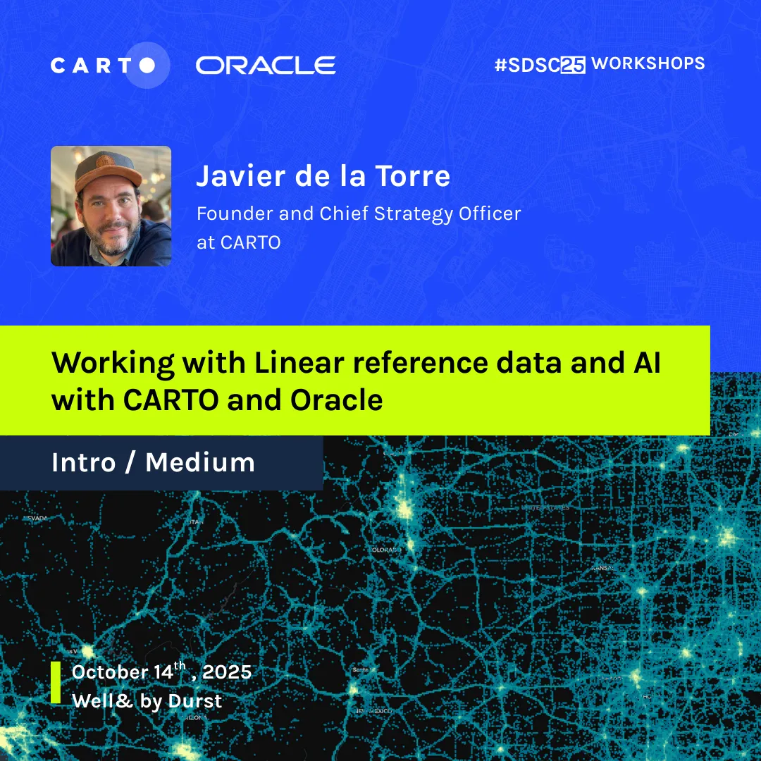
We're hosting a hands-on workshop at the Spatial Data Science Conference (October 14th-15th, NYC) where we'll demonstrate these capabilities live, from network routing analysis to real-time raster processing. If you're an Oracle user interested in attending, please reach out to us for a special conference pass. We'd love to show you what's possible when you combine Oracle's spatial power with modern cloud-native workflows.
A huge thanks to the Oracle Spatial team for their support in enabling this integration and for sharing our passion for geospatial data. Special recognition to David Lapp and Siva Ravada for their partnership and collaboration in making this happen.
We're just getting started. It's time to modernize geospatial, and Oracle users now have a clear path forward.