Harness the Power of Vector with CARTO VL


Six months after the beta release the CARTO team is proud to announce the full public launch of CARTO VL our JavaScript library for vector-based visualization and analytics enabling faster smarter decision making with Location Intelligence applications.
CARTO VL leverages the entire CARTO platform with new high-performance cartographic capabilities smart aggregations access to CARTO's Data Observatory advanced spatial analytics and more.
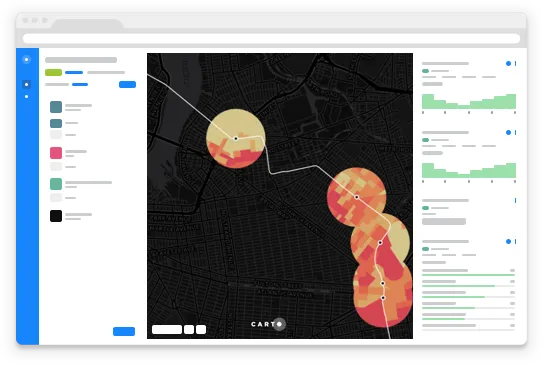
By enabling greater interaction with the underlying information CARTO VL helps surface more patterns and insights. Users can quickly create filters pop-ups graphs and widgets on top of their data customizing the design of their LI application to give precise answers to business questions.
More Than the Sum of Its Parts
In order to make CARTO VL the most effective tool possible for building a new generation of Location Intelligence applications it was critical for the javascript library to have powerful integrations and components. Our team worked hard to make sure that CARTO VL can be easily integrated into common workflows and development stacks.
Bring in the Basemaps
LI applications require a geographic context having a great basemap helps to provide that background. We think Mapbox GL is the best library for providing quality and accounting for cartographic nuance.
For that reason we've integrated CARTO VL with Mapbox GL from the start so that developers can benefit from beautiful high quality and ready-made basemaps. Developers can also customize their design based on their specific needs.
A Smarter Backend
These days it's not uncommon to find clients with datasets that contain millions of rows. Analyzing this data and having strong visual representation is critical. Alongside CARTO VL we have revamped our Maps API—improving transferring speed and size—making it easier than ever to visualize analyze and experience Vector data. This is all a part of our goal of building the new tech stack for Location Intelligence.
State of the Art Styling
CARTO VL unleashes the full potential behind WebGL. It's a completely GPU accelerated library for map making with both styling and drawing happening in the GPU. The Result is super-fast restyling allowing the display of a large number of animated features at 60 frames per second.
Some other styling highlights include:
- Dynamic data-oriented styling a strong alternative to existing styling languages that is faster more intuitive and developer friendly.
- Multi-scale thematic mapping - Styling automatically optimized for viewport and zoom level. Never worry about map clutter or information overload.
- The batteries are included! CARTO VL supports CARTO Colors mixing expressions a focus on interpolation qualifiers like quantiles and equal intervals and support for images.
- Support for temporal dimensions
- JS developer friendly
Developer-Focused Integrations
A big part of making CARTO VL a core component of the Location Intelligence stack is making sure that it is integrated with the tools developers need. In addition to working with Mapbox GL VL can be integrated with any other basemap provider. It also includes integrations with CartoColors and offers the freedom to render tiles from anywhere with support for many client-side rendering libraries.
Learn how CARTO VL works with integrations like CARTOframes by watching our recent webinar! Watch Today!
Interaction Animation and Performance
CARTO VL was designed with user interaction in mind. Dynamic styling and responsive cartography based on user interaction has been improved. Style can be changed per feature and charts and widgets perform with almost zero latency.Animation is more seamless than ever with clean fade-in and fade-out transitions. CARTO VL is also a powerful tool for temporal maps using torque to animate points polygons and lines to visually represent data patterns over time.
In the development of CARTO VL the team focused on performance as a feature with the above mentioned fast rendering fast filtering and temporal animation all happening at 60+ FPS. Visualizations made using CARTO VL are automatically optimized for speed and user experience and are performant at all scales. CARTO VL can carry the load when working with big datasets rendering +1M points of data client side.
Get Started with CARTO VL
Developers building Location Intelligence applications with CARTO VL have new ways of visualizing and understanding their data and can make sure that their application remains performant leading to better more informed business decision making. This means that executives analysts project managers marketers and anyone leaning on location data can benefit from the added functionality. Check out our documentation and get started with CARTO VL today.
Want to chat about CARTO VL?
Our location intelligence specialists are available to talk about your next project.