

Medellín’s Data Portal Adds Transparency to Smart Cities Initiative


Location data is paramount to intelligent cities planning and development. Geographical information provides a common frame of reference and big picture analysis for entrepreneurs citizens and policymakers alike.
How cities can best leverage location data to the benefit of the community is a common challenge. CartoDB offers the solution to your cities location data needs!
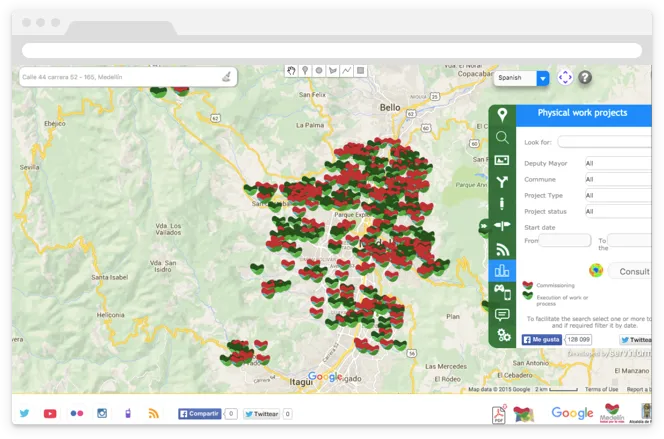
Medellín the second largest city in Colombia developed a platform to serve all its citizens - public and private. Using CartoDB Servinformación created Mapas Medellín for the Sigamos Medellín website. The data portal hopes to foster communication channels between government and citizens.
Now citizens can view in real time traffic public transit and other government initiatives.
Discover how Medellín used CartoDB to create a data portal that serves its citizens:
The availability of geo-tagged data creates rich new layers of information that can be utilized at scale to create evolving solutions for more livable cities intelligent policy and design better research improved emergency response predictive analysis and economic opportunity. Medellín is making all this possible with the Mapas Medellín data portal.
We really hope to see more successful user experiences like this one!
Happy data mapping!


