Javier de la Torre interviews with Forbes Magazine: Changing the Name of the Data Game to Location


How we view collect and process data has gone through a revolutionary transformation. Roughly 45 years ago the most widely disseminated image of the Earth was captured by NASA The Blue Marble. Eight years ago smartphones were invented -- forever changing the way we take images and store and collect data. Now companies like CartoDB are ushering in the age of data analysis.
Recently our co-founder and CEO Javier de la Torre sat down with Forbes Magazine and True Bridge to dicuss how almost all forms of data have a location component and how analyzing location data changes the way we act and react in the world.
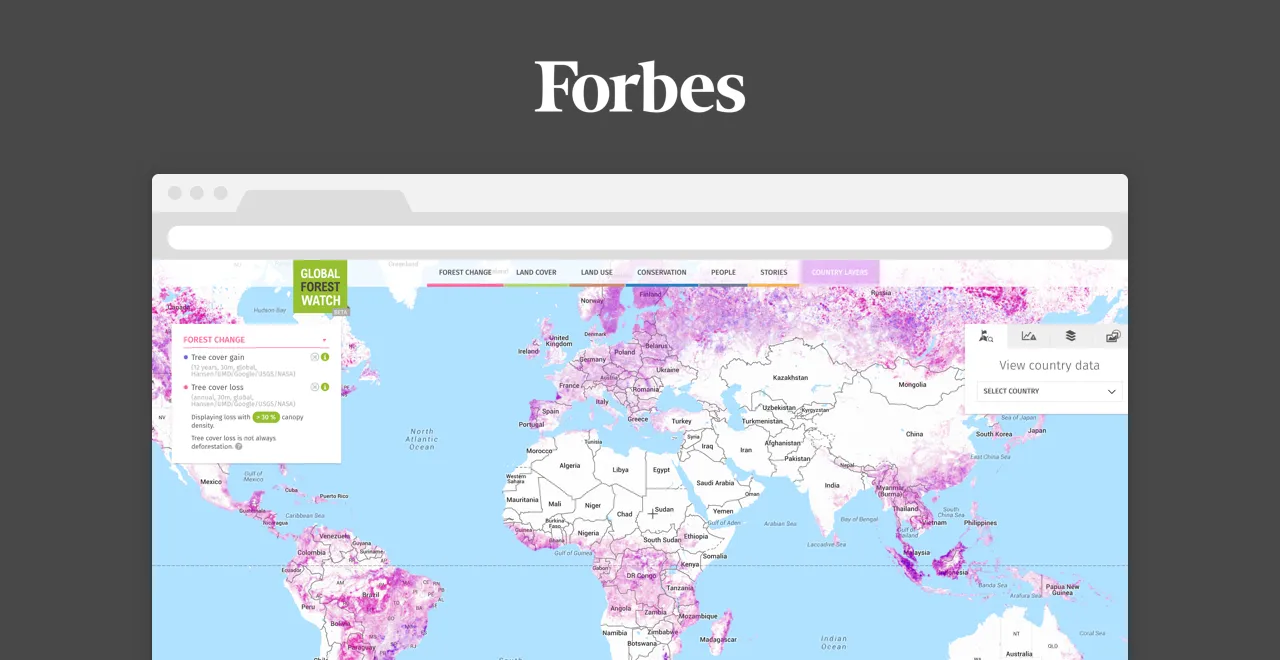
In the first of a two-part series Forbes explores how a new generation of tech consists entirely of data - imaging aggregation and analysis. In part-two CartoDB along with our friends at the World Resources Institute and Global Forest Watch are highlighted for the use of location intelligence to make better business decisions and the world a better place.
Partnerships with organizations like WRI and GFW help broaden the understanding of location data democratize access to that data and help visualize the earth in a whole new way.
Javier and our friends at Forbes make it clear that imaging and location data are only going to become more relevant from here and perhaps as common a resource for everyday decision making as a Google search.
Read more about how CartoDB is changing the game of data analysis and making location data a household name.
Happy location data mapping!