Announcing the Spatial Data Scientist of the Year 2020


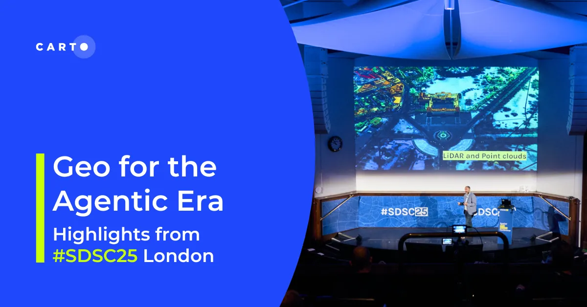
What a week it has been! Thousands of you attended this year's Spatial Data Science Conference 2020 (#SDSC20) making it our biggest event so far featuring 50 speakers across 36 interactive talks workshops and panels.
At this year's conference the inaugural Spatial Data Scientist of the Year was awarded and we are very pleased to announce Dani Arribas-Bel as the winner!
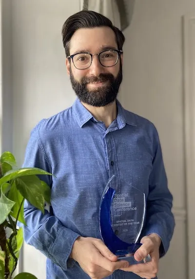
Dani is a Senior Lecturer in Geographic Data Science within the Department of Geography and Planning at the University of Liverpool in the UK and an ESRC Fellow at the Alan Turing Institute.
Dani is also part of the development team of the open source library PySAL for spatial analysis in Python; and created contextily a small Python package to use web tile services in static maps.
Since 2019 he is the co-editor of "Environment and Planning B - Urban Analytics and City Science" and since 2020 he is also in the editorial panel of "Journal of the Royal Statistical Society Series A - Statistics in Society".
Dani's research interests combine urban studies computational methods and new forms of data. His research has been published in journals such as PLOS ONE Demography Geographical Analysis or Environment and Planning (A/B/C).
I'm thilled to receive this award and extremely humbled by the recognition from CARTO an inspiring company and a trailblazer; and the committee made up entirely of folks I have deeply admired for a long time. I'm particularly excited about the fact that part of the decision for the award was my work to nurture community. Geographic/Spatial Data Science is a team sport and it is impossible to think of any of my contributions without the role of collectives like the Geographic Data Science Lab at the University of Liverpool teams like the PySAL developers and communities like that one around the CARTO conference.
More information about Dani including more about his research teaching and work can be found on his personal website.
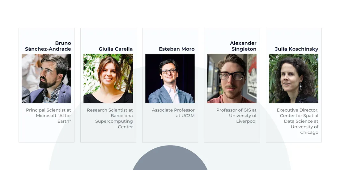
He was picked by CARTO's Scientific Community (seen below) based on the following judging criteria:
- Use of new types of data: the individual has used new types of geospatial data which are considered more challenging to analyze moving the needle for their organization to extract insights from new types of location data (rather than using traditional datasets only). This might be mobile event data GPS data indoor WiFi data social media data or any other type of Big Data which has only recently started to be used in spatial analysis workflows.
- Impact of projects delivered: the results of the individual's analysis and modeling are causing a change in their industry and/or being applied to a real business or societal challenge.
- Innovation in methodology: the individual uses new technologies libraries and methodologies to create spatial models creating more sophisticated models for their organization or research.
Many congratulations to Dani! The other highly ranked nominees on the shortlist were:
 | Anita Graser - Researcher at the Austrian Institute of Technology Anita is a spatial data scientist open source GIS advocate and author. She is the developer of MovingPandas a Python library for analyzing movement data. She was nominated by Owen Vachell for “her outstanding work revolutionizing analysis of movement data”. Projects that Anita has worked on can be found on her website. |
 | Alexander Zipf - Prof. for Geoinformatics at Heidelberg University Alexander is chair of GIScience (Geoinformatics) at Heidelberg University (Department of Geography). He is a member of the Centre for Scientific Computing (IWR) and founding member of the Heidelberg Center for the Environment (HCE). He was nominated by Bernhard Höfle for “his impact on humanitarian projects disaster management and big spatial data analytics”. |
 | Dr. Clio Andris - Assistant Professor at Georgia Institute of Technology Clio’s research is on mathematical models of social networks social flows and interpersonal relationships in geographic space applied to issues of urban planning visualization transportation and geography. She was nominated by Varun Adibhatla for “her important work to democratize applied research in spatial networks and spatial flows - 2 factors that are critical in managing and responding to a global pandemic”. |
 | Dr. Edward Boyda - Chief Scientist at Earthrise Media Edward is a physicist educator satellite investigator and data scientist. He was nominated by Dan Hammer for “his work to measure change from satellite imagery for environmental and humanitarian reporters”. |
SDSC20 may have finished but the learning and networking doesn't stop here. If you missed any of the talks you can catch up on-demand on our YouTube channel and keep the conversation going with the hashtag <a href="https://twitter.com/hashtag/sdsc20?src=hashtag_click
" target="_blank">#SDSC20 and by joining our Slack community.
We look forward to seeing you at #SDSC21!
Missed any of the talks?