Introducing CARTO VL - Vector Technology for Location Intelligence


The future of location intelligence relies on systems capable of analyzing and visualizing vast amounts of data that respond quickly to user interactions and queries. Vector-based client-side technology provides this foundation.
Dynamic vector support has been available via CARTO's SQL APIs and customers like the City of New York have been leveraging vector in CARTO for some time. In January we announced support in CARTO for Mapbox Vector Tiles the first step in advancing vector technology for businesses in our platform. Today we are thrilled to announce the Beta release of CARTO VL our new Javascript library for vector-based visualization inside Location Intelligence applications.
How CARTO VL is changing the game for Location Intelligence
While traditional raster tiles are effective for visualizing data layers in digital mapping some use cases require greater functionality than what is currently possible when rendering image-based tiles. With CARTO VL users can interact more dynamically with points lines and polygons in CARTO and move past the constraints of external servers.
Vector tiles inside of CARTO render data Client-side or in the user's browser as opposed to on a server. This is an improvement on raster in several key ways:
- Client-side rendering provides significant improvements in application load time and performance. This reduces the risk of server problems leading to missed opportunities or incomplete analysis.
- Vector rendering allows large datasets to be visualized more quickly and seamlessly. Maps are always optimized for the data being viewed.
- Using CARTO VL Data can be dynamically manipulated aggregated and styled generating vector tiles on the fly without requiring tiles to be re-rendered.
- CARTO VL allows lines and polygons to be animated in addition to points based on time data or other values.
Performant visualization of large data sets
With global adoption of mobile devices a world moving more towards digital interaction and a rising Internet of Things companies are generating more data faster than ever. Being able to visualize and manipulate massive datasets without slowing down an application is critical.
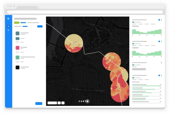
CARTO VL's powerful on-the-fly data aggregation and geometry simplification with vector rendering allows users to visualize larger datasets as seen below.
##_IMAGE_SIZE_LIMT_## https://carto.com/media-content/blog/img/posts/2018/2018-05-21-carto-vl-vector-library/interpolated-lines.gif##_IMAGE_SIZE_LIMT_##
Smart data-driven styling for complex data
Using CARTO VL designers and developers have more flexibility and control over how they style their maps. CARTO VL enables data visualization based on interpolation (or the mixing of multiple variables to create new data) and expressions (mathematical formulas).
Data can be styled and scaled with styling automatically optimized at each zoom level. Combined with a greater degree of interactivity such as greater feedback on hover and click deriving insight and information from Location Intelligence applications will be more seamless than ever.
Animated points lines and polygons
CARTO VL allows developers to animate lines and polygons as opposed to only being able to animate point data. This unlocks new ways of visualizing and understanding data.
##_IMAGE_SIZE_LIMT_## https://carto.com/media-content/blog/img/posts/2018/2018-05-21-carto-vl-vector-library/polygon-animation.gif##_IMAGE_SIZE_LIMT_##
For example helping a company to visualize how weather patterns might affect their delivery routes can cut costs and help them to avoid risk. Allowing a Department of City Planning to track changes in infrastructure over time can inform future project management. Understanding and visualizing human movement patterns can inform geomarketing efforts for big box retailers looking for an edge.
##_IMAGE_SIZE_LIMT_## https://carto.com/media-content/blog/img/posts/2018/2018-05-21-carto-vl-vector-library/line-animation.gif##_IMAGE_SIZE_LIMT_##
Start exploring CARTO VL today
Speed reliability and control can make the difference when catching credit card fraud as it occurs keeping traffic running smoothly or even managing major disaster relief. For data-driven businesses governments and organizations vector support is critical in making sure that Location Intelligence applications are performant when it counts the most.
Using CARTO VL users are able to interact with and manipulate location data in the browser enabling faster rendering speeds enhanced capabilities for on-the-fly analysis responsive data-driven visualizations and dynamic user interactions.
CARTO VL offers freedom to render tiles from anywhere with support for many client-side rendering libraries and is designed to work with your current technology and needs. Currently in Beta CARTO VL benefits directly from your feedback. Let us know your thoughts and help us continue to build and improve our new vector library.
Want to chat about CARTO VL?
Our location intelligence specialists are available to talk about your next project.