

Powered by CartoDB: MapGeo brings location intelligence to local government


The 'smarter city' is all the rage and while a buzzing megapolis may have the complexity and resources to deploy a mayoral 'geek squad' or install flocks of sensors the average town has to fulfill its duties on a much tighter budget.
We're all about tools that bring location intelligence to everyone which is why a new product from our partner AppGeo has us excited. They just launched the next generation of MapGeo a data management and visualization platform for local governments. They've rebuilt it from scratch using CartoDB and if we may say so MapGeo 2.0 is fantastic.
If you're interested learning more about what MapGeo can offer your town or city we hope you'll join our [October 8 webinar].
Why Location Matters to Municipalities
Cities and towns manage services and infrastructure across geographic area so they need to track and understand what's happening where. Location-based decisions are central to many city activities -- from transportation to housing to public safety. Local authorities are also looking for ways to work smart -- to do more more efficiently and to use data to aid their decision-making.
Kate Hickey AppGeo's VP for Local Government Services explains the inspiration for MapGeo:
"After a decade of rolling out custom websites for local agencies we had a sense of the common needs. Everybody needed base maps query tools access to property information and the like. We started to build a blueprint of what a hosted platform might look like in partnership with several municipalities. That blueprint became MapGeo."
"The more users interacted with MapGeo the more they wanted to do. They wanted the power of heatmaps and the impact of animated visualizations to explain change. City leaders wanted summary graphics to guide their work and share their reasoning with constituents. CartoDB's mapping and analysis features make data easy to understand and the platform is really robust so we know we can build even more great functionality over time."
More than a hundred municipalities are using MapGeo today. So this upgrade is based on a deep understanding of what citizens and officials do and care about. Here are some of the ways MapGeo helps address their needs.
Using Land Records to Spot Trends
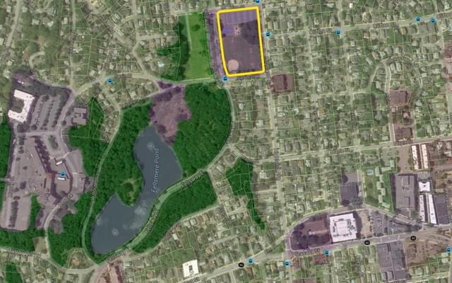
Land records stewardship is crucial for determining zoning regulations collecting taxes and managing right of ways along with dozens of other day-to-day municipal tasks. MapGeo was designed with these parcel data at its heart. An intuitive interface makes data updates and publishing fast and simple. The result is that staff and citizens have quick access to key information and broader insights.
Powered by the CartoDB APIs MapGeo converts these tables of records into visuals showing trends and patterns. Users can see economic development indicators such as property sales and values construction activity neighborhood revitalization projects and commercial site availability and track change over time.
"In modernizing MapGeo we evaluated a variety of cloud-based solutions including Google Maps Engine " explains Hickey. "In the end CartoDB stood out as the best fit for us offering the flexibility power and features we needed."
A CartoDB-powered heatmap of property values helps city leaders spot clusters of economic activity.
Self-service tools for the public
MapGeo uses CartoDB's analytical functions via the CartoDB SQL API to automate previously laborious and error-prone tasks.
If you're building on a property many towns require that you notify nearby landowners -- for example those within a certain radius -- to protect against environmental and safety hazards. MapGeo allows you to simply choose your property and then query the land records for the list of nearby properties -- and even create a set of mailing labels --according to the exact local regulations.
Identify abutting properties for notification and other regulations saving a trip to the land records office.
MapGeo also makes it easy for the public to find other location-dependent information. Residents can learn when trash pickup occurs in their neighborhood. Visitors can find information about where to park. Business owners can find industrial zones to help determine where to locate a new warehouse.
Fresh information saves time
Direct access to up-to-date data including details and related documents can improve operations offer new perspective and uncover hidden opportunities.
MapGeo combines data from a jurisdiction with other public and private sources including Google's Street View to help city staff save time. One simple example is property assessment. Now when assessors and inspectors want to check the status of a development project they can answer a lot of questions before they even arrive on site.
CartoDB powers MapGeo's on-demand visualizations allowing for timelapse views of everything from municipal inspection sites to home sales.
The idea is to offer each audience just what they need. For example while staffers of the Department of Public Works might look at just a few types of data -- repair requests or locations of infrastructure like hydrants -- city leaders want to know how a given street or neighborhood is impacted by the full range of government services.
Various departments can look at the city's workforce activity showing crime incidents and responses summarizing the number and location of inspections detailing work order requests and how quickly they are closed.
The smarter city is within reach
Great technology is all about breaking down barriers and making hard things easy. MapGeo is a real step toward helping local governments to do just that and we're proud to be involved.
We're getting closer to a day when –- whether you're a town council member city planner or new resident –- you won't need to visit multiple offices or dig through endless file cabinets to find an answer. Those of you who've ever worked on local policy or investment projects will understand just what a big step forward this is!
If you're interested in MapGeo for your town join our [October 8 webinar] to learn more.


