

Introducing Our Location Data Streams Catalog


Location Intelligence is transforming how companies are doing business across multiple industries worldwide. Business decisions are no longer made based solely on an organization's own data such as client transactions or even external single datasets such as census but on a myriad of new big data sources.
When it comes to spatial data and analysis there are three key drivers for this change:
- New data is more accessible than ever: it’s much easier to obtain crowdsourced or open data as well as information about credit card transactions mobile devices and traffic patterns
- New analysis: through more sophisticated optimization spatial prediction visual inference or spatial data science
- New (and more) end-users: Organizations of all sizes are setting up and growing Data Science and Business Intelligence teams
This shift will be a game-changer for those companies that learn how to capitalize on these new data sources and analysis which is why we’re working hard to diversify the range of Location Data Streams available in our new catalog.
Why Thinking Spatially Matters
Spatial dimensions may not be immediately obvious in some business models but most companies do have underlying spatial structures even if they don’t know it. Building spatial context using external data uncovering those spatial relationships and factoring them into data analysis is key to getting meaningful insights.
No matter how sophisticated your modeling techniques are or how much you invest in your data science teams and tools if your models are not spatially aware you are not working at full potential. Only the best data leads to the best analysis and spatial context is very often essential to see the full picture.
Powerful Context Through Geospatial Data
Besides company-generated data such as CRM information organizations across the globe are uncovering new insights by augmenting their data - understanding the context through external datasets. Some of these data types include:
- Financial: Merchant and ATM transaction data from leading banks and credit card companies
- Human mobility: Mobile device and GPS data provide insight into human movement patterns
- Demographics: The most recent census data including: age income household types and more
- Housing: Property statistics prices and history to drive decisions in investment portfolios
- Road traffic: Data from routing apps and GPS to analyze traffic patterns and commuter behavior
- Environmental: Climate and weather data including climatology metrics forecasts and exposure to weather hazards
- Points of interest: Location data for business establishments restaurants schools attractions and more
A One-stop Shop for Spatial Data
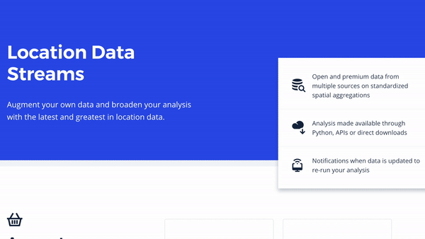
Selecting collecting and consuming spatial data can be a lengthy painful process for Data Scientists: from using untapped data sources and discovering new ones to onboarding individual data providers to performing spatial analysis with the best tools. That’s why at CARTO we’ve brought it all together in one place: our Location Data Streams library is a single and easy-to-use access point for all things geospatial data.
Using our extensive collection of curated datasets allows you to enrich your own data and broaden your analysis. Our Location Data Streams allow you to access different datasets on common standardized spatial aggregations including both open data and premium data from market leaders. With access to the best data you can focus on what matters the most - quickly extracting actionable insights that inform business decisions.
See It for Yourself
With our newly launched data catalog you can browse through the different datasets we curate. Simply select what type of data you’re interested in and then choose a country to see which datasets we have available. You will get an idea of what types of data points we have on that category and at what level (for example administrative regions).
If you don’t find a particular country coverage for a dataset you’re interested in don’t worry - you can get in touch with our team of data experts and they will look into how we can help.
Want to power your analysis with new Location Data Streams?
 | This project has received funding from the European Union's Horizon 2020 research and innovation programme under grant agreement No 960401. |


