

Physical 3D mapping with the Exploratorium


While we were in San Francisco recently we were invited to the Exploratorium to take a look at some of the really interesting mapping projects they have on display. If you haven’t been been to the Exploratorium before you have to go! Their location on the waterfront is really amazing and the space is huge. While there be sure to walk all way to the back where there is a room dedicated to many things geospatial. There were maps interactive maps and activities to tell you stories about the world around us it was really inspiring.
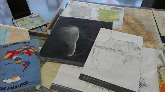
One of the first tables you see when you enter is a table covered with prints of some of the best maps coming out of our community. Some of our favorites were there including maps by Eric Fischer and maps by Stamen printed on large posters. Seeing maps that we are so used to seeing in the digital world on display in print was really beautiful.
One of the big points of us going was to take a look at their 3D relief map of the San Francisco area. The map is installed with a top-down projector that allows the Exploratorium to create new interactive maps on top of the relief map! Totally cool. They let us plug in our laptop and start playing with some CartoDB maps on the 3D surface. Here are a couple of shots from the day!
Getting things lined up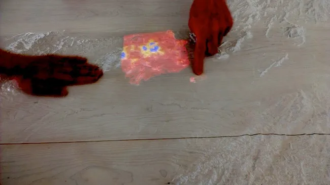
Wind maps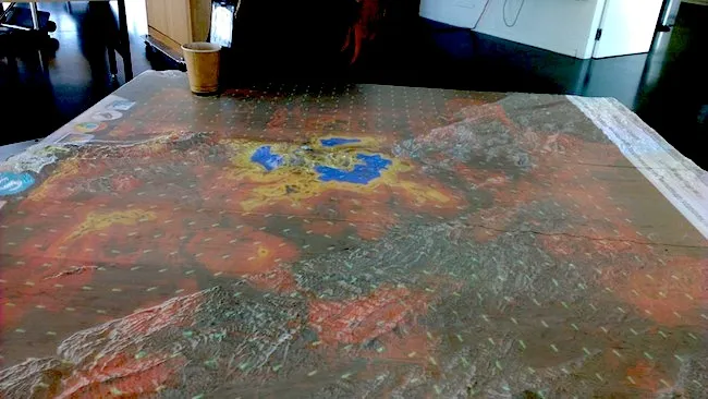
It was really cool to see how quickly we could make CartoDB work in an environment we had never even considered before. We were able to demonstrate beautiful data visualization using the standard CartoDB interface as well as some cool things we have built with VECNIK Torque and D3. So fun!
If you have done any other neat projects that make use of CartoDB and want to share it with us please contact us!


