Redistricting maps from the Center for Urban Research


This post may describe functionality for an old version of CARTO. Find out about the latest and cloud-native version here.
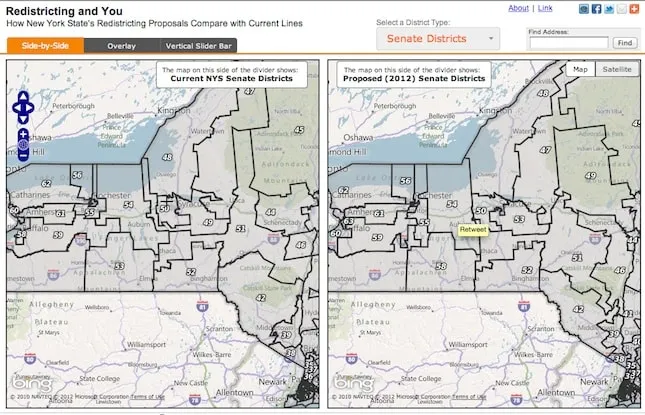
In United States there is quite a discussion about redrawing legislative district lines. The Center for Urban Research in New York together with The New York World have developed some comparison maps. They have used CartoDB to develop those maps and we would like to share the link to the application as we think is really interesting comparison technique. Steven Romalewski has written a blog post about it.